Right-side seats win overall due to the exceptional mountain scenery during the first 30 minutes of climb-out from AVL. While left-side landing views are solid, the dramatic Blue Ridge topography on departure is more visually distinctive than the urban approach to Atlanta.
Flown AVL to ATL? Did we get it right?
Flight Path
Asheville to Atlanta is 164 miles (264 km), a flight of about 1 hour 15 minutes.
The flight path crosses the Piedmont plateau between the Blue Ridge Mountains and Atlanta. Notable features include the Etowah River valley (visible around the midpoint), transition from Appalachian foothills to rolling Piedmont terrain, and scattered lakes and reservoirs (including possible views of Lake Allatoona to the northwest of Atlanta on clear days). The landscape gradually transitions from mountainous to increasingly urbanized as the aircraft approaches the Atlanta metropolitan area.
Great circle distance and headings ›Phase by phase
Takeoff from AVL
RIGHTRight-side seats offer immediate views of the Blue Ridge Mountains as the aircraft climbs out southwestward from AVL. The ridgelines and valleys of the southern Appalachian range dominate the early climb, providing dramatic topography that's clearly visible within the first 10-15 minutes.
Landing at ATL
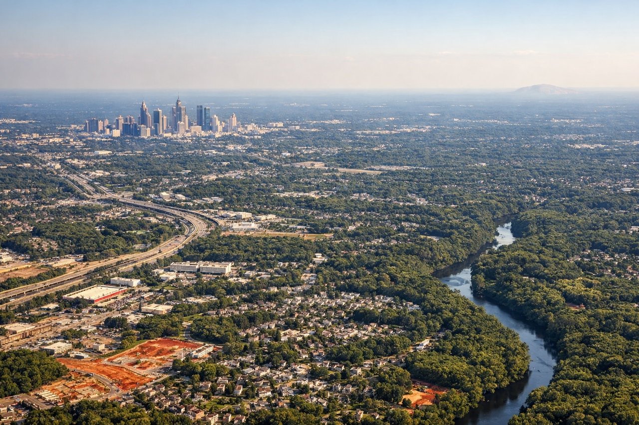
LEFTLeft-side seats provide the best views during descent into ATL. As the aircraft approaches from the north on a typical southbound descent, left-side passengers see the Chattahoochee River, Atlanta's urban sprawl, and the transition from Piedmont terrain into the city's developed areas.
Will your flight be in sunlight?
Pick a date and time in the Sun Map to watch the sun move across your whole flight.
About This Route
Which side of the plane should I sit on flying from Asheville Regional Airport (AVL) to The William B Hartsfield Atlanta International (ATL)?
Sit on the Right side of the plane for the best views on flights from Asheville to Atlanta. Right-side seats win overall due to the exceptional mountain scenery during the first 30 minutes of climb-out from AVL. While left-side landing views are solid, the dramatic Blue Ridge topography on departure is more visually distinctive than the urban approach to Atlanta.
What can I see during takeoff from Asheville Regional Airport in Asheville?
During takeoff from Asheville Regional Airport (AVL), sit on the Right side for the best views. Right-side seats offer immediate views of the Blue Ridge Mountains as the aircraft climbs out southwestward from AVL. The ridgelines and valleys of the southern Appalachian range dominate the early climb, providing dramatic topography that's clearly visible within the first 10-15 minutes. Notable sights include: Blue Ridge Mountains (ridgelines and valleys), French Broad River valley (winding below), Asheville urban area (receding behind), Pisgah National Forest (forested slopes to the west).
What can I see when landing at The William B Hartsfield Atlanta International in Atlanta?
When landing at The William B Hartsfield Atlanta International (ATL), sit on the Left side for the best views. Left-side seats provide the best views during descent into ATL. As the aircraft approaches from the north on a typical southbound descent, left-side passengers see the Chattahoochee River, Atlanta's urban sprawl, and the transition from Piedmont terrain into the city's developed areas. Notable sights include: Chattahoochee River (major waterway defining Atlanta's western boundary), Atlanta metropolitan area (dense urban grid), Piedmont plateau terrain (rolling forested landscape), Lake Lanier (visible to the north on clear days).
How long is the flight from Asheville to Atlanta?
The flight from Asheville Regional Airport (AVL) to The William B Hartsfield Atlanta International (ATL) takes about 1 hour 15 minutes. The shortest flight path between them is 164 miles (264 km); winds and air traffic control usually add a few percent.
What does the Asheville to Atlanta flight path pass over?
The flight path crosses the Piedmont plateau between the Blue Ridge Mountains and Atlanta. Notable features include the Etowah River valley (visible around the midpoint), transition from Appalachian foothills to rolling Piedmont terrain, and scattered lakes and reservoirs (including possible views of Lake Allatoona to the northwest of Atlanta on clear days). The landscape gradually transitions from mountainous to increasingly urbanized as the aircraft approaches the Atlanta metropolitan area.