While the left offers excellent mountain scenery during takeoff, the right side provides superior views for the majority of the flight, especially during descent with Lake Norman and the Charlotte approach. The right seat captures more of the varied Piedmont landscape and the dramatic contrast between water and urban development.
Flown AVL to CLT? Did we get it right?
Flight Path
Asheville to Charlotte is 91 miles (147 km), a flight of about 50 minutes.
The flight path crosses from the Blue Ridge Mountains through the foothills toward the Piedmont plateau. Notable midpoint features include the transition zone where mountain ridges give way to rolling hills (visible around 20 minutes into flight), scattered lakes and reservoirs in the foothills (Wylie, Norman, and smaller impoundments), and the gradual flattening of terrain as the aircraft approaches the Charlotte basin. The Catawba River system is visible throughout much of the flight as a winding corridor of vegetation.
Great circle distance and headings ›Phase by phase
Takeoff from AVL
LEFTLeft-side seats capture the Blue Ridge Mountains immediately after departure, with the ridgelines and valleys of the Asheville area visible as the aircraft climbs southwest initially before turning southeast toward Charlotte.
Landing at CLT
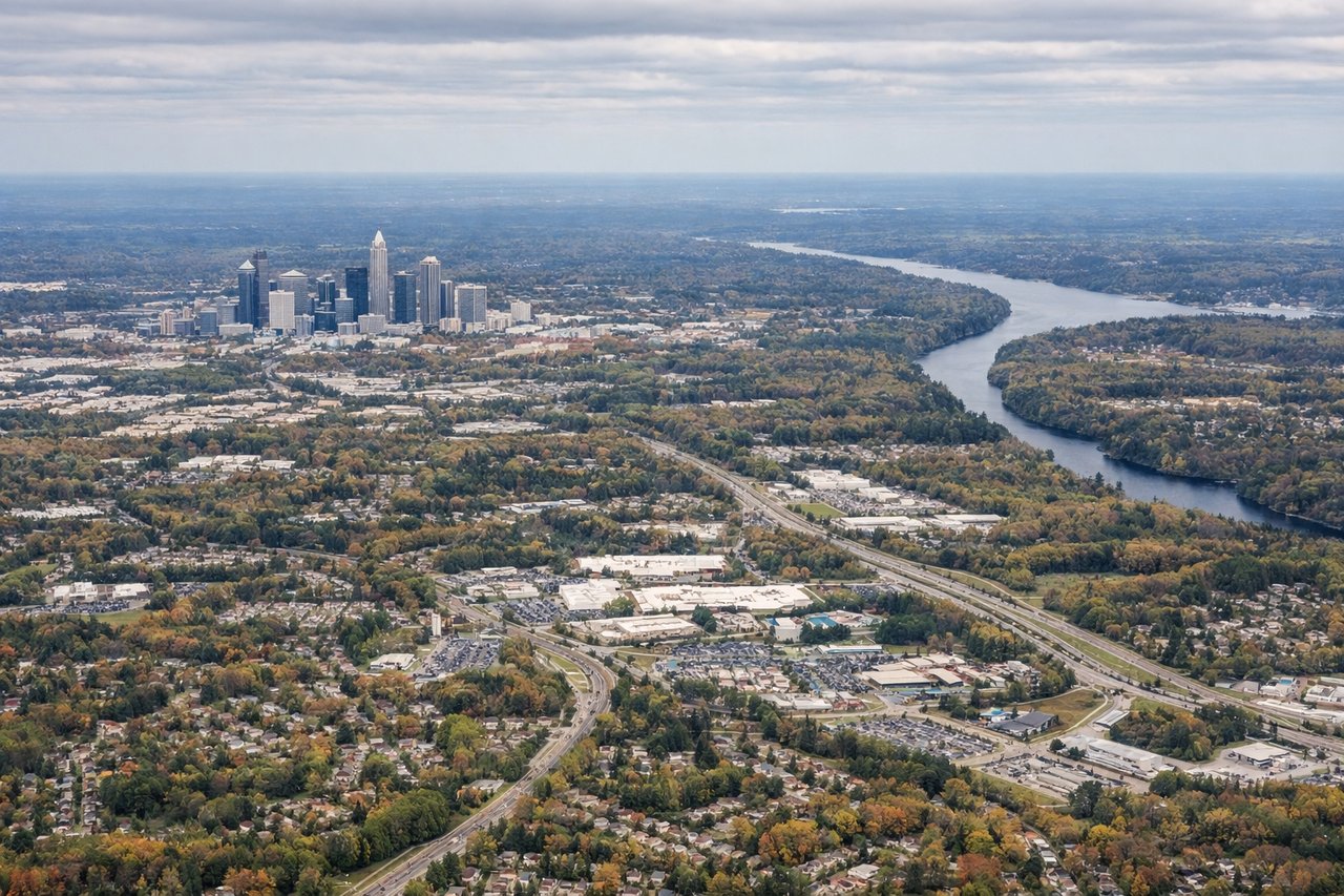
RIGHTRight-side seats offer the best views during approach to Charlotte, with clear sightlines to the Piedmont landscape, Lake Norman, and the Charlotte skyline as the aircraft descends from the northwest.
Will your flight be in sunlight?
Pick a date and time in the Sun Map to watch the sun move across your whole flight.
About This Route
Which side of the plane should I sit on flying from Asheville Regional Airport (AVL) to Charlotte Douglas International (CLT)?
Sit on the Right side of the plane for the best views on flights from Asheville to Charlotte. While the left offers excellent mountain scenery during takeoff, the right side provides superior views for the majority of the flight, especially during descent with Lake Norman and the Charlotte approach. The right seat captures more of the varied Piedmont landscape and the dramatic contrast between water and urban development.
What can I see during takeoff from Asheville Regional Airport in Asheville?
During takeoff from Asheville Regional Airport (AVL), sit on the Left side for the best views. Left-side seats capture the Blue Ridge Mountains immediately after departure, with the ridgelines and valleys of the Asheville area visible as the aircraft climbs southwest initially before turning southeast toward Charlotte. Notable sights include: Blue Ridge Mountains (Asheville vicinity), French Broad River valley, Biltmore Estate grounds (visible as cleared estate land), ridgeline formations east of Asheville.
What can I see when landing at Charlotte Douglas International in Charlotte?
When landing at Charlotte Douglas International (CLT), sit on the Right side for the best views. Right-side seats offer the best views during approach to Charlotte, with clear sightlines to the Piedmont landscape, Lake Norman, and the Charlotte skyline as the aircraft descends from the northwest. Notable sights include: Lake Norman (large reservoir north of Charlotte), Catawba River valley, Charlotte downtown skyline and urban sprawl, Piedmont terrain transition from foothills to flat plains.
How long is the flight from Asheville to Charlotte?
The flight from Asheville Regional Airport (AVL) to Charlotte Douglas International (CLT) takes about 50 minutes. The shortest flight path between them is 91 miles (147 km); winds and air traffic control usually add a few percent.
What does the Asheville to Charlotte flight path pass over?
The flight path crosses from the Blue Ridge Mountains through the foothills toward the Piedmont plateau. Notable midpoint features include the transition zone where mountain ridges give way to rolling hills (visible around 20 minutes into flight), scattered lakes and reservoirs in the foothills (Wylie, Norman, and smaller impoundments), and the gradual flattening of terrain as the aircraft approaches the Charlotte basin. The Catawba River system is visible throughout much of the flight as a winding corridor of vegetation.