While takeoff offers dramatic mountain scenery on the right, the landing approach on the left provides iconic urban and river views of Philadelphia that are more visually distinctive and memorable for most passengers.
Flown AVL to PHL? Did we get it right?
Flight Path
Asheville to Philadelphia is 503 miles (810 km), a flight of about 2 hours 15 minutes.
The flight path crosses the Appalachian ridgelines (Shenandoah Valley visible to the left around 1h 00m), then transitions over the Piedmont plateau with scattered lakes and forested terrain. The Potomac River valley becomes visible around 1h 30m as the aircraft approaches the Washington DC airspace corridor. The flight passes east of the Blue Ridge and Great Valley, offering views of rolling Piedmont terrain with small towns and agricultural patches before descending into the Atlantic Coastal Plain near Philadelphia.
Great circle distance and headings ›Phase by phase
Takeoff from AVL
RIGHTRight side offers immediate views of the Blue Ridge Mountains as the aircraft climbs northeast from Asheville. The left side faces inland terrain with less dramatic relief.
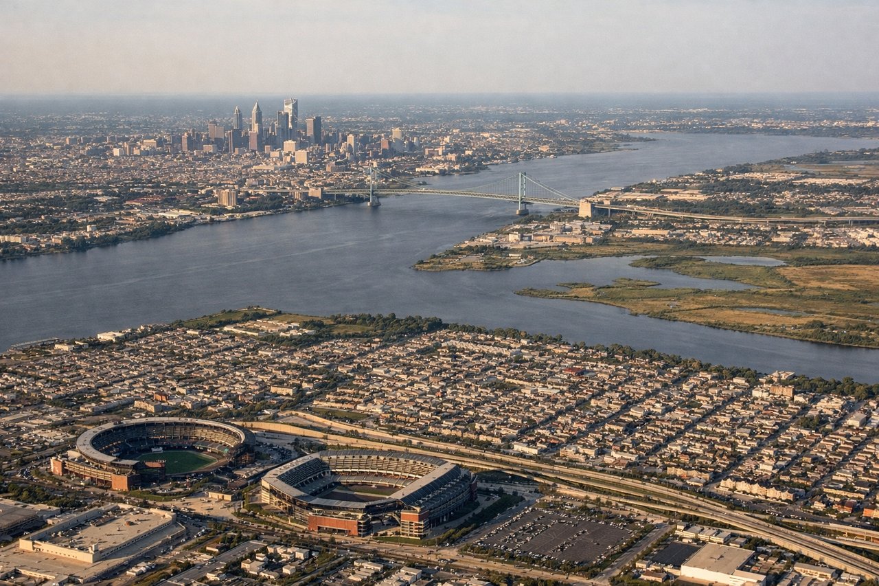
Landing at PHL
LEFTLeft side provides views of the Schuylkill River, downtown Philadelphia skyline, and the Delaware River as the aircraft descends into PHL from the northwest. Right side faces New Jersey suburbs with less distinctive landmarks.
Will your flight be in sunlight?
Pick a date and time in the Sun Map to watch the sun move across your whole flight.
About This Route
Which side of the plane should I sit on flying from Asheville Regional Airport (AVL) to Philadelphia International (PHL)?
Sit on the Left side of the plane for the best views on flights from Asheville to Philadelphia. While takeoff offers dramatic mountain scenery on the right, the landing approach on the left provides iconic urban and river views of Philadelphia that are more visually distinctive and memorable for most passengers.
What can I see during takeoff from Asheville Regional Airport in Asheville?
During takeoff from Asheville Regional Airport (AVL), sit on the Right side for the best views. Right side offers immediate views of the Blue Ridge Mountains as the aircraft climbs northeast from Asheville. The left side faces inland terrain with less dramatic relief. Notable sights include: Blue Ridge Mountains (immediate foreground), French Broad River valley (below), Pisgah National Forest ridgelines (middle distance).
What can I see when landing at Philadelphia International in Philadelphia?
When landing at Philadelphia International (PHL), sit on the Left side for the best views. Left side provides views of the Schuylkill River, downtown Philadelphia skyline, and the Delaware River as the aircraft descends into PHL from the northwest. Right side faces New Jersey suburbs with less distinctive landmarks. Notable sights include: Schuylkill River (prominent in middle distance), Philadelphia downtown skyline (center-left), Delaware River (far left horizon), Fairmount Park (foreground-left).
How long is the flight from Asheville to Philadelphia?
The flight from Asheville Regional Airport (AVL) to Philadelphia International (PHL) takes about 2 hours 15 minutes. The shortest flight path between them is 503 miles (810 km); winds and air traffic control usually add a few percent.
What does the Asheville to Philadelphia flight path pass over?
The flight path crosses the Appalachian ridgelines (Shenandoah Valley visible to the left around 1h 00m), then transitions over the Piedmont plateau with scattered lakes and forested terrain. The Potomac River valley becomes visible around 1h 30m as the aircraft approaches the Washington DC airspace corridor. The flight passes east of the Blue Ridge and Great Valley, offering views of rolling Piedmont terrain with small towns and agricultural patches before descending into the Atlantic Coastal Plain near Philadelphia.