While Bangkok's takeoff slightly favors the right, the left side wins overall because the long cruise phase over Siberia, the Bering region, and Alaska's mountain ranges offers dramatic terrain, and the final descent into Phoenix reveals the Sonoran Desert's mountain ranges — collectively more visually rewarding than the right side's flatter, ocean-heavy sequence.
Flown BKK to PHX? Did we get it right?
Flight Path
Bangkok to Phoenix is 8,531 miles (13,730 km), a flight of about 15 hours 45 minutes.
The great-circle route passes over southern China's hill country, the Siberian taiga, the Bering Strait region, and the Alaska Range before the flight path bends southeast across western Canada and the Rocky Mountains toward Arizona.
Great circle distance and headings ›


Phase by phase

Takeoff from BKK
RIGHTDeparting Suvarnabhumi, the right side offers views over Bangkok's sprawling grid and the Chao Phraya River delta as the aircraft climbs and banks toward its northeasterly routing, with glimpses of the Gulf of Thailand's coastline further south. The left side mostly shows flat agricultural land with little to distinguish it.
Landing at PHX
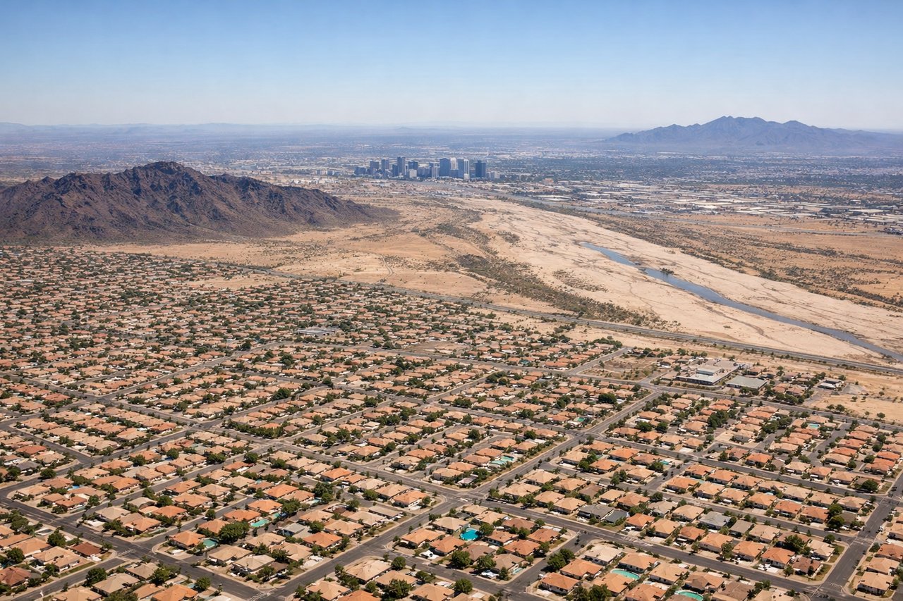
LEFTOn approach into Phoenix Sky Harbor from the north, the left side captures the rugged Sonoran Desert terrain, including the jagged Superstition Mountains and the distant McDowell range, before the final turn reveals downtown Phoenix and South Mountain. The right side during this leg mostly shows flatter suburban sprawl with less topographic interest.
Will your flight be in sunlight?
Pick a date and time in the Sun Map to watch the sun move across your whole flight.
About This Route
Which side of the plane should I sit on flying from Suvarnabhumi Airport (BKK) to Phoenix Sky Harbor International (PHX)?
Sit on the Left side of the plane for the best views on flights from Bangkok to Phoenix. While Bangkok's takeoff slightly favors the right, the left side wins overall because the long cruise phase over Siberia, the Bering region, and Alaska's mountain ranges offers dramatic terrain, and the final descent into Phoenix reveals the Sonoran Desert's mountain ranges — collectively more visually rewarding than the right side's flatter, ocean-heavy sequence.
What can I see during takeoff from Suvarnabhumi Airport in Bangkok?
During takeoff from Suvarnabhumi Airport (BKK), sit on the Right side for the best views. Departing Suvarnabhumi, the right side offers views over Bangkok's sprawling grid and the Chao Phraya River delta as the aircraft climbs and banks toward its northeasterly routing, with glimpses of the Gulf of Thailand's coastline further south. The left side mostly shows flat agricultural land with little to distinguish it. Notable sights include: Chao Phraya River delta, Bangkok skyline, Gulf of Thailand coastline.
What can I see when landing at Phoenix Sky Harbor International in Phoenix?
When landing at Phoenix Sky Harbor International (PHX), sit on the Left side for the best views. On approach into Phoenix Sky Harbor from the north, the left side captures the rugged Sonoran Desert terrain, including the jagged Superstition Mountains and the distant McDowell range, before the final turn reveals downtown Phoenix and South Mountain. The right side during this leg mostly shows flatter suburban sprawl with less topographic interest. Notable sights include: Superstition Mountains, McDowell Mountains, South Mountain Park, downtown Phoenix skyline.
How long is the flight from Bangkok to Phoenix?
The flight from Suvarnabhumi Airport (BKK) to Phoenix Sky Harbor International (PHX) takes about 15 hours 45 minutes. The shortest flight path between them is 8,531 miles (13,730 km); winds and air traffic control usually add a few percent.
What does the Bangkok to Phoenix flight path pass over?
The great-circle route passes over southern China's hill country, the Siberian taiga, the Bering Strait region, and the Alaska Range before the flight path bends southeast across western Canada and the Rocky Mountains toward Arizona.