The right side offers a stronger start with Phoenix's mountain-ringed skyline on departure and, during the long Pacific crossing, better sightlines toward the Kamchatka coastline and Japanese archipelago on clear-weather routings, giving it more cumulative visual variety than the left, which is dominated by open ocean until the Bangkok approach.
Flown PHX to BKK? Did we get it right?
Flight Path
Phoenix to Bangkok is 8,531 miles (13,730 km), a flight of about 17 hours 45 minutes.
Bering Sea, Kamchatka Peninsula coastline, Sea of Japan, East China Sea, Taiwan Strait, South China Sea, Gulf of Thailand
Great circle distance and headings ›


Phase by phase
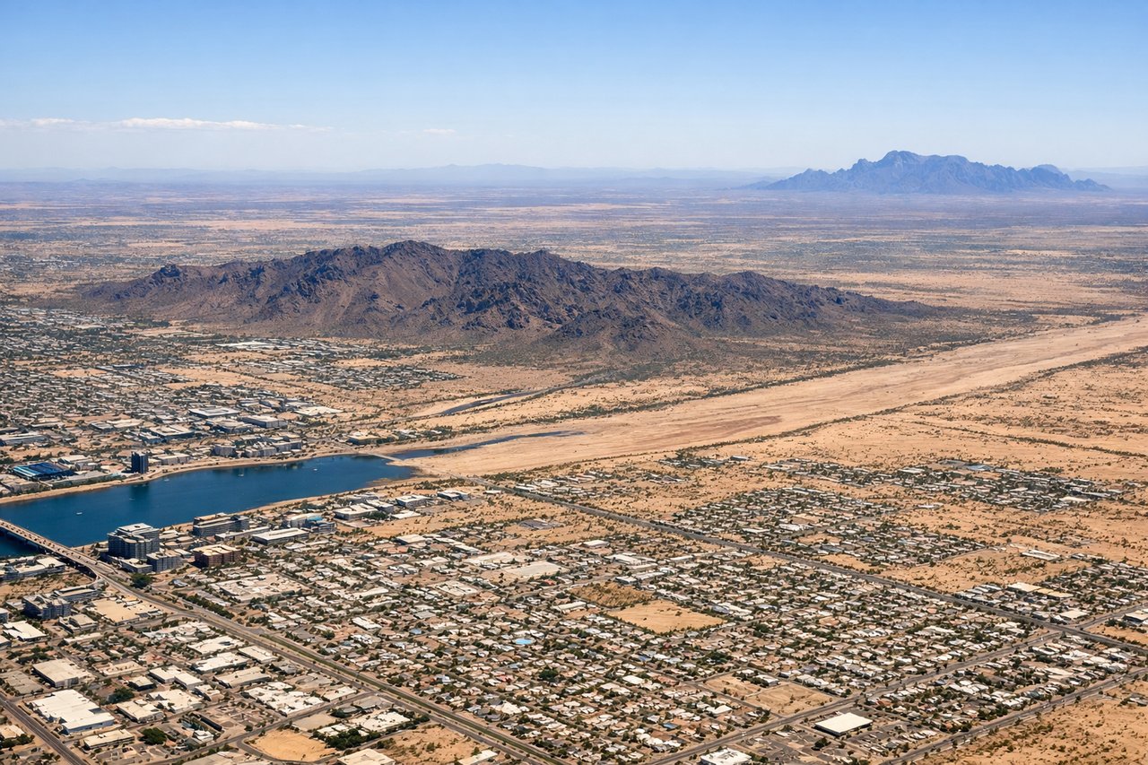
Takeoff from PHX
RIGHTDeparting PHX in typical west-flow conditions, the aircraft climbs west then banks north toward the Pacific routing, putting downtown Phoenix, Piestewa Peak, and the Phoenix Mountains Preserve on the right side of the cabin. The left side mainly shows flat Sonoran desert and the Estrella foothills, which are less distinctive.
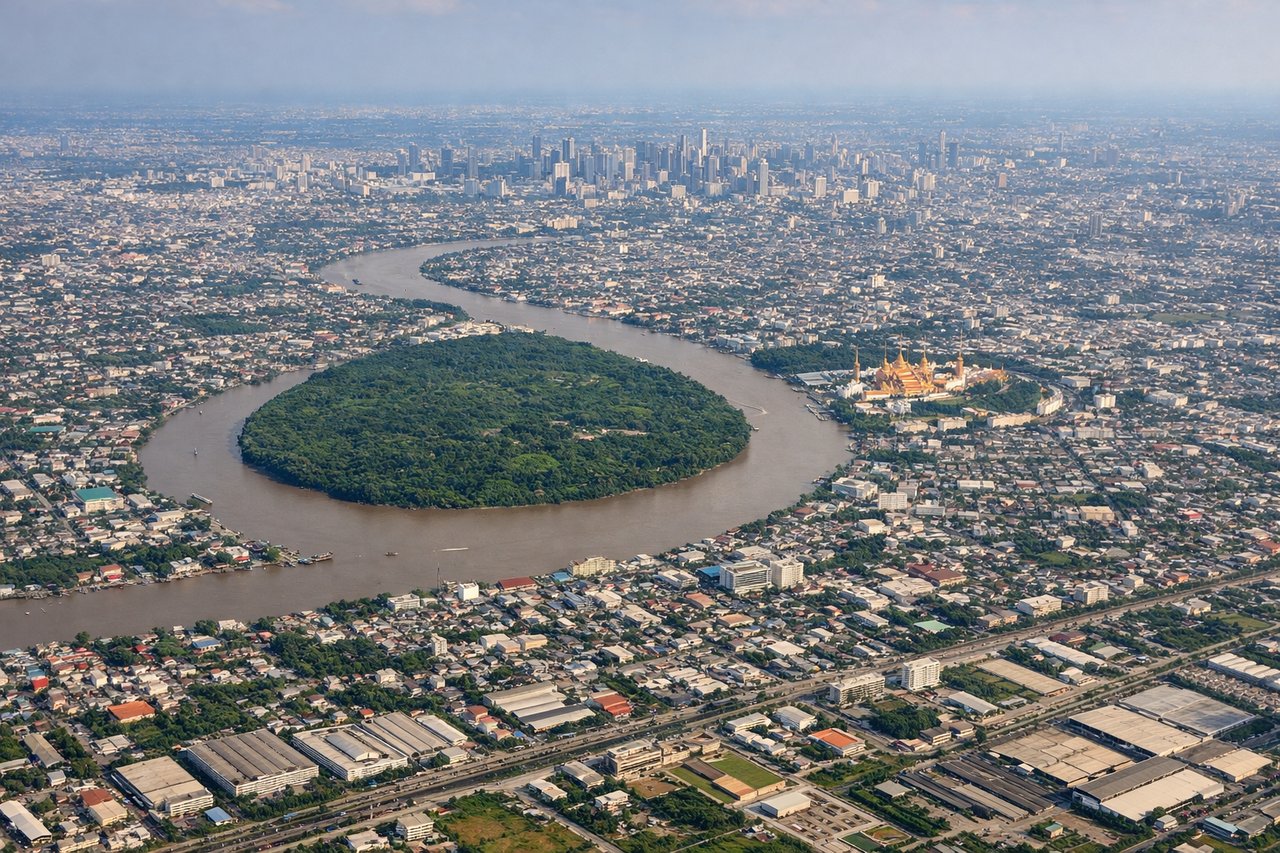
Landing at BKK
LEFTOn a dry-season approach into BKK, arrivals descend from the north on runway 19, tracking south over greater Bangkok before turning onto final. This puts the Chao Phraya River's winding curves and the dense skyscraper cluster of central Bangkok on the left side of the aircraft.
Will your flight be in sunlight?
Pick a date and time in the Sun Map to watch the sun move across your whole flight.
About This Route
Which side of the plane should I sit on flying from Phoenix Sky Harbor International (PHX) to Suvarnabhumi Airport (BKK)?
Sit on the Right side of the plane for the best views on flights from Phoenix to Bangkok. The right side offers a stronger start with Phoenix's mountain-ringed skyline on departure and, during the long Pacific crossing, better sightlines toward the Kamchatka coastline and Japanese archipelago on clear-weather routings, giving it more cumulative visual variety than the left, which is dominated by open ocean until the Bangkok approach.
What can I see during takeoff from Phoenix Sky Harbor International in Phoenix?
During takeoff from Phoenix Sky Harbor International (PHX), sit on the Right side for the best views. Departing PHX in typical west-flow conditions, the aircraft climbs west then banks north toward the Pacific routing, putting downtown Phoenix, Piestewa Peak, and the Phoenix Mountains Preserve on the right side of the cabin. The left side mainly shows flat Sonoran desert and the Estrella foothills, which are less distinctive. Notable sights include: Piestewa Peak, Phoenix downtown skyline, Camelback Mountain, South Mountain Park.
What can I see when landing at Suvarnabhumi Airport in Bangkok?
When landing at Suvarnabhumi Airport (BKK), sit on the Left side for the best views. On a dry-season approach into BKK, arrivals descend from the north on runway 19, tracking south over greater Bangkok before turning onto final. This puts the Chao Phraya River's winding curves and the dense skyscraper cluster of central Bangkok on the left side of the aircraft. Notable sights include: Chao Phraya River, Bangkok skyline (Sathorn/Silom towers), Suvarnabhumi's paddy-field surroundings, Bang Na canals.
How long is the flight from Phoenix to Bangkok?
The flight from Phoenix Sky Harbor International (PHX) to Suvarnabhumi Airport (BKK) takes about 17 hours 45 minutes. The shortest flight path between them is 8,531 miles (13,730 km); winds and air traffic control usually add a few percent.
What does the Phoenix to Bangkok flight path pass over?
Bering Sea, Kamchatka Peninsula coastline, Sea of Japan, East China Sea, Taiwan Strait, South China Sea, Gulf of Thailand