The right side wins on both ends of the flight—Moreton Bay's islands at departure and Osaka Bay's city-and-mountain backdrop at arrival—while the long Coral Sea and Philippine Sea cruise portion offers little differentiation between sides.
Flown BNE to KIX? Did we get it right?
Flight Path
Brisbane to Osaka is 4,428 miles (7,126 km), a flight of about 9 hours 20 minutes.
Coral Sea, Solomon Sea near Papua New Guinea, Philippine Sea, East China Sea approaching Japan — the vast majority of the route is open ocean with no significant landmarks visible from either side.
Great circle distance and headings ›Phase by phase
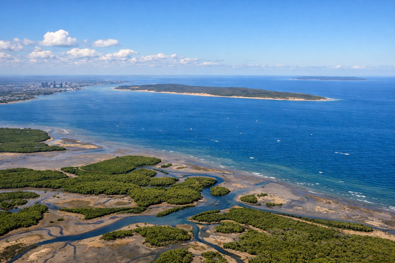
Takeoff from BNE
RIGHTDeparting BNE northbound, the right side looks east over Moreton Bay, North Stradbroke and Moreton Islands, giving a nice coastal/bay view during the initial climb, while the left side just shows flat Brisbane suburbs and the low, hazy Great Dividing Range foothills.
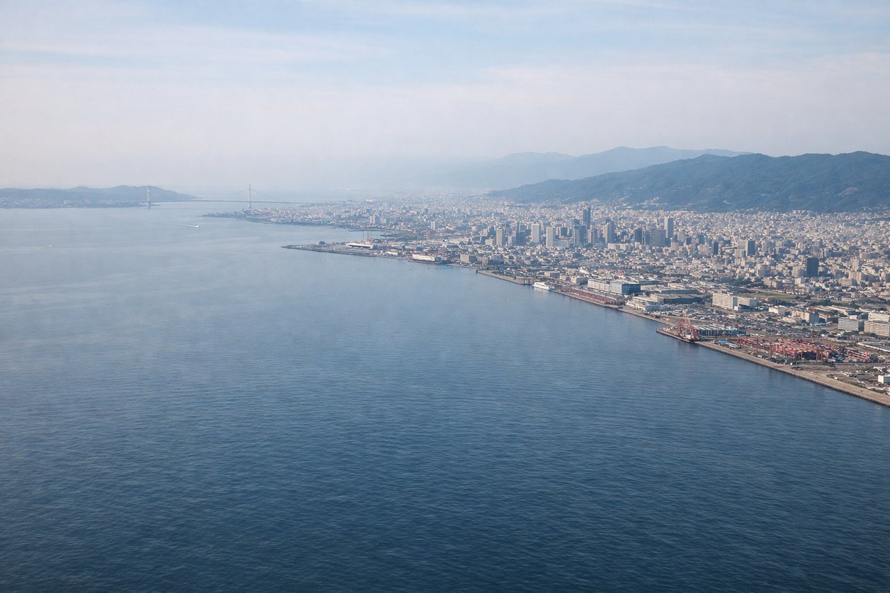
Landing at KIX
RIGHTOn approach into KIX, the runway-24 pattern typically brings the aircraft down from the northeast over Osaka Bay, so the right side faces the city and mountains: Osaka's skyline, the Kobe waterfront, and the steep green wall of the Rokko mountains behind it, with Awaji Island visible further out in the bay.
Will your flight be in sunlight?
Pick a date and time in the Sun Map to watch the sun move across your whole flight.
About This Route
Which side of the plane should I sit on flying from Brisbane International (BNE) to Kansai International (KIX)?
Sit on the Right side of the plane for the best views on flights from Brisbane to Osaka. The right side wins on both ends of the flight—Moreton Bay's islands at departure and Osaka Bay's city-and-mountain backdrop at arrival—while the long Coral Sea and Philippine Sea cruise portion offers little differentiation between sides.
What can I see during takeoff from Brisbane International in Brisbane?
During takeoff from Brisbane International (BNE), sit on the Right side for the best views. Departing BNE northbound, the right side looks east over Moreton Bay, North Stradbroke and Moreton Islands, giving a nice coastal/bay view during the initial climb, while the left side just shows flat Brisbane suburbs and the low, hazy Great Dividing Range foothills. Notable sights include: Moreton Bay, North Stradbroke Island, Moreton Island, Brisbane River mouth.
What can I see when landing at Kansai International in Osaka?
When landing at Kansai International (KIX), sit on the Right side for the best views. On approach into KIX, the runway-24 pattern typically brings the aircraft down from the northeast over Osaka Bay, so the right side faces the city and mountains: Osaka's skyline, the Kobe waterfront, and the steep green wall of the Rokko mountains behind it, with Awaji Island visible further out in the bay. Notable sights include: Osaka skyline, Kobe waterfront, Rokko mountain range, Awaji Island.
How long is the flight from Brisbane to Osaka?
The flight from Brisbane International (BNE) to Kansai International (KIX) takes about 9 hours 20 minutes. The shortest flight path between them is 4,428 miles (7,126 km); winds and air traffic control usually add a few percent.
What does the Brisbane to Osaka flight path pass over?
Coral Sea, Solomon Sea near Papua New Guinea, Philippine Sea, East China Sea approaching Japan — the vast majority of the route is open ocean with no significant landmarks visible from either side.