Cedar City to Marrakech is 5,641 miles (9,078 km), a flight of about 10 hours 15 minutes.
While takeoff offers dramatic local geology, the left side captures the most visually significant features across the entire transatlantic route: the High Atlas Mountains during descent are more impressive than Cedar City's local plateaus, and left-side seats also capture the Atlantic coastline and European geography during the mid-flight crossing.
Flight Path
The flight path crosses the continental United States (Great Plains, Mississippi River valley, Appalachian Mountains visible on clear days), then the Atlantic Ocean (typically no landmarks except open water and occasional ship traffic), then approaches Europe over Portugal's Atlantic coast and the Iberian Peninsula before turning southeast toward Morocco. The Strait of Gibraltar and North African coastline become visible during the final approach phase. Notable mid-route features include the curvature of the Atlantic coastline near Portugal and the transition from European to North African geography.
Great circle distance and headings ›


Phase by phase
Takeoff from CDC
RIGHTRight-side seats offer views of the red rock formations and plateaus surrounding Cedar City during initial climb. The terrain rises steeply to the east and south, creating dramatic relief visible immediately after departure.
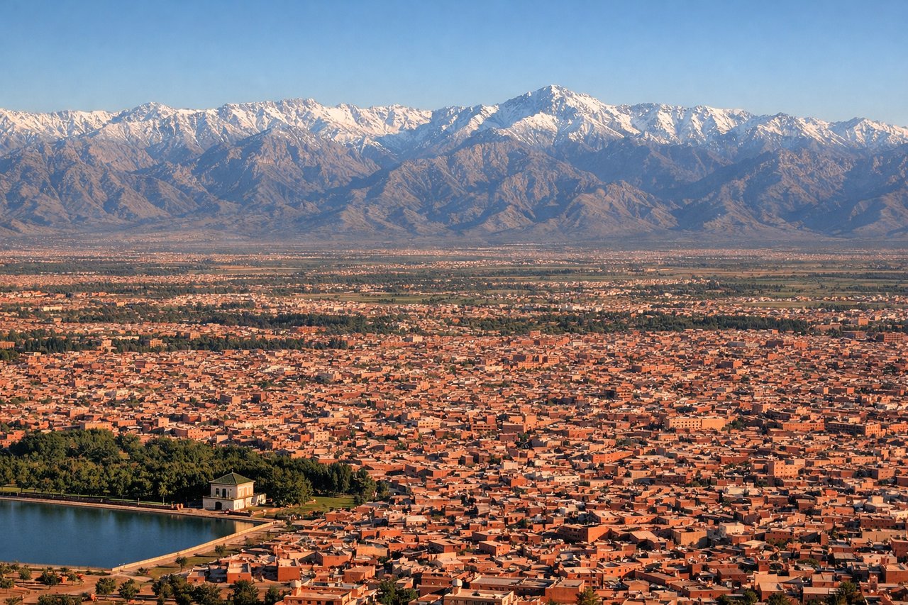
Landing at RAK
LEFTLeft-side seats provide views of the Atlas Mountains and the Marrakech medina during descent into Menara Airport. The High Atlas range dominates the southern approach, and the city's distinctive layout becomes visible in the final descent phase.
Landmarks on this routeAll landmarks →
Will your flight be in sunlight?
Pick a date and time in the Sun Map to watch the sun move across your whole flight.
About This Route
Which side of the plane should I sit on flying from Cedar City Rgnl (CDC) to Menara (RAK)?
Sit on the Left side of the plane for the best views on flights from Cedar City to Marrakech. While takeoff offers dramatic local geology, the left side captures the most visually significant features across the entire transatlantic route: the High Atlas Mountains during descent are more impressive than Cedar City's local plateaus, and left-side seats also capture the Atlantic coastline and European geography during the mid-flight crossing.
What can I see during takeoff from Cedar City Rgnl in Cedar City?
During takeoff from Cedar City Rgnl (CDC), sit on the Right side for the best views. Right-side seats offer views of the red rock formations and plateaus surrounding Cedar City during initial climb. The terrain rises steeply to the east and south, creating dramatic relief visible immediately after departure. Notable sights include: Markagunt Plateau, Hurricane Cliffs, Kolob Canyons (Zion National Park northern section), Cedar Breaks rim.
What can I see when landing at Menara in Marrakech?
When landing at Menara (RAK), sit on the Left side for the best views. Left-side seats provide views of the Atlas Mountains and the Marrakech medina during descent into Menara Airport. The High Atlas range dominates the southern approach, and the city's distinctive layout becomes visible in the final descent phase. Notable sights include: High Atlas Mountains (snow-capped peaks visible in winter/spring), Marrakech medina (old city with dense urban fabric), Menara Gardens and olive groves, Anti-Atlas foothills.
How long is the flight from Cedar City to Marrakech?
The flight from Cedar City Rgnl (CDC) to Menara (RAK) takes about 10 hours 15 minutes. The shortest flight path between them is 5,641 miles (9,078 km); winds and air traffic control usually add a few percent.
What does the Cedar City to Marrakech flight path pass over?
The flight path crosses the continental United States (Great Plains, Mississippi River valley, Appalachian Mountains visible on clear days), then the Atlantic Ocean (typically no landmarks except open water and occasional ship traffic), then approaches Europe over Portugal's Atlantic coast and the Iberian Peninsula before turning southeast toward Morocco. The Strait of Gibraltar and North African coastline become visible during the final approach phase. Notable mid-route features include the curvature of the Atlantic coastline near Portugal and the transition from European to North African geography.