While takeoff on the left offers Paris views, the landing approach on the right showcases the dramatic transition from European temperate zones to Arctic boreal landscape—the glacial lakes and taiga forest are visually distinctive and unique to this route's northern destination.
Flown CDG to KTT? Did we get it right?
Flight Path
Paris to Kittila is 1,504 miles (2,421 km), a flight of about 3 hours 15 minutes.
The flight path crosses the Rhine valley and German plains, then transitions over the North European Plain. Notable features include the Rhine River (visible during climb-out), the Ruhr industrial region, the North German Plain, and eventually the transition into Scandinavian terrain with increasing forest coverage and water features. The Baltic Sea region may be visible to the east depending on exact routing. As you progress north, the landscape gradually shifts from agricultural plains to boreal forest with increasing lake density, particularly visible in southern Finland.
Great circle distance and headings ›

Phase by phase
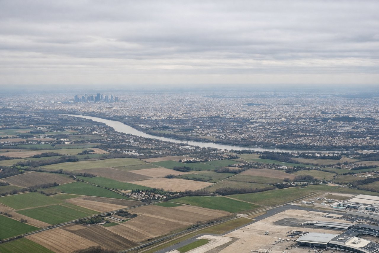
Takeoff from CDG
LEFTLeft side offers views of the Seine River winding through Paris and the surrounding Île-de-France region as you climb northeastward. You'll see the urban sprawl gradually give way to agricultural plains and forests.
Landing at KTT
RIGHTRight side provides views of Finnish Lapland's boreal forest, lakes, and the approach to Kittila. You'll see the characteristic landscape of countless small lakes dotting dense coniferous forest as you descend into the region.
Will your flight be in sunlight?
Pick a date and time in the Sun Map to watch the sun move across your whole flight.
About This Route
Which side of the plane should I sit on flying from Charles De Gaulle (CDG) to Kittila (KTT)?
Sit on the Right side of the plane for the best views on flights from Paris to Kittila. While takeoff on the left offers Paris views, the landing approach on the right showcases the dramatic transition from European temperate zones to Arctic boreal landscape—the glacial lakes and taiga forest are visually distinctive and unique to this route's northern destination.
What can I see during takeoff from Charles De Gaulle in Paris?
During takeoff from Charles De Gaulle (CDG), sit on the Left side for the best views. Left side offers views of the Seine River winding through Paris and the surrounding Île-de-France region as you climb northeastward. You'll see the urban sprawl gradually give way to agricultural plains and forests. Notable sights include: Seine River, Paris urban area, Fontainebleau Forest (southeast), Champagne plains extending northeast.
What can I see when landing at Kittila in Kittila?
When landing at Kittila (KTT), sit on the Right side for the best views. Right side provides views of Finnish Lapland's boreal forest, lakes, and the approach to Kittila. You'll see the characteristic landscape of countless small lakes dotting dense coniferous forest as you descend into the region. Notable sights include: Boreal forest (taiga), numerous glacial lakes, Pyhä-Luosto mountain area (south of Kittila), Kittila valley and settlement.
How long is the flight from Paris to Kittila?
The flight from Charles De Gaulle (CDG) to Kittila (KTT) takes about 3 hours 15 minutes. The shortest flight path between them is 1,504 miles (2,421 km); winds and air traffic control usually add a few percent.
What does the Paris to Kittila flight path pass over?
The flight path crosses the Rhine valley and German plains, then transitions over the North European Plain. Notable features include the Rhine River (visible during climb-out), the Ruhr industrial region, the North German Plain, and eventually the transition into Scandinavian terrain with increasing forest coverage and water features. The Baltic Sea region may be visible to the east depending on exact routing. As you progress north, the landscape gradually shifts from agricultural plains to boreal forest with increasing lake density, particularly visible in southern Finland.