The right side (Caribbean/Panama approach) scores higher due to the Panama Canal and Gatun Lake—genuinely dramatic and recognizable landmarks visible from altitude—plus the visual contrast between Caribbean coastline, rainforest canopy, and urban Panama City. The CDG departure offers only modest Parisian urban scenery and flat farmland. The landing approach on the right side is significantly more scenic than the takeoff on the left.
Flown CDG to PAC? Did we get it right?
Flight Path
Paris to Panama City is 5,394 miles (8,681 km), a flight of about 9 hours 15 minutes.
Atlantic Ocean crossing (5+ hours of open water with minimal visual interest), Azores archipelago potentially visible if flight path passes nearby (unlikely for direct routing), African coast near Morocco or Western Sahara (if southern routing), Caribbean islands and Lesser Antilles approaching Panama, Yucatan Peninsula and Caribbean waters in final approach phase
Great circle distance and headings ›


Phase by phase
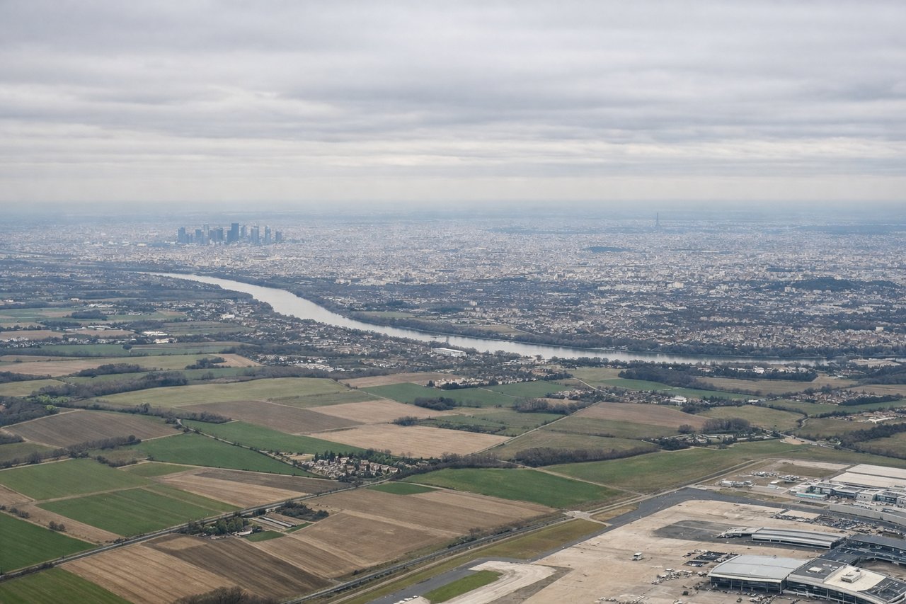
Takeoff from CDG
LEFTParis departure offers urban scenery of the Île-de-France region and Seine River valley during climb-out, with some rolling terrain visible to the northwest toward Normandy. Right side faces inland toward flat agricultural plains with minimal visual interest.
Landing at PAC
RIGHTPanama approach from the Caribbean side reveals the Panama Canal, Gatun Lake, and the dramatic transition from Caribbean coastline to the Darién jungle and Pacific lowlands. Left side shows only open Caribbean Sea and flat coastal plains with minimal terrain variation.
Will your flight be in sunlight?
Pick a date and time in the Sun Map to watch the sun move across your whole flight.
About This Route
Which side of the plane should I sit on flying from Charles De Gaulle (CDG) to Marcos A Gelabert International (PAC)?
Sit on the Right side of the plane for the best views on flights from Paris to Panama City. The right side (Caribbean/Panama approach) scores higher due to the Panama Canal and Gatun Lake—genuinely dramatic and recognizable landmarks visible from altitude—plus the visual contrast between Caribbean coastline, rainforest canopy, and urban Panama City. The CDG departure offers only modest Parisian urban scenery and flat farmland. The landing approach on the right side is significantly more scenic than the takeoff on the left.
What can I see during takeoff from Charles De Gaulle in Paris?
During takeoff from Charles De Gaulle (CDG), sit on the Left side for the best views. Paris departure offers urban scenery of the Île-de-France region and Seine River valley during climb-out, with some rolling terrain visible to the northwest toward Normandy. Right side faces inland toward flat agricultural plains with minimal visual interest. Notable sights include: Seine River winding through Paris suburbs, Île-de-France patchwork farmland, distant chalk cliffs of Normandy coast (far horizon), Notre-Dame and central Paris skyline during initial climb.
What can I see when landing at Marcos A Gelabert International in Panama City?
When landing at Marcos A Gelabert International (PAC), sit on the Right side for the best views. Panama approach from the Caribbean side reveals the Panama Canal, Gatun Lake, and the dramatic transition from Caribbean coastline to the Darién jungle and Pacific lowlands. Left side shows only open Caribbean Sea and flat coastal plains with minimal terrain variation. Notable sights include: Panama Canal and Gatun Lake (visible as a large inland water body with the canal cutting through), Caribbean coastline with Colón visible, Darién jungle and rainforest canopy, Panama City skyline and Pacific coast during final descent.
How long is the flight from Paris to Panama City?
The flight from Charles De Gaulle (CDG) to Marcos A Gelabert International (PAC) takes about 9 hours 15 minutes. The shortest flight path between them is 5,394 miles (8,681 km); winds and air traffic control usually add a few percent.
What does the Paris to Panama City flight path pass over?
Atlantic Ocean crossing (5+ hours of open water with minimal visual interest), Azores archipelago potentially visible if flight path passes nearby (unlikely for direct routing), African coast near Morocco or Western Sahara (if southern routing), Caribbean islands and Lesser Antilles approaching Panama, Yucatan Peninsula and Caribbean waters in final approach phase