While the takeoff offers Paris views, the landing approach to St. Thomas provides more dramatic and visually distinctive scenery with the Caribbean islands, turquoise waters, and volcanic terrain. The approach is the highlight of this transatlantic route.
Flown CDG to STT? Did we get it right?
Flight Path
Paris to St. Thomas is 4,257 miles (6,851 km), a flight of about 7 hours 50 minutes.
Atlantic Ocean crossing with no major landmarks visible for most of the flight. You'll pass over the Bay of Biscay and the open Atlantic. The Azores archipelago lies south of the typical great-circle route. As you approach the Caribbean, the Lesser Antilles island chain becomes visible, with islands like Dominica, Guadeloupe, and Montserrat appearing along the eastern horizon before reaching the US Virgin Islands.
Great circle distance and headings ›


Phase by phase
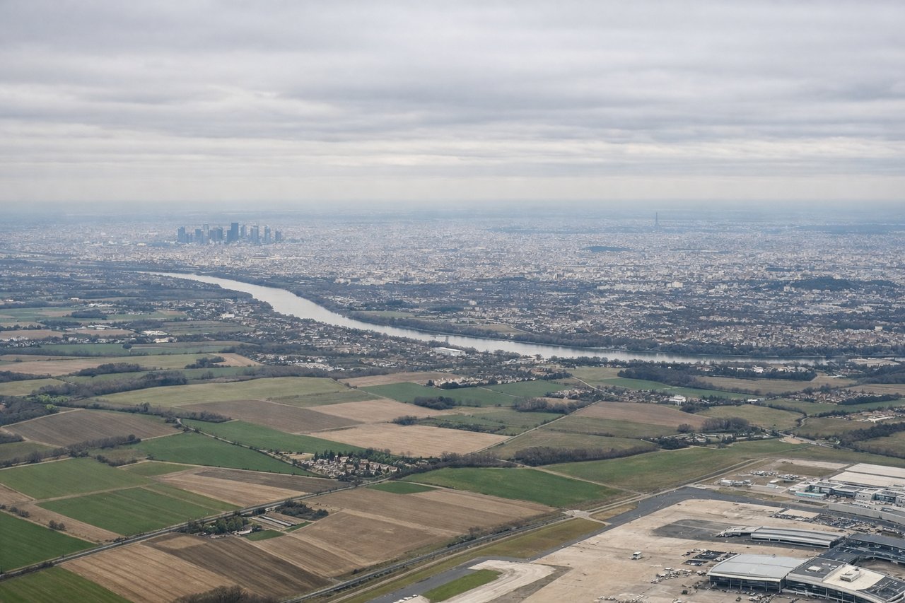
Takeoff from CDG
LEFTLeft side offers views of the Seine River winding through Paris and the surrounding Île-de-France region as you climb out northwestward from CDG. You'll see the urban sprawl of greater Paris and the flat agricultural plains extending toward Normandy.
Landing at STT
RIGHTRight side provides views of the Caribbean islands and the approach to St. Thomas. You'll see the US Virgin Islands archipelago, including Water Island and the southern coast of St. Thomas with its bays and harbors as you descend toward Cyril E King Airport.
Will your flight be in sunlight?
Pick a date and time in the Sun Map to watch the sun move across your whole flight.
About This Route
Which side of the plane should I sit on flying from Charles De Gaulle (CDG) to Cyril E King (STT)?
Sit on the Right side of the plane for the best views on flights from Paris to St. Thomas. While the takeoff offers Paris views, the landing approach to St. Thomas provides more dramatic and visually distinctive scenery with the Caribbean islands, turquoise waters, and volcanic terrain. The approach is the highlight of this transatlantic route.
What can I see during takeoff from Charles De Gaulle in Paris?
During takeoff from Charles De Gaulle (CDG), sit on the Left side for the best views. Left side offers views of the Seine River winding through Paris and the surrounding Île-de-France region as you climb out northwestward from CDG. You'll see the urban sprawl of greater Paris and the flat agricultural plains extending toward Normandy. Notable sights include: Seine River, Paris urban area, Île-de-France plains, Versailles region.
What can I see when landing at Cyril E King in St. Thomas?
When landing at Cyril E King (STT), sit on the Right side for the best views. Right side provides views of the Caribbean islands and the approach to St. Thomas. You'll see the US Virgin Islands archipelago, including Water Island and the southern coast of St. Thomas with its bays and harbors as you descend toward Cyril E King Airport. Notable sights include: Caribbean Sea, US Virgin Islands, St. Thomas coastline, Magens Bay.
How long is the flight from Paris to St. Thomas?
The flight from Charles De Gaulle (CDG) to Cyril E King (STT) takes about 7 hours 50 minutes. The shortest flight path between them is 4,257 miles (6,851 km); winds and air traffic control usually add a few percent.
What does the Paris to St. Thomas flight path pass over?
Atlantic Ocean crossing with no major landmarks visible for most of the flight. You'll pass over the Bay of Biscay and the open Atlantic. The Azores archipelago lies south of the typical great-circle route. As you approach the Caribbean, the Lesser Antilles island chain becomes visible, with islands like Dominica, Guadeloupe, and Montserrat appearing along the eastern horizon before reaching the US Virgin Islands.