Paris to Antananarivo is 5,436 miles (8,748 km), a flight of about 11 hours 30 minutes.
While the left side wins at takeoff for Paris views, the right side delivers more consistently across the full flight — the Mediterranean coast near Marseille, the Nile delta region over Egypt, the Ethiopian highlands, and the spectacular approach into Antananarivo's highland basin all favor the right side on this southeast-tracking route.
Flight Path
The route tracks southeast over the French Alps or Mediterranean depending on the exact routing, then crosses the Mediterranean Sea, Egypt and the Nile Delta, the Red Sea, the Ethiopian Highlands and Rift Valley lakes, then over the Mozambique Channel before reaching Madagascar's central highlands. The Ethiopian Rift Valley lakes — including Lake Turkana and Lake Victoria region — may be visible depending on exact routing. The Mozambique Channel crossing is largely open ocean.
Great circle distance and headings ›.jpg?width=600)
_Panoramica_del_centro_della_citt%C3%A0_dal_lago.jpg?width=600)


Phase by phase
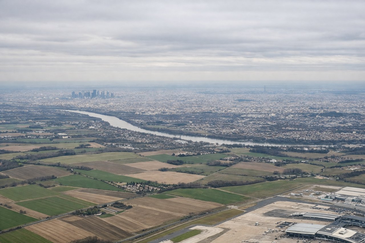
Takeoff from CDG
LEFTCDG's primary departure runways (08L/08R heading east, or 27L/27R heading west) mean left-side seats get views over central Paris during the climbing turn southward. You'll see the Seine river bends, the Eiffel Tower area, and the dense Haussmann grid of central Paris before the aircraft tracks southeast.
Landing at TNR
RIGHTAntananarivo Ivato airport sits northwest of the city, and aircraft typically approach from the north or east on runway 11/29. A right-side seat on approach from the north gives views over the central highlands, the rice paddies of the Betsimitatatra plain, and the city of Antananarivo itself spread across its distinctive ridge system.
Landmarks on this routeAll landmarks →
Will your flight be in sunlight?
Pick a date and time in the Sun Map to watch the sun move across your whole flight.
About This Route
Which side of the plane should I sit on flying from Charles De Gaulle (CDG) to Antananarivo Ivato (TNR)?
Sit on the Right side of the plane for the best views on flights from Paris to Antananarivo. While the left side wins at takeoff for Paris views, the right side delivers more consistently across the full flight — the Mediterranean coast near Marseille, the Nile delta region over Egypt, the Ethiopian highlands, and the spectacular approach into Antananarivo's highland basin all favor the right side on this southeast-tracking route.
What can I see during takeoff from Charles De Gaulle in Paris?
During takeoff from Charles De Gaulle (CDG), sit on the Left side for the best views. CDG's primary departure runways (08L/08R heading east, or 27L/27R heading west) mean left-side seats get views over central Paris during the climbing turn southward. You'll see the Seine river bends, the Eiffel Tower area, and the dense Haussmann grid of central Paris before the aircraft tracks southeast. Notable sights include: Seine river loops through central Paris, Eiffel Tower and Champ de Mars, Bois de Vincennes forest to the southeast, Marne river valley.
What can I see when landing at Antananarivo Ivato in Antananarivo?
When landing at Antananarivo Ivato (TNR), sit on the Right side for the best views. Antananarivo Ivato airport sits northwest of the city, and aircraft typically approach from the north or east on runway 11/29. A right-side seat on approach from the north gives views over the central highlands, the rice paddies of the Betsimitatatra plain, and the city of Antananarivo itself spread across its distinctive ridge system. Notable sights include: Antananarivo ridge city and Rova of Antananarivo palace, Betsimitatatra rice paddy plain, Lac Mandroseza reservoir, central highlands red laterite terrain.
How long is the flight from Paris to Antananarivo?
The flight from Charles De Gaulle (CDG) to Antananarivo Ivato (TNR) takes about 11 hours 30 minutes. The shortest flight path between them is 5,436 miles (8,748 km); winds and air traffic control usually add a few percent.
What does the Paris to Antananarivo flight path pass over?
The route tracks southeast over the French Alps or Mediterranean depending on the exact routing, then crosses the Mediterranean Sea, Egypt and the Nile Delta, the Red Sea, the Ethiopian Highlands and Rift Valley lakes, then over the Mozambique Channel before reaching Madagascar's central highlands. The Ethiopian Rift Valley lakes — including Lake Turkana and Lake Victoria region — may be visible depending on exact routing. The Mozambique Channel crossing is largely open ocean.