Cuiaba to Brasilia is 545 miles (877 km), a flight of about 1 hour 15 minutes.
While the takeoff offers pleasant cerrado and river views, the landing approach to Brasilia provides more distinctive and visually striking features—the artificial Paranoá Lake and the city's unique modernist geometric layout are more memorable than the departure landscape.
Flight Path
The flight path travels roughly east-southeast across the Mato Grosso plateau and into Goias state. Notable features include the transition from Mato Grosso's cerrado and scattered forest patches into the higher central plateau; the landscape becomes progressively more open grassland and lower vegetation as altitude increases. The Araguaia River system lies to the north of the direct flight path but may be visible on clear days from higher altitudes. The terrain gradually rises toward the Brasilia plateau. No major mountain ranges cross this route, but subtle elevation changes and the transition from lower to higher cerrado plateau are visible. The landscape remains predominantly natural cerrado vegetation with minimal urban development along the flight corridor until approaching Brasilia's airspace.
Great circle distance and headings ›Phase by phase
Takeoff from CGB
RIGHTRight-side seats offer views of the Cuiaba River valley and the transition from Mato Grosso's cerrado landscape toward the central plateau. The river's meandering path through vegetation is distinctive during climb-out.
Landing at BSB
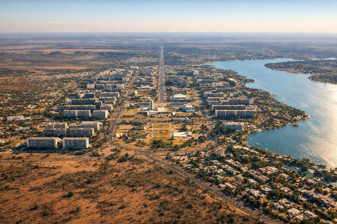
LEFTLeft-side seats provide views of Brasilia's distinctive modernist urban layout and the artificial Paranoá Lake during descent. The geometric city plan and water body are visually striking and unique to this approach.
Will your flight be in sunlight?
Pick a date and time in the Sun Map to watch the sun move across your whole flight.
About This Route
Which side of the plane should I sit on flying from Marechal Rondon (CGB) to Presidente Juscelino Kubitschek (BSB)?
Sit on the Left side of the plane for the best views on flights from Cuiaba to Brasilia. While the takeoff offers pleasant cerrado and river views, the landing approach to Brasilia provides more distinctive and visually striking features—the artificial Paranoá Lake and the city's unique modernist geometric layout are more memorable than the departure landscape.
What can I see during takeoff from Marechal Rondon in Cuiaba?
During takeoff from Marechal Rondon (CGB), sit on the Right side for the best views. Right-side seats offer views of the Cuiaba River valley and the transition from Mato Grosso's cerrado landscape toward the central plateau. The river's meandering path through vegetation is distinctive during climb-out. Notable sights include: Cuiaba River valley, cerrado grassland and scattered forest patches, urban sprawl of Cuiaba city to the west, transition zone between wetland and upland terrain.
What can I see when landing at Presidente Juscelino Kubitschek in Brasilia?
When landing at Presidente Juscelino Kubitschek (BSB), sit on the Left side for the best views. Left-side seats provide views of Brasilia's distinctive modernist urban layout and the artificial Paranoá Lake during descent. The geometric city plan and water body are visually striking and unique to this approach. Notable sights include: Paranoá Lake (artificial reservoir), Brasilia's geometric urban grid and central axis, surrounding cerrado plateau landscape, Brasilia's iconic government buildings and monuments along the central axis.
How long is the flight from Cuiaba to Brasilia?
The flight from Marechal Rondon (CGB) to Presidente Juscelino Kubitschek (BSB) takes about 1 hour 15 minutes. The shortest flight path between them is 545 miles (877 km); winds and air traffic control usually add a few percent.
What does the Cuiaba to Brasilia flight path pass over?
The flight path travels roughly east-southeast across the Mato Grosso plateau and into Goias state. Notable features include the transition from Mato Grosso's cerrado and scattered forest patches into the higher central plateau; the landscape becomes progressively more open grassland and lower vegetation as altitude increases. The Araguaia River system lies to the north of the direct flight path but may be visible on clear days from higher altitudes. The terrain gradually rises toward the Brasilia plateau. No major mountain ranges cross this route, but subtle elevation changes and the transition from lower to higher cerrado plateau are visible. The landscape remains predominantly natural cerrado vegetation with minimal urban development along the flight corridor until approaching Brasilia's airspace.