Charlotte to Augusta is 862 miles (1,388 km), a flight of about 2 hours 10 minutes.
Left side wins at both ends of the flight — Charlotte's urban core on departure and the Kennebec River valley on arrival. During the cruise portion heading northeast, left-side passengers also get better views of the Connecticut River valley and the White Mountains of New Hampshire as the flight tracks up the New England coast.
Flight Path
The flight tracks northeast over the Virginia and North Carolina piedmont, crossing the Blue Ridge briefly near Roanoke, then over the mid-Atlantic coastal plain through Virginia and Maryland. Over Pennsylvania and New Jersey the route passes near Philadelphia and the Delaware River. Crossing into New England, the Connecticut River valley is visible, followed by the forested uplands of Massachusetts and New Hampshire. The White Mountains of New Hampshire may be visible to the northwest near the end of cruise before descent into central Maine.
Great circle distance and headings ›.jpg?width=600)
.jpeg?width=600)
Phase by phase
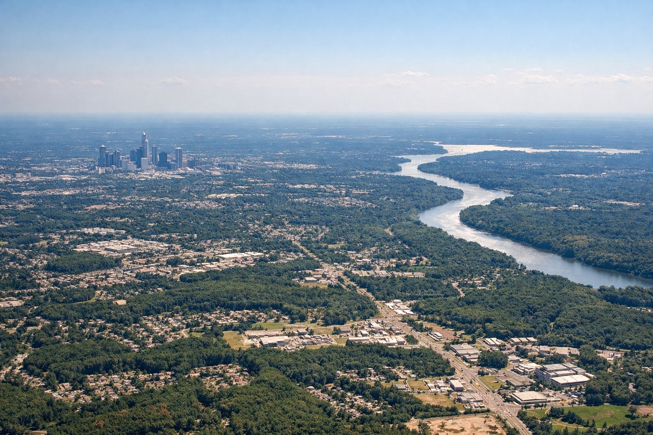
Takeoff from CLT
LEFTCLT's primary departure runways (18C/36C and 18L/36L) oriented north-south mean a northbound departure climbs out over the city of Charlotte to the east on the left side. Left-seat passengers get a clear view of uptown Charlotte's skyline and the urban grid before the aircraft turns northeast toward the Appalachians.
Landing at AUG
LEFTAugusta State Airport (AUG) sits just west of the Kennebec River, and approaches from the southwest on runway 17 bring aircraft over the river and downtown Augusta on the left side. Left-seat passengers see the Kennebec River, the Maine State House dome, and the surrounding forested Maine landscape on final approach.
Landmarks on this routeAll landmarks →
Will your flight be in sunlight?
Pick a date and time in the Sun Map to watch the sun move across your whole flight.
About This Route
Which side of the plane should I sit on flying from Charlotte Douglas International (CLT) to Augusta State (AUG)?
Sit on the Left side of the plane for the best views on flights from Charlotte to Augusta. Left side wins at both ends of the flight — Charlotte's urban core on departure and the Kennebec River valley on arrival. During the cruise portion heading northeast, left-side passengers also get better views of the Connecticut River valley and the White Mountains of New Hampshire as the flight tracks up the New England coast.
What can I see during takeoff from Charlotte Douglas International in Charlotte?
During takeoff from Charlotte Douglas International (CLT), sit on the Left side for the best views. CLT's primary departure runways (18C/36C and 18L/36L) oriented north-south mean a northbound departure climbs out over the city of Charlotte to the east on the left side. Left-seat passengers get a clear view of uptown Charlotte's skyline and the urban grid before the aircraft turns northeast toward the Appalachians. Notable sights include: Uptown Charlotte skyline, Lake Norman to the northwest, Charlotte Motor Speedway visible to the northeast, Catawba River corridor.
What can I see when landing at Augusta State in Augusta?
When landing at Augusta State (AUG), sit on the Left side for the best views. Augusta State Airport (AUG) sits just west of the Kennebec River, and approaches from the southwest on runway 17 bring aircraft over the river and downtown Augusta on the left side. Left-seat passengers see the Kennebec River, the Maine State House dome, and the surrounding forested Maine landscape on final approach. Notable sights include: Kennebec River, Maine State House and downtown Augusta, Togus Pond to the west, forested central Maine terrain.
How long is the flight from Charlotte to Augusta?
The flight from Charlotte Douglas International (CLT) to Augusta State (AUG) takes about 2 hours 10 minutes. The shortest flight path between them is 862 miles (1,388 km); winds and air traffic control usually add a few percent.
What does the Charlotte to Augusta flight path pass over?
The flight tracks northeast over the Virginia and North Carolina piedmont, crossing the Blue Ridge briefly near Roanoke, then over the mid-Atlantic coastal plain through Virginia and Maryland. Over Pennsylvania and New Jersey the route passes near Philadelphia and the Delaware River. Crossing into New England, the Connecticut River valley is visible, followed by the forested uplands of Massachusetts and New Hampshire. The White Mountains of New Hampshire may be visible to the northwest near the end of cruise before descent into central Maine.