While takeoff favors the left side with Charlotte's urban and piedmont scenery, the landing experience on the right side—featuring the Gambia River estuary, mangrove wetlands, and coastal approach—provides more distinctive and geographically dramatic views. The cruise phase over the Atlantic is equally unremarkable from both sides, but the arrival sequence tips the balance to the right. Both sides score equally at 2.5 due to the long ocean crossing that dominates the flight; however, the right side's landing approach offers more visual interest than the left side's takeoff.
Flown CLT to BJL? Did we get it right?
Flight Path
Charlotte to Banjul is 4,246 miles (6,833 km), a flight of about 8 hours 15 minutes.
Atlantic Ocean crossing with no visible landmarks for approximately 6 hours; the flight path crosses over open water south of the Azores and north of the Cape Verde Islands (both too distant to see from cruise altitude). Approaching West Africa, the Sahara Desert's southern edge becomes visible as a tan-colored expanse, followed by the transition to Sahel grasslands and eventually the green vegetation of Senegal and Gambia's coastal regions.
Great circle distance and headings ›Phase by phase
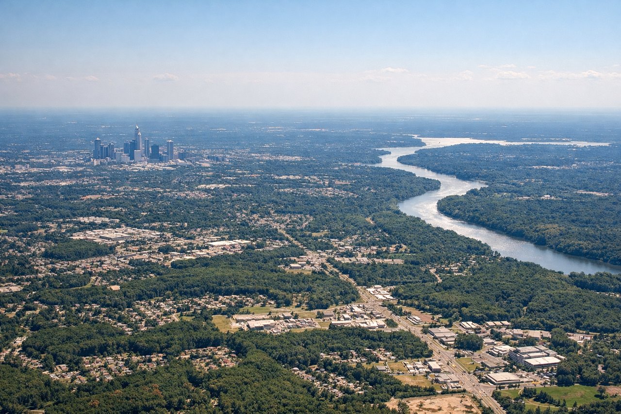
Takeoff from CLT
LEFTLeft side (north/west) offers views of Charlotte's urban sprawl and the Piedmont region during initial climb. Right side faces open terrain with fewer immediate landmarks.
Landing at BJL
RIGHTRight side (north/east) during descent into BJL provides views of the Gambia River estuary, mangrove wetlands, and the Atlantic coastline as the aircraft approaches from the east. Left side faces open Atlantic Ocean for most of the approach.
Will your flight be in sunlight?
Pick a date and time in the Sun Map to watch the sun move across your whole flight.
About This Route
Which side of the plane should I sit on flying from Charlotte Douglas International (CLT) to Banjul International (BJL)?
Sit on the Right side of the plane for the best views on flights from Charlotte to Banjul. While takeoff favors the left side with Charlotte's urban and piedmont scenery, the landing experience on the right side—featuring the Gambia River estuary, mangrove wetlands, and coastal approach—provides more distinctive and geographically dramatic views. The cruise phase over the Atlantic is equally unremarkable from both sides, but the arrival sequence tips the balance to the right. Both sides score equally at 2.5 due to the long ocean crossing that dominates the flight; however, the right side's landing approach offers more visual interest than the left side's takeoff.
What can I see during takeoff from Charlotte Douglas International in Charlotte?
During takeoff from Charlotte Douglas International (CLT), sit on the Left side for the best views. Left side (north/west) offers views of Charlotte's urban sprawl and the Piedmont region during initial climb. Right side faces open terrain with fewer immediate landmarks. Notable sights include: Charlotte downtown skyline, Lake Norman to the northwest, Piedmont foothills in distant background.
What can I see when landing at Banjul International in Banjul?
When landing at Banjul International (BJL), sit on the Right side for the best views. Right side (north/east) during descent into BJL provides views of the Gambia River estuary, mangrove wetlands, and the Atlantic coastline as the aircraft approaches from the east. Left side faces open Atlantic Ocean for most of the approach. Notable sights include: Gambia River estuary with mangrove forests, Banjul peninsula and harbor, Atlantic coastline.
How long is the flight from Charlotte to Banjul?
The flight from Charlotte Douglas International (CLT) to Banjul International (BJL) takes about 8 hours 15 minutes. The shortest flight path between them is 4,246 miles (6,833 km); winds and air traffic control usually add a few percent.
What does the Charlotte to Banjul flight path pass over?
Atlantic Ocean crossing with no visible landmarks for approximately 6 hours; the flight path crosses over open water south of the Azores and north of the Cape Verde Islands (both too distant to see from cruise altitude). Approaching West Africa, the Sahara Desert's southern edge becomes visible as a tan-colored expanse, followed by the transition to Sahel grasslands and eventually the green vegetation of Senegal and Gambia's coastal regions.