The left side delivers the better views at both ends of this short flight — Charlotte's skyline and lake system on departure, and Columbus's river corridor and recognizable landmarks on approach. The flight is brief enough that midpoint scenery is limited, so the bookend city views are what matter most.
Flown CLT to CMH? Did we get it right?
Flight Path
Charlotte to Columbus is 347 miles (559 km), a flight of about 1 hour 10 minutes.
The flight crosses the North Carolina piedmont, then the Virginia-West Virginia border region with the Appalachian ridges of the Blue Ridge and Allegheny Mountains visible as parallel northeast-southwest ridgelines in the distance to the left. Over southern Ohio the terrain flattens dramatically into the glaciated till plain. The New River Gorge area of West Virginia may be visible as a dark forested cut in the plateau below at cruise altitude.
Great circle distance and headings ›Phase by phase
Takeoff from CLT
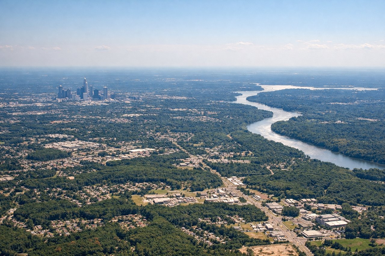
LEFTCharlotte Douglas primarily uses runways 18L/18R and 36L/36R oriented north-south. On a northbound departure toward Columbus, climbing out heading north, the left (west) side gives a view back over Charlotte's uptown skyline and the Catawba River corridor. The right side faces east toward open suburban sprawl with less visual interest.
Landing at CMH
LEFTColumbus approaches from the south on runways 28L/28R or 10L/10R depending on wind. On a typical westerly approach, the left side looks south over the Scioto River valley and downtown Columbus's skyline as the aircraft descends. The right side faces north toward less distinctive suburban terrain.
Will your flight be in sunlight?
Pick a date and time in the Sun Map to watch the sun move across your whole flight.
About This Route
Which side of the plane should I sit on flying from Charlotte Douglas International (CLT) to Port Columbus International (CMH)?
Sit on the Left side of the plane for the best views on flights from Charlotte to Columbus. The left side delivers the better views at both ends of this short flight — Charlotte's skyline and lake system on departure, and Columbus's river corridor and recognizable landmarks on approach. The flight is brief enough that midpoint scenery is limited, so the bookend city views are what matter most.
What can I see during takeoff from Charlotte Douglas International in Charlotte?
During takeoff from Charlotte Douglas International (CLT), sit on the Left side for the best views. Charlotte Douglas primarily uses runways 18L/18R and 36L/36R oriented north-south. On a northbound departure toward Columbus, climbing out heading north, the left (west) side gives a view back over Charlotte's uptown skyline and the Catawba River corridor. The right side faces east toward open suburban sprawl with less visual interest. Notable sights include: Charlotte uptown skyline, Catawba River/Lake Norman to the northwest, I-85 corridor threading north, Lake Wylie to the southwest.
What can I see when landing at Port Columbus International in Columbus?
When landing at Port Columbus International (CMH), sit on the Left side for the best views. Columbus approaches from the south on runways 28L/28R or 10L/10R depending on wind. On a typical westerly approach, the left side looks south over the Scioto River valley and downtown Columbus's skyline as the aircraft descends. The right side faces north toward less distinctive suburban terrain. Notable sights include: Downtown Columbus skyline along the Scioto River, Scioto River winding through the city, Ohio State University campus (large oval stadium visible), Hoover Reservoir to the northeast.
How long is the flight from Charlotte to Columbus?
The flight from Charlotte Douglas International (CLT) to Port Columbus International (CMH) takes about 1 hour 10 minutes. The shortest flight path between them is 347 miles (559 km); winds and air traffic control usually add a few percent.
What does the Charlotte to Columbus flight path pass over?
The flight crosses the North Carolina piedmont, then the Virginia-West Virginia border region with the Appalachian ridges of the Blue Ridge and Allegheny Mountains visible as parallel northeast-southwest ridgelines in the distance to the left. Over southern Ohio the terrain flattens dramatically into the glaciated till plain. The New River Gorge area of West Virginia may be visible as a dark forested cut in the plateau below at cruise altitude.