The left side delivers the better views at both ends of this short flight — Charlotte's skyline and Lake Norman on departure, and the Great Miami River valley with Dayton's downtown on approach. The right side sees mostly undifferentiated Piedmont and Ohio farmland throughout.
Flight Path
The flight crosses the North Carolina-Virginia border region over the Piedmont Triad area near Greensboro, then transits central Virginia and crosses into West Virginia briefly before entering Ohio. The terrain transitions from rolling Piedmont farmland through the foothills of the Appalachian plateau in southern Ohio, with the Ohio River valley visible as a broad lowland corridor if routing takes you near Cincinnati. Much of the mid-flight view is flat to gently rolling agricultural land with small towns and river valleys characteristic of the Ohio interior.
Great circle distance and headings ›Phase by phase
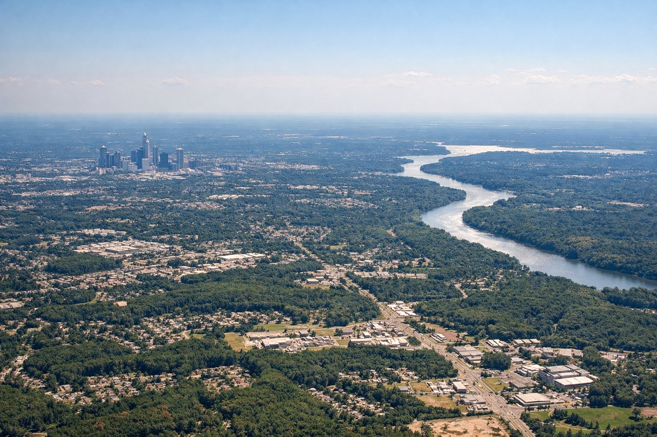
Takeoff from CLT
LEFTCharlotte Douglas typically departs runway 18C/18L heading south before turning northwest toward Dayton, meaning the left side faces east toward uptown Charlotte's skyline and the Piedmont landscape. As the aircraft banks left to head north, the left side gets a clear view of the city grid and the Catawba River corridor.
Landing at DAY
LEFTDayton International typically lands on runway 24L heading west-southwest, placing the left side of the aircraft facing south toward the Great Miami River valley and the Dayton urban area. The left seat gets a prolonged view of the city, the river, and Wright-Patterson Air Force Base as the aircraft descends.
Landmarks on this routeAll landmarks →
Will your flight be in sunlight?
See exactly which side of the plane gets sun and shade at your departure time.
About This Route
Which side of the plane should I sit on flying from Charlotte Douglas International (CLT) to James M Cox Dayton International (DAY)?
Sit on the Left side of the plane for the best views on flights from Charlotte to Dayton. The left side delivers the better views at both ends of this short flight — Charlotte's skyline and Lake Norman on departure, and the Great Miami River valley with Dayton's downtown on approach. The right side sees mostly undifferentiated Piedmont and Ohio farmland throughout.
What can I see during takeoff from Charlotte Douglas International in Charlotte?
During takeoff from Charlotte Douglas International (CLT), sit on the Left side for the best views. Charlotte Douglas typically departs runway 18C/18L heading south before turning northwest toward Dayton, meaning the left side faces east toward uptown Charlotte's skyline and the Piedmont landscape. As the aircraft banks left to head north, the left side gets a clear view of the city grid and the Catawba River corridor. Notable sights include: Uptown Charlotte skyline, Catawba River, Lake Norman to the north, Piedmont farmland patchwork.
What can I see when landing at James M Cox Dayton International in Dayton?
When landing at James M Cox Dayton International (DAY), sit on the Left side for the best views. Dayton International typically lands on runway 24L heading west-southwest, placing the left side of the aircraft facing south toward the Great Miami River valley and the Dayton urban area. The left seat gets a prolonged view of the city, the river, and Wright-Patterson Air Force Base as the aircraft descends. Notable sights include: Dayton city skyline, Great Miami River, Wright-Patterson Air Force Base, Mad River confluence.
How long is the flight from Charlotte to Dayton?
The flight from Charlotte Douglas International (CLT) to James M Cox Dayton International (DAY) takes Approximately 1 hour to 1 hour 15 minutes.
What does the Charlotte to Dayton flight path pass over?
The flight crosses the North Carolina-Virginia border region over the Piedmont Triad area near Greensboro, then transits central Virginia and crosses into West Virginia briefly before entering Ohio. The terrain transitions from rolling Piedmont farmland through the foothills of the Appalachian plateau in southern Ohio, with the Ohio River valley visible as a broad lowland corridor if routing takes you near Cincinnati. Much of the mid-flight view is flat to gently rolling agricultural land with small towns and river valleys characteristic of the Ohio interior.