Left side wins both ends of the flight — Charlotte's skyline on departure and the Detroit River plus downtown Detroit on approach. During cruise the left side also faces generally southeast, keeping the Appalachian ridgelines of West Virginia and the Ohio River valley in view during the middle portion of the flight.
Flown CLT to DTW? Did we get it right?
Flight Path
Charlotte to Detroit is 501 miles (806 km), a flight of about 1 hour 45 minutes.
The flight tracks northeast over the North Carolina Piedmont, crosses the Blue Ridge and Appalachian ridges of Virginia and West Virginia (visible as parallel forested ridgelines from altitude), then flattens out over the Ohio River valley near Columbus Ohio before crossing into the flat Lake Erie plain of northwest Ohio and southeast Michigan. The Ohio River itself may be briefly visible as a broad winding ribbon near the West Virginia-Ohio border.
Great circle distance and headings ›Phase by phase
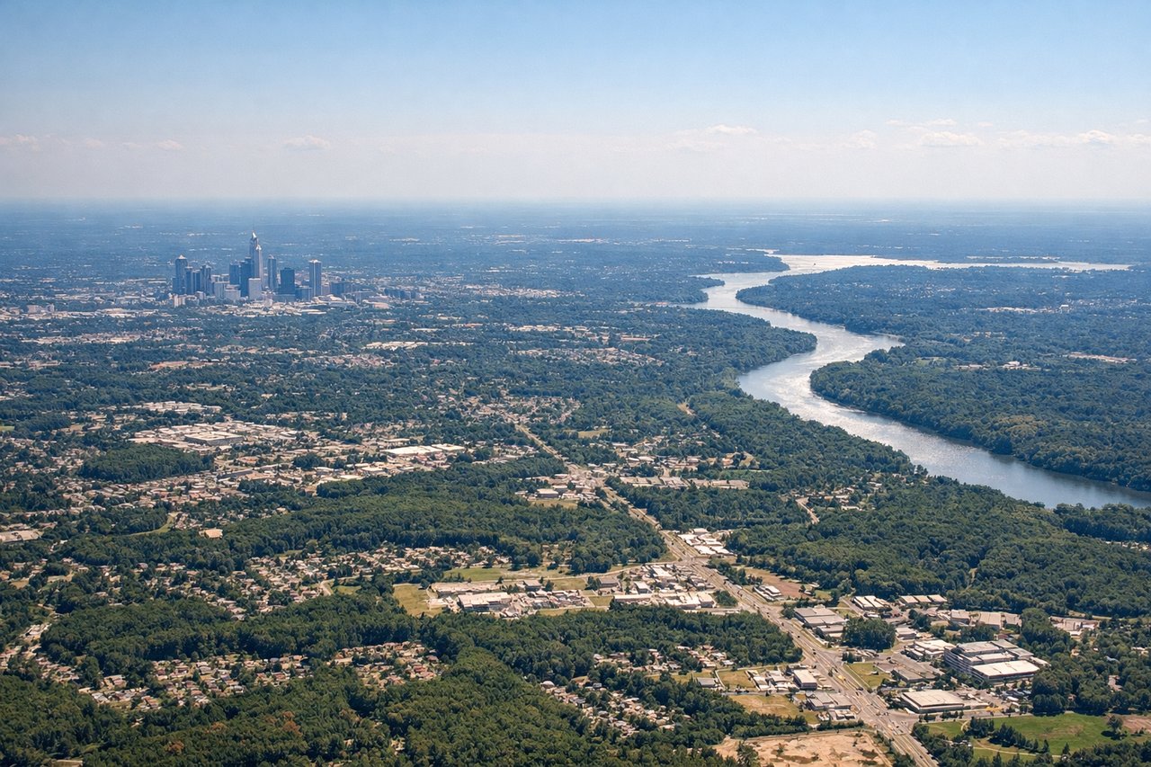
Takeoff from CLT
LEFTCLT's primary departure runways 18C/18L/18R send aircraft heading south before turning northeast toward DTW. On the left (east) side you get a clear view back over uptown Charlotte's skyline as the aircraft banks northeast. The right side faces west toward undeveloped Piedmont terrain with little of interest.
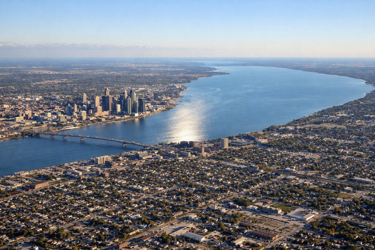
Landing at DTW
LEFTDTW's primary arrival runways are 21L/21R (heading southwest), meaning the aircraft approaches from the northeast over the Detroit metro area. The left (southeast) side gives you a clear view of the Detroit River, Windsor Ontario across the border, and the downtown Detroit skyline on final approach. The right side faces northwest over suburban sprawl.
Will your flight be in sunlight?
Pick a date and time in the Sun Map to watch the sun move across your whole flight.
About This Route
Which side of the plane should I sit on flying from Charlotte Douglas International (CLT) to Detroit Metro Wayne Co (DTW)?
Sit on the Left side of the plane for the best views on flights from Charlotte to Detroit. Left side wins both ends of the flight — Charlotte's skyline on departure and the Detroit River plus downtown Detroit on approach. During cruise the left side also faces generally southeast, keeping the Appalachian ridgelines of West Virginia and the Ohio River valley in view during the middle portion of the flight.
What can I see during takeoff from Charlotte Douglas International in Charlotte?
During takeoff from Charlotte Douglas International (CLT), sit on the Left side for the best views. CLT's primary departure runways 18C/18L/18R send aircraft heading south before turning northeast toward DTW. On the left (east) side you get a clear view back over uptown Charlotte's skyline as the aircraft banks northeast. The right side faces west toward undeveloped Piedmont terrain with little of interest. Notable sights include: Uptown Charlotte skyline, Lake Norman to the northwest (visible briefly on right before bank), University Research Park area, I-85/I-77 interchange spaghetti.
What can I see when landing at Detroit Metro Wayne Co in Detroit?
When landing at Detroit Metro Wayne Co (DTW), sit on the Left side for the best views. DTW's primary arrival runways are 21L/21R (heading southwest), meaning the aircraft approaches from the northeast over the Detroit metro area. The left (southeast) side gives you a clear view of the Detroit River, Windsor Ontario across the border, and the downtown Detroit skyline on final approach. The right side faces northwest over suburban sprawl. Notable sights include: Detroit River and Windsor Ontario, downtown Detroit skyline, Lake Erie visible to the southeast on descent, Ford River Rouge Complex along the Rouge River.
How long is the flight from Charlotte to Detroit?
The flight from Charlotte Douglas International (CLT) to Detroit Metro Wayne Co (DTW) takes about 1 hour 45 minutes. The shortest flight path between them is 501 miles (806 km); winds and air traffic control usually add a few percent.
What does the Charlotte to Detroit flight path pass over?
The flight tracks northeast over the North Carolina Piedmont, crosses the Blue Ridge and Appalachian ridges of Virginia and West Virginia (visible as parallel forested ridgelines from altitude), then flattens out over the Ohio River valley near Columbus Ohio before crossing into the flat Lake Erie plain of northwest Ohio and southeast Michigan. The Ohio River itself may be briefly visible as a broad winding ribbon near the West Virginia-Ohio border.