Right side wins both ends of the flight. During the long overwater cruise over the Amazon basin and South Atlantic corridor, neither side has a significant advantage, but the right side delivers the better views at both Charlotte departure and Buenos Aires arrival.
Flight Path
The route tracks south-southeast over South Carolina and Georgia, crosses the Caribbean near Cuba or Hispaniola, transits Venezuela and Colombia airspace, crosses the vast Amazon basin with its river network visible on clear days, then tracks over central Brazil's cerrado plateau before descending into the Pampas of Argentina. The Amazon River tributaries and the broad brown Río de la Plata estuary on descent are the most visually striking geographic features of the cruise phase.
Great circle distance and headings ›

_(cropped).jpg?width=600)
Phase by phase

Takeoff from CLT
RIGHTCLT's primary departure runways (18C/36C complex) mean southbound departures head roughly south, putting the Charlotte skyline and the Piedmont terrain to the right (west) side. Right-side passengers get a clear view of uptown Charlotte's cluster of towers before the aircraft banks south over the Carolina Piedmont.
Landing at EZE
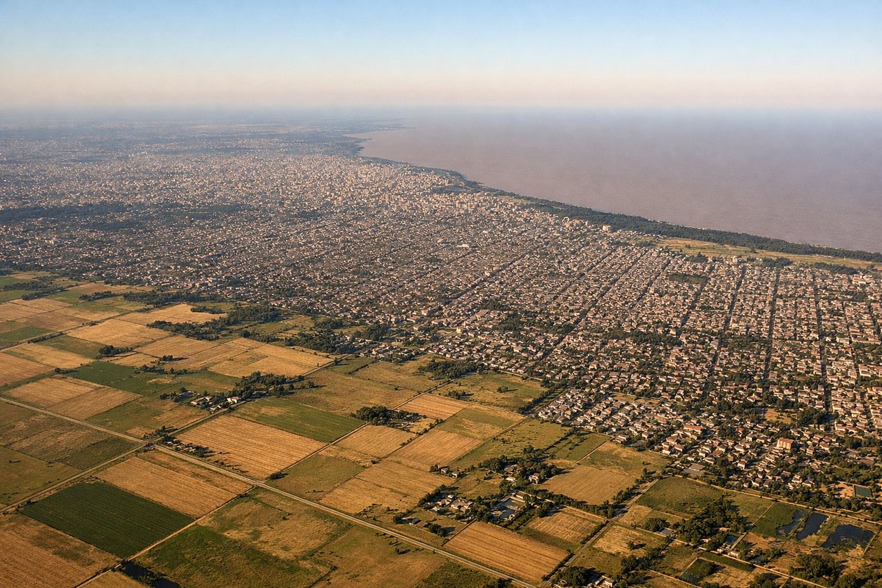
RIGHTEzeiza typically uses runways 11/29 or 17/35. On approach from the north, aircraft generally track southward over the Río de la Plata estuary and the Buenos Aires metro area. Right-side (west-facing) passengers see the dense Buenos Aires urban grid, the Riachuelo river boundary, and the sprawling southern suburbs, while left-side passengers face the broad brown expanse of the Río de la Plata.
Landmarks on this routeAll landmarks →
Will your flight be in sunlight?
See exactly which side of the plane gets sun and shade at your departure time.
About This Route
Which side of the plane should I sit on flying from Charlotte Douglas International (CLT) to Ezeiza Ministro Pistarini (EZE)?
Sit on the Right side of the plane for the best views on flights from Charlotte to Buenos Aires. Right side wins both ends of the flight. During the long overwater cruise over the Amazon basin and South Atlantic corridor, neither side has a significant advantage, but the right side delivers the better views at both Charlotte departure and Buenos Aires arrival.
What can I see during takeoff from Charlotte Douglas International in Charlotte?
During takeoff from Charlotte Douglas International (CLT), sit on the Right side for the best views. CLT's primary departure runways (18C/36C complex) mean southbound departures head roughly south, putting the Charlotte skyline and the Piedmont terrain to the right (west) side. Right-side passengers get a clear view of uptown Charlotte's cluster of towers before the aircraft banks south over the Carolina Piedmont. Notable sights include: Uptown Charlotte skyline, Lake Norman to the northwest, Lake Wylie to the southwest, Catawba River corridor.
What can I see when landing at Ezeiza Ministro Pistarini in Buenos Aires?
When landing at Ezeiza Ministro Pistarini (EZE), sit on the Right side for the best views. Ezeiza typically uses runways 11/29 or 17/35. On approach from the north, aircraft generally track southward over the Río de la Plata estuary and the Buenos Aires metro area. Right-side (west-facing) passengers see the dense Buenos Aires urban grid, the Riachuelo river boundary, and the sprawling southern suburbs, while left-side passengers face the broad brown expanse of the Río de la Plata. Notable sights include: Buenos Aires urban grid and downtown skyline, Riachuelo river, Matanza river corridor, southern Gran Buenos Aires suburban sprawl.
How long is the flight from Charlotte to Buenos Aires?
The flight from Charlotte Douglas International (CLT) to Ezeiza Ministro Pistarini (EZE) takes Approximately 9 to 10 hours.
What does the Charlotte to Buenos Aires flight path pass over?
The route tracks south-southeast over South Carolina and Georgia, crosses the Caribbean near Cuba or Hispaniola, transits Venezuela and Colombia airspace, crosses the vast Amazon basin with its river network visible on clear days, then tracks over central Brazil's cerrado plateau before descending into the Pampas of Argentina. The Amazon River tributaries and the broad brown Río de la Plata estuary on descent are the most visually striking geographic features of the cruise phase.