While the right side wins at takeoff for the Charlotte skyline, the left side dominates the bulk of the flight. Heading south-southeast, the left side tracks closer to the South Carolina and Georgia interior, and crucially delivers the dramatic Everglades-to-Miami transition on descent, which is one of the more visually striking approaches in the eastern US.
Flown CLT to MIA? Did we get it right?
Flight Path
Charlotte to Miami is 652 miles (1,049 km), a flight of about 1 hour 55 minutes.
The flight tracks south-southeast over the South Carolina Piedmont, then crosses into Georgia airspace over the Savannah River watershed. Around the midpoint you pass over central Georgia's pine flatlands near Valdosta. The route then crosses into Florida over the Big Bend area, transitioning to the flat Florida peninsula with its chain of lakes in central Florida visible below, before the landscape flattens further into the Everglades on descent into Miami.
Great circle distance and headings ›Phase by phase

Takeoff from CLT
RIGHTCLT's primary departure runways (18C/36C and 18L/36L) oriented north-south mean southbound departures swing east over the city. The right side gives you a clear look back at uptown Charlotte's skyline and then the sprawling Piedmont landscape as you climb out heading south-southeast.
Landing at MIA
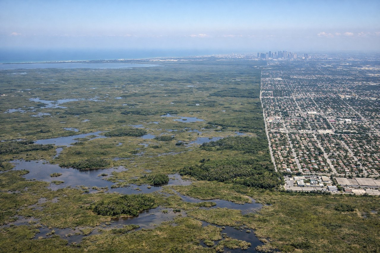
LEFTMIA typically uses runways 08L/R for eastward arrivals or 26L/R for westward approaches. On the common eastward approach over the Everglades, the left side gives you the full sweep of the Everglades wetlands and then Biscayne Bay, with downtown Miami appearing ahead-left as you descend. On a westward approach, the left side still captures the Atlantic coastline and Miami Beach barrier island.
Will your flight be in sunlight?
Pick a date and time in the Sun Map to watch the sun move across your whole flight.
About This Route
Which side of the plane should I sit on flying from Charlotte Douglas International (CLT) to Miami International (MIA)?
Sit on the Left side of the plane for the best views on flights from Charlotte to Miami. While the right side wins at takeoff for the Charlotte skyline, the left side dominates the bulk of the flight. Heading south-southeast, the left side tracks closer to the South Carolina and Georgia interior, and crucially delivers the dramatic Everglades-to-Miami transition on descent, which is one of the more visually striking approaches in the eastern US.
What can I see during takeoff from Charlotte Douglas International in Charlotte?
During takeoff from Charlotte Douglas International (CLT), sit on the Right side for the best views. CLT's primary departure runways (18C/36C and 18L/36L) oriented north-south mean southbound departures swing east over the city. The right side gives you a clear look back at uptown Charlotte's skyline and then the sprawling Piedmont landscape as you climb out heading south-southeast. Notable sights include: Uptown Charlotte skyline, Lake Norman to the northwest (visible on left briefly), Lake Wylie to the southwest, Piedmont farmland patchwork.
What can I see when landing at Miami International in Miami?
When landing at Miami International (MIA), sit on the Left side for the best views. MIA typically uses runways 08L/R for eastward arrivals or 26L/R for westward approaches. On the common eastward approach over the Everglades, the left side gives you the full sweep of the Everglades wetlands and then Biscayne Bay, with downtown Miami appearing ahead-left as you descend. On a westward approach, the left side still captures the Atlantic coastline and Miami Beach barrier island. Notable sights include: Everglades wetland grid and water conservation areas, Biscayne Bay, Miami Beach barrier island and Atlantic coastline, downtown Miami skyline.
How long is the flight from Charlotte to Miami?
The flight from Charlotte Douglas International (CLT) to Miami International (MIA) takes about 1 hour 55 minutes. The shortest flight path between them is 652 miles (1,049 km); winds and air traffic control usually add a few percent.
What does the Charlotte to Miami flight path pass over?
The flight tracks south-southeast over the South Carolina Piedmont, then crosses into Georgia airspace over the Savannah River watershed. Around the midpoint you pass over central Georgia's pine flatlands near Valdosta. The route then crosses into Florida over the Big Bend area, transitioning to the flat Florida peninsula with its chain of lakes in central Florida visible below, before the landscape flattens further into the Everglades on descent into Miami.