The left side wins narrowly because the Blue Ridge Mountain views during climb-out offer more topographic drama than the flat Midwestern cruise, even though the right side gets a nice river-and-skyline moment on final approach into MSP.
Flown CLT to MSP? Did we get it right?
Flight Path
Charlotte to Minneapolis is 930 miles (1,496 km), a flight of about 2 hours 20 minutes.
Rolling farmland and river valleys of eastern Tennessee, Kentucky's Bluegrass region, and the Ohio River crossing near the Kentucky-Indiana border, followed by flat corn and soybean country across Indiana, Illinois, and Wisconsin's Driftless Area hills before descending toward the Minnesota River valley.
Great circle distance and headings ›

Phase by phase
Takeoff from CLT
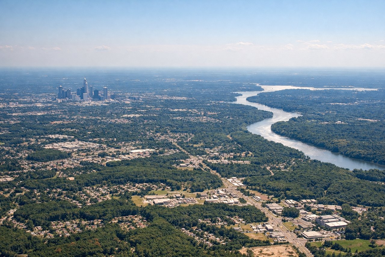
LEFTDeparting CLT in the likely south flow, the aircraft climbs out and banks onto its northwest course toward MSP, putting the foothills and ridgelines of the Blue Ridge Mountains on the left side of the cabin. This is the only real topographic relief on the whole route, giving early climb passengers a brief but genuine mountain view before the terrain flattens out over Tennessee and Kentucky.
Landing at MSP
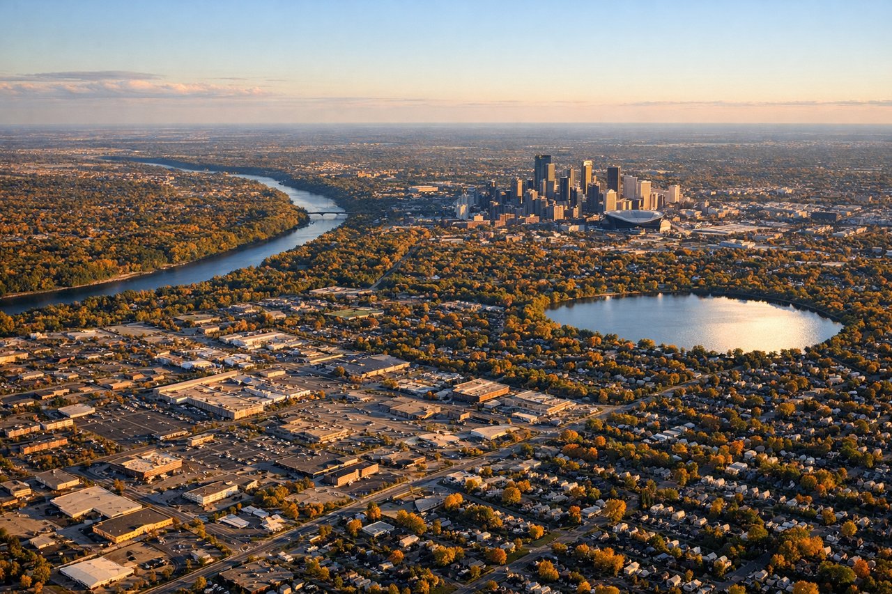
RIGHTOn approach to MSP from the southeast, most arrivals line up for runway 30, tracking over the southern suburbs and the Minnesota River valley before crossing near the Mississippi River. This puts downtown St. Paul, the river bluffs, and the distant Minneapolis skyline on the right side of the aircraft during the final descent.
Will your flight be in sunlight?
Pick a date and time in the Sun Map to watch the sun move across your whole flight.
About This Route
Which side of the plane should I sit on flying from Charlotte Douglas International (CLT) to Minneapolis St Paul International (MSP)?
Sit on the Left side of the plane for the best views on flights from Charlotte to Minneapolis. The left side wins narrowly because the Blue Ridge Mountain views during climb-out offer more topographic drama than the flat Midwestern cruise, even though the right side gets a nice river-and-skyline moment on final approach into MSP.
What can I see during takeoff from Charlotte Douglas International in Charlotte?
During takeoff from Charlotte Douglas International (CLT), sit on the Left side for the best views. Departing CLT in the likely south flow, the aircraft climbs out and banks onto its northwest course toward MSP, putting the foothills and ridgelines of the Blue Ridge Mountains on the left side of the cabin. This is the only real topographic relief on the whole route, giving early climb passengers a brief but genuine mountain view before the terrain flattens out over Tennessee and Kentucky. Notable sights include: Blue Ridge Mountains foothills, South Mountains of western NC, Catawba River valley, Charlotte's outer suburbs.
What can I see when landing at Minneapolis St Paul International in Minneapolis?
When landing at Minneapolis St Paul International (MSP), sit on the Right side for the best views. On approach to MSP from the southeast, most arrivals line up for runway 30, tracking over the southern suburbs and the Minnesota River valley before crossing near the Mississippi River. This puts downtown St. Paul, the river bluffs, and the distant Minneapolis skyline on the right side of the aircraft during the final descent. Notable sights include: Mississippi River bends, downtown St. Paul skyline, Minnesota River confluence, distant Minneapolis skyline.
How long is the flight from Charlotte to Minneapolis?
The flight from Charlotte Douglas International (CLT) to Minneapolis St Paul International (MSP) takes about 2 hours 20 minutes. The shortest flight path between them is 930 miles (1,496 km); winds and air traffic control usually add a few percent.
What does the Charlotte to Minneapolis flight path pass over?
Rolling farmland and river valleys of eastern Tennessee, Kentucky's Bluegrass region, and the Ohio River crossing near the Kentucky-Indiana border, followed by flat corn and soybean country across Indiana, Illinois, and Wisconsin's Driftless Area hills before descending toward the Minnesota River valley.