Charlotte to Grant County Airport is 2,134 miles (3,434 km), a flight of about 4 hours 45 minutes.
Right-side seats capture the most dramatic scenery across the full flight path: the Blue Ridge Mountains during climb-out from Charlotte, the Appalachian terrain during the westbound cruise, and the Cascade Range foothills during descent into Grant County. Left-side views are primarily high desert plateau with less visual variety.
Flight Path
Appalachian Mountains (Tennessee and Kentucky ridges), Ohio River valley, Cumberland Plateau, Great Lakes region far to the north, transition from deciduous eastern forests to the semi-arid Columbia Plateau of Washington state, Snake River basin in Idaho and eastern Washington
Great circle distance and headings ›.jpeg?width=600)


_48.jpg?width=600)
.jpg?width=600)
Phase by phase
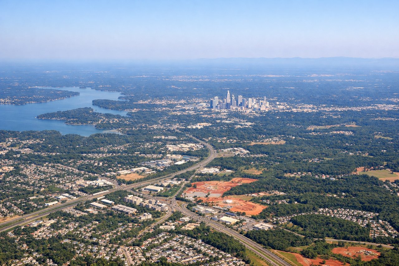
Takeoff from CLT
RIGHTRight-side seats offer views of the Piedmont region's rolling terrain and the Blue Ridge Mountains beginning to rise to the northwest. The climb-out path from CLT heads generally westward, positioning right-side passengers to see the topographic transition from the Piedmont plateau toward the Appalachian foothills.
Landing at MWH
LEFTLeft-side seats provide views of the Columbia Plateau and the approach corridor into Grant County. As the aircraft descends from the east toward MWH, left-side passengers see the high desert terrain, the Cascade Range foothills to the west, and the distinctive landscape of central Washington's semi-arid plateau.
Landmarks on this routeAll landmarks →
Will your flight be in sunlight?
Pick a date and time in the Sun Map to watch the sun move across your whole flight.
About This Route
Which side of the plane should I sit on flying from Charlotte Douglas International (CLT) to Grant Co International (MWH)?
Sit on the Right side of the plane for the best views on flights from Charlotte to Grant County Airport. Right-side seats capture the most dramatic scenery across the full flight path: the Blue Ridge Mountains during climb-out from Charlotte, the Appalachian terrain during the westbound cruise, and the Cascade Range foothills during descent into Grant County. Left-side views are primarily high desert plateau with less visual variety.
What can I see during takeoff from Charlotte Douglas International in Charlotte?
During takeoff from Charlotte Douglas International (CLT), sit on the Right side for the best views. Right-side seats offer views of the Piedmont region's rolling terrain and the Blue Ridge Mountains beginning to rise to the northwest. The climb-out path from CLT heads generally westward, positioning right-side passengers to see the topographic transition from the Piedmont plateau toward the Appalachian foothills. Notable sights include: Blue Ridge Mountains (distant northwestern horizon), Catawba River valley, Charlotte urban sprawl fading southeastward, Piedmont plateau terrain.
What can I see when landing at Grant Co International in Grant County Airport?
When landing at Grant Co International (MWH), sit on the Left side for the best views. Left-side seats provide views of the Columbia Plateau and the approach corridor into Grant County. As the aircraft descends from the east toward MWH, left-side passengers see the high desert terrain, the Cascade Range foothills to the west, and the distinctive landscape of central Washington's semi-arid plateau. Notable sights include: Cascade Range (western horizon), Columbia Plateau semi-arid terrain, Grant County agricultural fields, Quincy Valley basin.
How long is the flight from Charlotte to Grant County Airport?
The flight from Charlotte Douglas International (CLT) to Grant Co International (MWH) takes about 4 hours 45 minutes. The shortest flight path between them is 2,134 miles (3,434 km); winds and air traffic control usually add a few percent.
What does the Charlotte to Grant County Airport flight path pass over?
Appalachian Mountains (Tennessee and Kentucky ridges), Ohio River valley, Cumberland Plateau, Great Lakes region far to the north, transition from deciduous eastern forests to the semi-arid Columbia Plateau of Washington state, Snake River basin in Idaho and eastern Washington