The left side offers a stronger cumulative view: glimpses of the southern Appalachians early in the flight, a chance at the Wind River Range and Snake River Plain during the Rockies crossing, and the dramatic Mount Hood approach into Portland, giving it more landmark density and terrain drama than the right side's flatter northern Plains and more distant Cascade peaks.
Flown CLT to PDX? Did we get it right?
Flight Path
Charlotte to Portland is 2,277 miles (3,665 km), a flight of about 5 hours 20 minutes.
Route passes over the Tennessee Valley and Appalachian foothills near departure, then the Great Plains of Missouri and Nebraska, the Wyoming Rockies (Wind River Range area), the Snake River Plain of southern Idaho, and the Columbia Plateau of eastern Oregon before descending toward the Cascades.
Great circle distance and headings ›


Phase by phase

Takeoff from CLT
RIGHTWith CLT's typical south-flow departure, aircraft climb out southbound before turning right onto the westbound routing, giving right-side passengers a brief look back at Charlotte's Uptown skyline and Lake Norman to the north before the plane settles onto its Piedmont crossing.
Landing at PDX
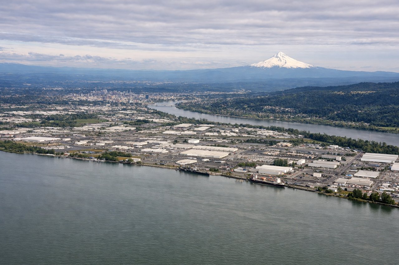
LEFTOn the common easterly approach into PDX along the Columbia River Gorge, the left side faces south toward Mount Hood, whose snow-capped volcanic cone looms large and close as the aircraft descends over the Willamette Valley.
Will your flight be in sunlight?
Pick a date and time in the Sun Map to watch the sun move across your whole flight.
About This Route
Which side of the plane should I sit on flying from Charlotte Douglas International (CLT) to Portland International (PDX)?
Sit on the Left side of the plane for the best views on flights from Charlotte to Portland. The left side offers a stronger cumulative view: glimpses of the southern Appalachians early in the flight, a chance at the Wind River Range and Snake River Plain during the Rockies crossing, and the dramatic Mount Hood approach into Portland, giving it more landmark density and terrain drama than the right side's flatter northern Plains and more distant Cascade peaks.
What can I see during takeoff from Charlotte Douglas International in Charlotte?
During takeoff from Charlotte Douglas International (CLT), sit on the Right side for the best views. With CLT's typical south-flow departure, aircraft climb out southbound before turning right onto the westbound routing, giving right-side passengers a brief look back at Charlotte's Uptown skyline and Lake Norman to the north before the plane settles onto its Piedmont crossing. Notable sights include: Charlotte Uptown skyline, Lake Norman, Piedmont rolling farmland, distant Blue Ridge foothills.
What can I see when landing at Portland International in Portland?
When landing at Portland International (PDX), sit on the Left side for the best views. On the common easterly approach into PDX along the Columbia River Gorge, the left side faces south toward Mount Hood, whose snow-capped volcanic cone looms large and close as the aircraft descends over the Willamette Valley. Notable sights include: Mount Hood, Columbia River, Willamette Valley farmland, forested Cascade foothills.
How long is the flight from Charlotte to Portland?
The flight from Charlotte Douglas International (CLT) to Portland International (PDX) takes about 5 hours 20 minutes. The shortest flight path between them is 2,277 miles (3,665 km); winds and air traffic control usually add a few percent.
What does the Charlotte to Portland flight path pass over?
Route passes over the Tennessee Valley and Appalachian foothills near departure, then the Great Plains of Missouri and Nebraska, the Wyoming Rockies (Wind River Range area), the Snake River Plain of southern Idaho, and the Columbia Plateau of eastern Oregon before descending toward the Cascades.