Charlotte to Savannah is 214 miles (344 km), a flight of about 1 hour 5 minutes.
While the left seat wins at takeoff for the Charlotte skyline, the right seat delivers the more dramatic and sustained scenery — the Georgia and South Carolina coastal marshes, the Savannah River delta, and the Atlantic coastline on approach are genuinely spectacular from the right side. The coastal Low Country views on descent are the highlight of this short flight.
Flight Path
The flight tracks southeast across the South Carolina Piedmont, crossing the Broad River and Saluda River systems near Columbia. As the aircraft descends, the terrain flattens into the South Carolina coastal plain, with the Savannah River drainage basin becoming visible. The transition from red clay Piedmont to flat coastal plain pine forests is noticeable around the midpoint near the I-26 corridor.
Great circle distance and headings ›Phase by phase
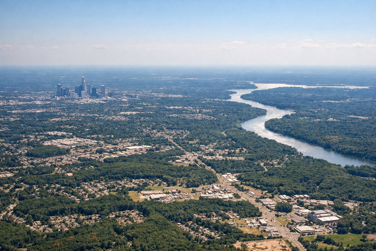
Takeoff from CLT
LEFTCLT typically departs south on runway 18C/18L, so a left (east) window gives you a view back over uptown Charlotte's skyline as you climb out. You'll see the grid of downtown and the surrounding Piedmont sprawl before the aircraft turns southeast toward Savannah.
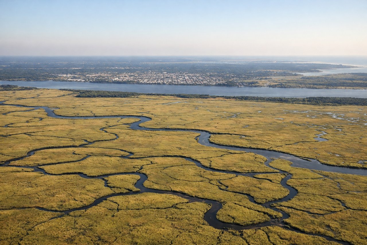
Landing at SAV
RIGHTSAV typically lands on runway 10 (heading east) or runway 28 (heading west). On an approach from the north/northwest on runway 10, the right (south) side gives you views over the Savannah River, the historic district grid, and the coastal marshes of the Georgia Low Country. On runway 28, the right side still captures the river and marsh systems on final.
Will your flight be in sunlight?
Pick a date and time in the Sun Map to watch the sun move across your whole flight.
About This Route
Which side of the plane should I sit on flying from Charlotte Douglas International (CLT) to Savannah Hilton Head International (SAV)?
Sit on the Right side of the plane for the best views on flights from Charlotte to Savannah. While the left seat wins at takeoff for the Charlotte skyline, the right seat delivers the more dramatic and sustained scenery — the Georgia and South Carolina coastal marshes, the Savannah River delta, and the Atlantic coastline on approach are genuinely spectacular from the right side. The coastal Low Country views on descent are the highlight of this short flight.
What can I see during takeoff from Charlotte Douglas International in Charlotte?
During takeoff from Charlotte Douglas International (CLT), sit on the Left side for the best views. CLT typically departs south on runway 18C/18L, so a left (east) window gives you a view back over uptown Charlotte's skyline as you climb out. You'll see the grid of downtown and the surrounding Piedmont sprawl before the aircraft turns southeast toward Savannah. Notable sights include: Uptown Charlotte skyline, Lake Norman to the north, Lake Wylie to the southwest, I-85/I-77 interchange.
What can I see when landing at Savannah Hilton Head International in Savannah?
When landing at Savannah Hilton Head International (SAV), sit on the Right side for the best views. SAV typically lands on runway 10 (heading east) or runway 28 (heading west). On an approach from the north/northwest on runway 10, the right (south) side gives you views over the Savannah River, the historic district grid, and the coastal marshes of the Georgia Low Country. On runway 28, the right side still captures the river and marsh systems on final. Notable sights include: Savannah River, Savannah historic district grid, Tybee Island and Atlantic coast, coastal marshes of the Georgia Low Country.
How long is the flight from Charlotte to Savannah?
The flight from Charlotte Douglas International (CLT) to Savannah Hilton Head International (SAV) takes about 1 hour 5 minutes. The shortest flight path between them is 214 miles (344 km); winds and air traffic control usually add a few percent.
What does the Charlotte to Savannah flight path pass over?
The flight tracks southeast across the South Carolina Piedmont, crossing the Broad River and Saluda River systems near Columbia. As the aircraft descends, the terrain flattens into the South Carolina coastal plain, with the Savannah River drainage basin becoming visible. The transition from red clay Piedmont to flat coastal plain pine forests is noticeable around the midpoint near the I-26 corridor.