Most of this short flight is spent over the Atlantic, and the right side offers glimpses of the Carolina and Georgia coastline shortly after departure and the turquoise shallows of the Bahamas and Turks and Caicos region as the route curves southeast — more visual variety than the featureless ocean on the left.
Flown CLT to SIG? Did we get it right?
Flight Path
Charlotte to San Juan is 1,472 miles (2,369 km), a flight of about 3 hours 10 minutes.
Atlantic Ocean, Bahamas archipelago (Great Abaco/Eleuthera vicinity), Turks and Caicos shallows
Great circle distance and headings ›Phase by phase
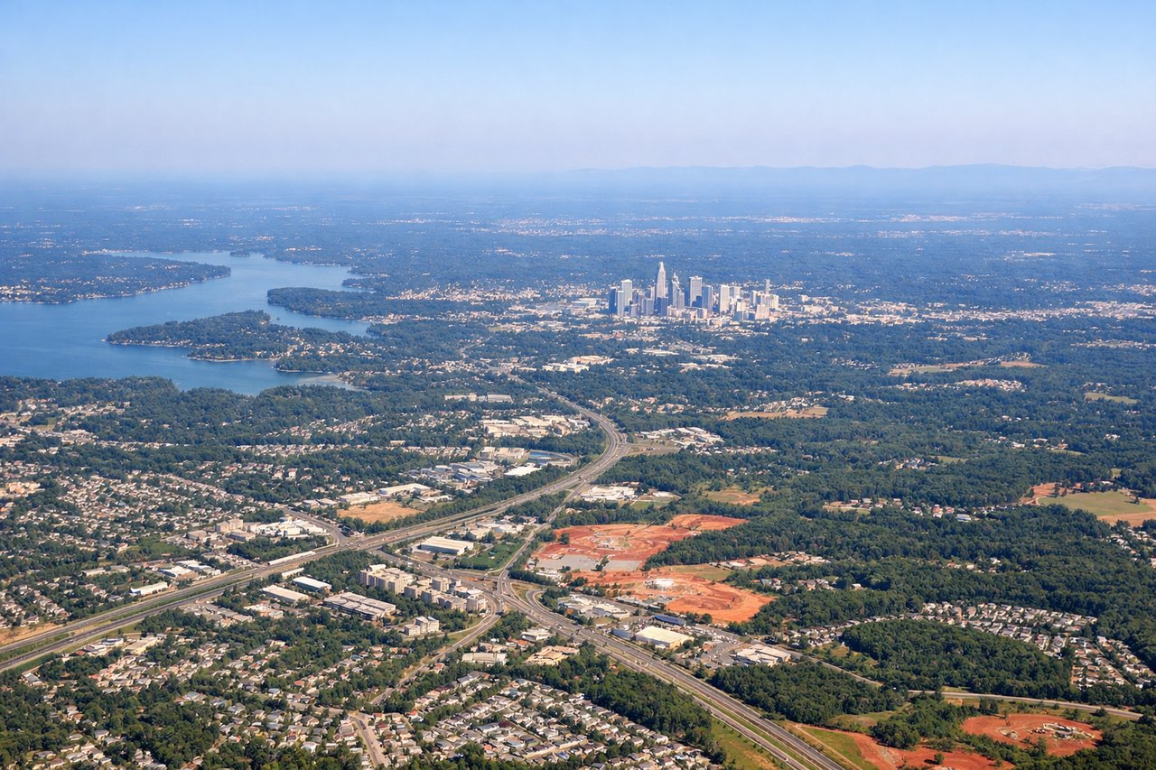
Takeoff from CLT
RIGHTDeparting CLT in south flow, the climb-out gives right-side passengers a brief look back at the Charlotte skyline and the rolling Piedmont countryside before the turn toward the coast. The left side mostly shows flat farmland and suburban sprawl with little variation.
Landing at SIG
LEFTOn the westerly approach into SIG's runway 09, the aircraft crosses over San Juan Bay and the historic Old San Juan peninsula, which sits to the north of the flight path — visible from the left side. The right side mainly shows open Caribbean water and the newer Isla Verde coastline.
Will your flight be in sunlight?
Pick a date and time in the Sun Map to watch the sun move across your whole flight.
About This Route
Which side of the plane should I sit on flying from Charlotte Douglas International (CLT) to Fernando Luis Ribas Dominicci (SIG)?
Sit on the Right side of the plane for the best views on flights from Charlotte to San Juan. Most of this short flight is spent over the Atlantic, and the right side offers glimpses of the Carolina and Georgia coastline shortly after departure and the turquoise shallows of the Bahamas and Turks and Caicos region as the route curves southeast — more visual variety than the featureless ocean on the left.
What can I see during takeoff from Charlotte Douglas International in Charlotte?
During takeoff from Charlotte Douglas International (CLT), sit on the Right side for the best views. Departing CLT in south flow, the climb-out gives right-side passengers a brief look back at the Charlotte skyline and the rolling Piedmont countryside before the turn toward the coast. The left side mostly shows flat farmland and suburban sprawl with little variation. Notable sights include: Charlotte skyline, Piedmont farmland, I-77 corridor.
What can I see when landing at Fernando Luis Ribas Dominicci in San Juan?
When landing at Fernando Luis Ribas Dominicci (SIG), sit on the Left side for the best views. On the westerly approach into SIG's runway 09, the aircraft crosses over San Juan Bay and the historic Old San Juan peninsula, which sits to the north of the flight path — visible from the left side. The right side mainly shows open Caribbean water and the newer Isla Verde coastline. Notable sights include: San Juan Bay, Old San Juan fort walls, Condado lagoon, Bacardi distillery on the bay.
How long is the flight from Charlotte to San Juan?
The flight from Charlotte Douglas International (CLT) to Fernando Luis Ribas Dominicci (SIG) takes about 3 hours 10 minutes. The shortest flight path between them is 1,472 miles (2,369 km); winds and air traffic control usually add a few percent.
What does the Charlotte to San Juan flight path pass over?
Atlantic Ocean, Bahamas archipelago (Great Abaco/Eleuthera vicinity), Turks and Caicos shallows