The right side scores higher due to the dramatic Amazon rainforest and river systems visible during the entire cruise and landing approach. While Cartagena's coastal takeoff is scenic, the 3+ hours of flight over the Colombian interior and Amazon basin on the right side offers greater terrain variety and visual interest than the left side's extended view of flat Caribbean waters and coastal plains.
Flight Path
Magdalena River valley and floodplain (visible during initial climb), transition from Caribbean coastal plains to Andean foothills near Medellín region, extensive Amazon rainforest canopy with tributary river systems, Putumayo River forming the Colombia-Peru border
Great circle distance and headings ›Phase by phase
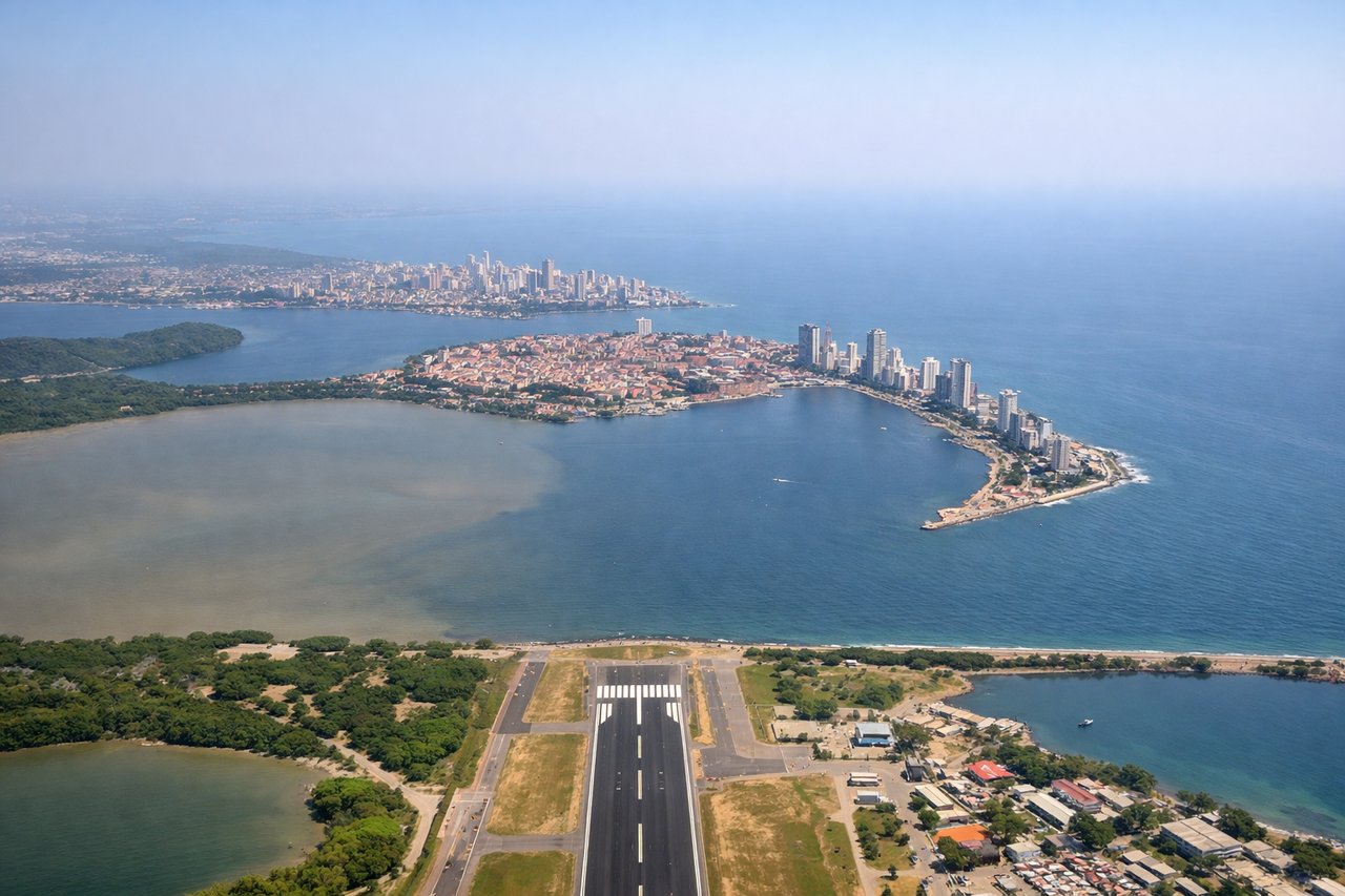
Takeoff from CTG
LEFTCartagena's Caribbean coastline and colonial harbor are visible during climb-out. The left side captures the turquoise waters of Cartagena Bay and the city's waterfront before the aircraft turns inland toward the Amazon.
Landing at LET
RIGHTThe approach to Leticia reveals the Amazon rainforest canopy and the confluence of the Amazon and Putumayo rivers. The right side offers dense, unbroken forest texture and the dramatic river systems that define this remote region.
Landmarks on this routeAll landmarks →
Will your flight be in sunlight?
See exactly which side of the plane gets sun and shade at your departure time.
About This Route
Which side of the plane should I sit on flying from Rafael Nunez (CTG) to Alfredo Vasquez Cobo (LET)?
Sit on the Right side of the plane for the best views on flights from Cartagena to Leticia. The right side scores higher due to the dramatic Amazon rainforest and river systems visible during the entire cruise and landing approach. While Cartagena's coastal takeoff is scenic, the 3+ hours of flight over the Colombian interior and Amazon basin on the right side offers greater terrain variety and visual interest than the left side's extended view of flat Caribbean waters and coastal plains.
What can I see during takeoff from Rafael Nunez in Cartagena?
During takeoff from Rafael Nunez (CTG), sit on the Left side for the best views. Cartagena's Caribbean coastline and colonial harbor are visible during climb-out. The left side captures the turquoise waters of Cartagena Bay and the city's waterfront before the aircraft turns inland toward the Amazon. Notable sights include: Cartagena Bay and harbor, Caribbean coastline, Rosario Islands archipelago to the southwest.
What can I see when landing at Alfredo Vasquez Cobo in Leticia?
When landing at Alfredo Vasquez Cobo (LET), sit on the Right side for the best views. The approach to Leticia reveals the Amazon rainforest canopy and the confluence of the Amazon and Putumayo rivers. The right side offers dense, unbroken forest texture and the dramatic river systems that define this remote region. Notable sights include: Amazon rainforest canopy, Amazon River, Putumayo River confluence, Leticia airstrip clearing.
How long is the flight from Cartagena to Leticia?
The flight from Rafael Nunez (CTG) to Alfredo Vasquez Cobo (LET) takes 3h 15m.
What does the Cartagena to Leticia flight path pass over?
Magdalena River valley and floodplain (visible during initial climb), transition from Caribbean coastal plains to Andean foothills near Medellín region, extensive Amazon rainforest canopy with tributary river systems, Putumayo River forming the Colombia-Peru border