Right side scores higher (3.0 vs 2.5) due to superior scenic content at both ends of the flight. Takeoff features Cartagena's iconic colonial waterfront and Caribbean setting; landing showcases Philadelphia's urban riverfront and downtown skyline. Left side offers minimal scenery during takeoff (inland flatlands) and suburban sprawl during landing. The cruise phase over the Atlantic and southeastern United States is largely ocean and featureless terrain for both sides, but the departure and arrival sequences decisively favor the right.
Flight Path
Atlantic Ocean (5+ hours of open water dominates the cruise phase), Bahamas archipelago and shallow banks (visible during early climb and late descent if routing permits), southeastern U.S. coastline including Georgia and South Carolina lowlands, Appalachian foothills in North Carolina and Virginia (distant, near horizon during mid-cruise)
Great circle distance and headings ›

Phase by phase
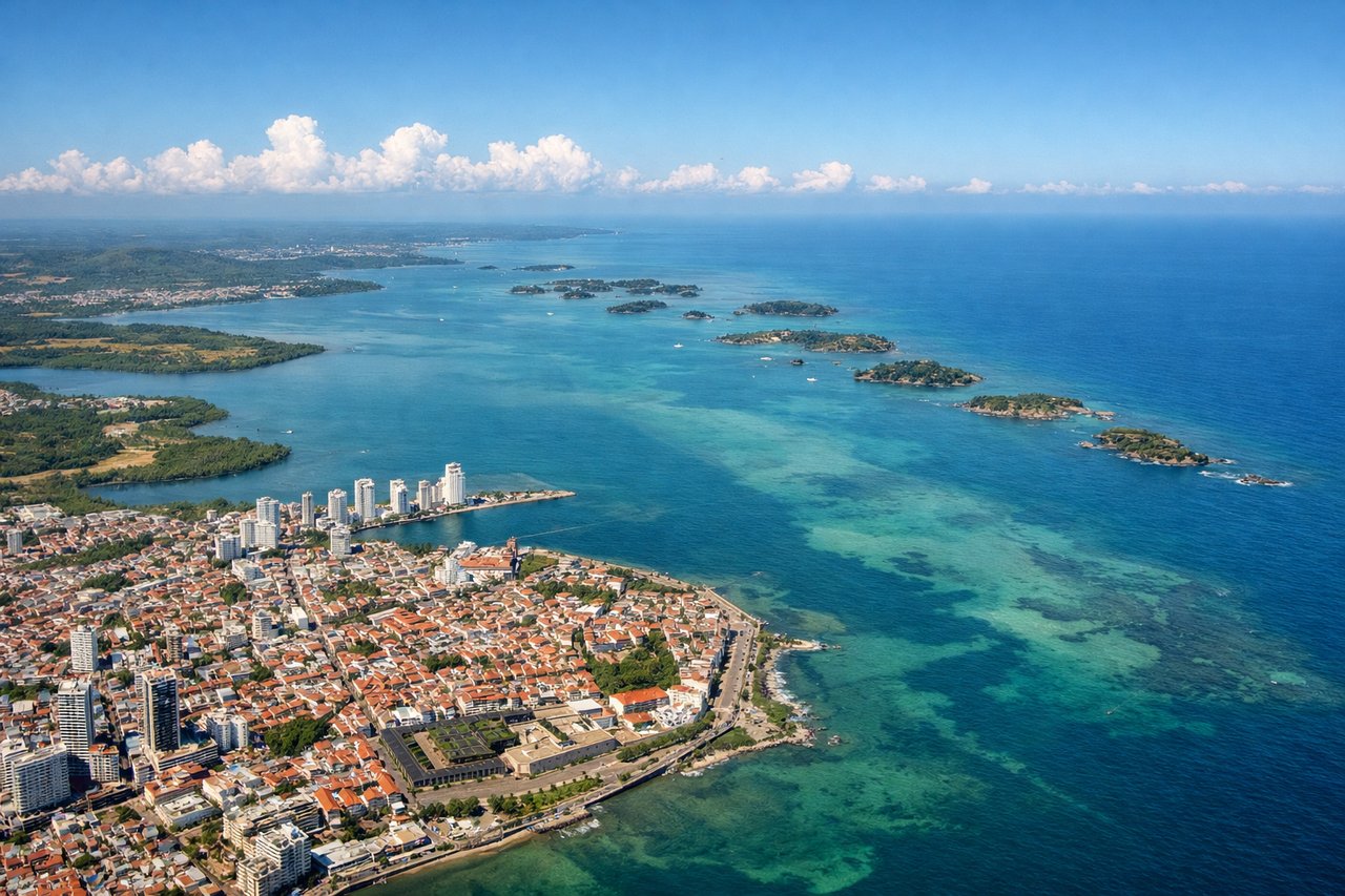
Takeoff from CTG
RIGHTRight side captures Cartagena's historic walled city and Caribbean coastline during initial climb. The colonial architecture and turquoise waters of Cartagena Bay are distinctive from 2,000–5,000 feet. Left side faces inland toward flat, featureless terrain with minimal visual interest during departure.

Landing at PHL
RIGHTRight side (north/northeast approach) offers views of the Delaware River, Philadelphia's downtown skyline, and the urban waterfront during descent and final approach to runways 27L/27R. The city's grid and river corridor are visually distinctive. Left side faces suburban sprawl and industrial areas with less scenic appeal.
Landmarks on this routeAll landmarks →
Will your flight be in sunlight?
See exactly which side of the plane gets sun and shade at your departure time.
About This Route
Which side of the plane should I sit on flying from Rafael Nunez (CTG) to Philadelphia International (PHL)?
Sit on the Right side of the plane for the best views on flights from Cartagena to Philadelphia. Right side scores higher (3.0 vs 2.5) due to superior scenic content at both ends of the flight. Takeoff features Cartagena's iconic colonial waterfront and Caribbean setting; landing showcases Philadelphia's urban riverfront and downtown skyline. Left side offers minimal scenery during takeoff (inland flatlands) and suburban sprawl during landing. The cruise phase over the Atlantic and southeastern United States is largely ocean and featureless terrain for both sides, but the departure and arrival sequences decisively favor the right.
What can I see during takeoff from Rafael Nunez in Cartagena?
During takeoff from Rafael Nunez (CTG), sit on the Right side for the best views. Right side captures Cartagena's historic walled city and Caribbean coastline during initial climb. The colonial architecture and turquoise waters of Cartagena Bay are distinctive from 2,000–5,000 feet. Left side faces inland toward flat, featureless terrain with minimal visual interest during departure. Notable sights include: Cartagena's walled old city (Ciudad Vieja), Cartagena Bay with its barrier islands, Caribbean Sea coastline, Rosario Islands archipelago to the southwest.
What can I see when landing at Philadelphia International in Philadelphia?
When landing at Philadelphia International (PHL), sit on the Right side for the best views. Right side (north/northeast approach) offers views of the Delaware River, Philadelphia's downtown skyline, and the urban waterfront during descent and final approach to runways 27L/27R. The city's grid and river corridor are visually distinctive. Left side faces suburban sprawl and industrial areas with less scenic appeal. Notable sights include: Delaware River corridor, Philadelphia downtown skyline and City Hall, Benjamin Franklin Bridge, Schuylkill River confluence, urban waterfront districts.
How long is the flight from Cartagena to Philadelphia?
The flight from Rafael Nunez (CTG) to Philadelphia International (PHL) takes 4h 15m.
What does the Cartagena to Philadelphia flight path pass over?
Atlantic Ocean (5+ hours of open water dominates the cruise phase), Bahamas archipelago and shallow banks (visible during early climb and late descent if routing permits), southeastern U.S. coastline including Georgia and South Carolina lowlands, Appalachian foothills in North Carolina and Virginia (distant, near horizon during mid-cruise)