While Dubai's departure offers immediate coastal interest, Toronto's landing dominates the overall experience. The right side captures Lake Ontario's scale and beauty, the Niagara Escarpment's geological significance, and Toronto's iconic waterfront skyline—features that create more visual variety and landmark density than the relatively flat Persian Gulf departure. The landing approach is substantially more scenic than the takeoff, and this advantage outweighs Dubai's modest coastal appeal.
Flown DXB to YTZ? Did we get it right?
Flight Path
Dubai to Toronto is 6,881 miles (11,075 km), a flight of about 14 hours 15 minutes.
Greenland's ice sheet and fjord-carved coastline (far north, visible on northerly routing); the Arctic Ocean and Canadian Arctic Archipelago islands (if routing crosses high latitudes); the Canadian Shield's boreal forest and lake-dotted terrain across northern Ontario and Quebec; Hudson Bay (if visible on routing); the Atlantic coastline of Newfoundland and Labrador (if routing passes eastward before turning west toward Toronto)
Great circle distance and headings ›


Phase by phase
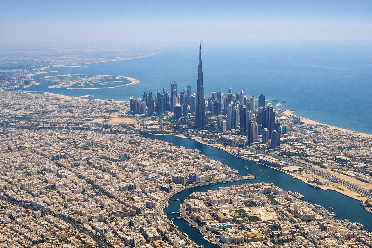
Takeoff from DXB
LEFTDubai's coastal departure offers immediate urban and maritime scenery. The left side (north/northwest) captures the Persian Gulf coastline, Dubai's harbor infrastructure, and the Hajar Mountains rising inland to the southeast—visible during initial climb.
Landing at YTZ
RIGHTToronto's approach from the east/northeast over Lake Ontario provides dramatic water scenery and the city's iconic waterfront. The right side (north/northeast) captures the Great Lakes basin, the Niagara Escarpment's geological edge, and Toronto's downtown skyline rising from the lakeshore during descent.
Will your flight be in sunlight?
Pick a date and time in the Sun Map to watch the sun move across your whole flight.
About This Route
Which side of the plane should I sit on flying from Dubai International (DXB) to City Centre (YTZ)?
Sit on the Right side of the plane for the best views on flights from Dubai to Toronto. While Dubai's departure offers immediate coastal interest, Toronto's landing dominates the overall experience. The right side captures Lake Ontario's scale and beauty, the Niagara Escarpment's geological significance, and Toronto's iconic waterfront skyline—features that create more visual variety and landmark density than the relatively flat Persian Gulf departure. The landing approach is substantially more scenic than the takeoff, and this advantage outweighs Dubai's modest coastal appeal.
What can I see during takeoff from Dubai International in Dubai?
During takeoff from Dubai International (DXB), sit on the Left side for the best views. Dubai's coastal departure offers immediate urban and maritime scenery. The left side (north/northwest) captures the Persian Gulf coastline, Dubai's harbor infrastructure, and the Hajar Mountains rising inland to the southeast—visible during initial climb. Notable sights include: Persian Gulf coastline, Dubai Marina and Palm Jumeirah artificial islands, Hajar Mountains (distant southeast), Dubai city grid.
What can I see when landing at City Centre in Toronto?
When landing at City Centre (YTZ), sit on the Right side for the best views. Toronto's approach from the east/northeast over Lake Ontario provides dramatic water scenery and the city's iconic waterfront. The right side (north/northeast) captures the Great Lakes basin, the Niagara Escarpment's geological edge, and Toronto's downtown skyline rising from the lakeshore during descent. Notable sights include: Lake Ontario's vast expanse, Niagara Escarpment ridge line, Toronto downtown skyline and CN Tower, Toronto Islands (barrier islands in the lake).
How long is the flight from Dubai to Toronto?
The flight from Dubai International (DXB) to City Centre (YTZ) takes about 14 hours 15 minutes. The shortest flight path between them is 6,881 miles (11,075 km); winds and air traffic control usually add a few percent.
What does the Dubai to Toronto flight path pass over?
Greenland's ice sheet and fjord-carved coastline (far north, visible on northerly routing); the Arctic Ocean and Canadian Arctic Archipelago islands (if routing crosses high latitudes); the Canadian Shield's boreal forest and lake-dotted terrain across northern Ontario and Quebec; Hudson Bay (if visible on routing); the Atlantic coastline of Newfoundland and Labrador (if routing passes eastward before turning west toward Toronto)