The takeoff experience from El Paso with the Franklin Mountains and Rio Grande valley is more visually striking and geographically distinctive than the landing approach. While the landing offers water views, the takeoff provides more dramatic terrain relief and clearer geographic context.
Flown ELP to BWI? Did we get it right?
Flight Path
El Paso to Baltimore is 1,738 miles (2,797 km), a flight of about 4 hours 15 minutes.
The flight path crosses the southern Great Plains, passing over the Pecos River valley in west Texas, then the Edwards Plateau and Hill Country region of central Texas. Crossing into Oklahoma and Arkansas, the terrain transitions to rolling forested hills and river valleys (Arkansas River, Ouachita River systems). The Appalachian foothills become visible in the final approach to Maryland, with the Blue Ridge Mountains appearing as a distant ridge on the western horizon during descent into the Baltimore area.
Great circle distance and headings ›


Phase by phase
Takeoff from ELP
LEFTLeft side offers immediate views of the Franklin Mountains running north-south directly adjacent to El Paso, and the Rio Grande valley stretching eastward. Right side faces the flat desert plateau with less dramatic terrain.
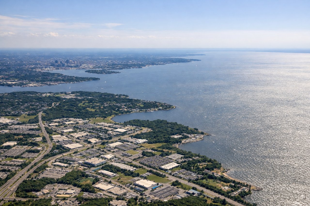
Landing at BWI
RIGHTRight side provides excellent views of the Patuxent River and its broad estuary as the aircraft descends into the Baltimore area, plus views of the Chesapeake Bay's western shore and the urban sprawl of the Baltimore-Washington corridor.
Will your flight be in sunlight?
Pick a date and time in the Sun Map to watch the sun move across your whole flight.
About This Route
Which side of the plane should I sit on flying from El Paso International (ELP) to Baltimore Washington International (BWI)?
Sit on the Left side of the plane for the best views on flights from El Paso to Baltimore. The takeoff experience from El Paso with the Franklin Mountains and Rio Grande valley is more visually striking and geographically distinctive than the landing approach. While the landing offers water views, the takeoff provides more dramatic terrain relief and clearer geographic context.
What can I see during takeoff from El Paso International in El Paso?
During takeoff from El Paso International (ELP), sit on the Left side for the best views. Left side offers immediate views of the Franklin Mountains running north-south directly adjacent to El Paso, and the Rio Grande valley stretching eastward. Right side faces the flat desert plateau with less dramatic terrain. Notable sights include: Franklin Mountains (immediately west), Rio Grande river valley (south and east), Ciudad Juárez urban sprawl (south across the border), Hueco Mountains (distant northeast on horizon).
What can I see when landing at Baltimore Washington International in Baltimore?
When landing at Baltimore Washington International (BWI), sit on the Right side for the best views. Right side provides excellent views of the Patuxent River and its broad estuary as the aircraft descends into the Baltimore area, plus views of the Chesapeake Bay's western shore and the urban sprawl of the Baltimore-Washington corridor. Notable sights include: Patuxent River estuary (prominent in descent), Chesapeake Bay western shoreline, Baltimore Harbor and Inner Harbor (urban waterfront), Patapsco River valley.
How long is the flight from El Paso to Baltimore?
The flight from El Paso International (ELP) to Baltimore Washington International (BWI) takes about 4 hours 15 minutes. The shortest flight path between them is 1,738 miles (2,797 km); winds and air traffic control usually add a few percent.
What does the El Paso to Baltimore flight path pass over?
The flight path crosses the southern Great Plains, passing over the Pecos River valley in west Texas, then the Edwards Plateau and Hill Country region of central Texas. Crossing into Oklahoma and Arkansas, the terrain transitions to rolling forested hills and river valleys (Arkansas River, Ouachita River systems). The Appalachian foothills become visible in the final approach to Maryland, with the Blue Ridge Mountains appearing as a distant ridge on the western horizon during descent into the Baltimore area.