While takeoff on the left offers brief estuary views, the landing on the right provides more sustained and visually striking scenery: Brisbane's river system, Moreton Bay islands, and coastal geography are far more distinctive than the flat pampas. Right side wins for the overall journey.
Flown EZE to BNE? Did we get it right?
Flight Path
Buenos Aires to Brisbane is 7,667 miles (12,339 km), a flight of about 13 hours 30 minutes.
This route typically crosses the South Pacific, passing south of New Zealand (if visible during daylight hours, the Southern Alps appear as a thin white line on the horizon). The flight path generally follows a great circle route southeast across the Tasman Sea, then northeast across open ocean toward Australia. No major landmarks are visible during the 8-10 hour mid-ocean portion. As you approach Australia, the Queensland coast becomes visible: the Great Barrier Reef's outer edge (subtle color change in water), Fraser Island (long sandy island off the coast), and eventually the Brisbane region.
Great circle distance and headings ›


Phase by phase

Takeoff from EZE
LEFTLeft side offers views of the Río de la Plata estuary and Buenos Aires urban sprawl as you climb out westward. The wide river and city grid are distinctive from altitude and visible for the first 15-20 minutes of climb.
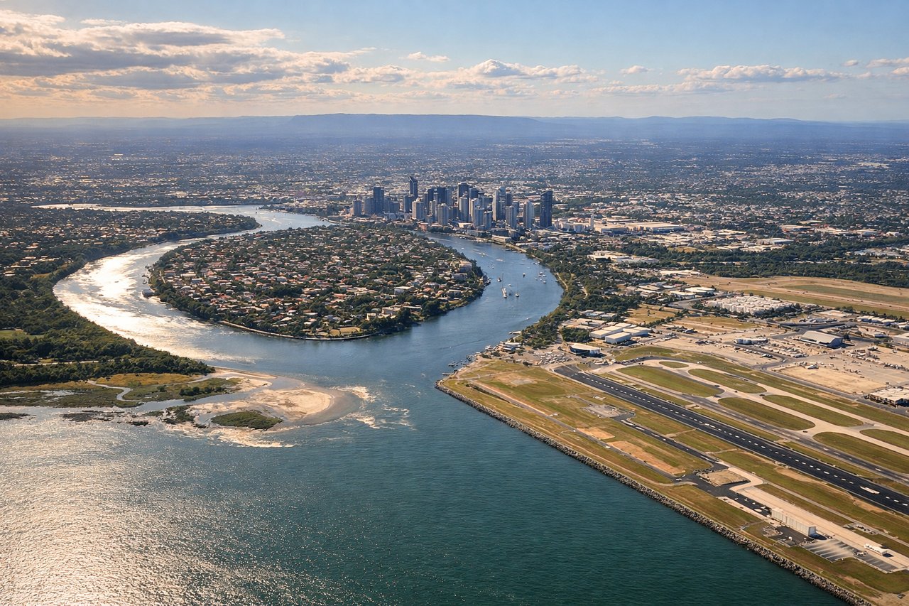
Landing at BNE
RIGHTRight side provides views of Brisbane's geography during descent: the Brisbane River winding through the city, Moreton Bay with its islands, and the coastal plain. These features are prominent on approach from the east and visible during the final 20-30 minutes of descent.
Will your flight be in sunlight?
Pick a date and time in the Sun Map to watch the sun move across your whole flight.
About This Route
Which side of the plane should I sit on flying from Ezeiza Ministro Pistarini (EZE) to Brisbane International (BNE)?
Sit on the Right side of the plane for the best views on flights from Buenos Aires to Brisbane. While takeoff on the left offers brief estuary views, the landing on the right provides more sustained and visually striking scenery: Brisbane's river system, Moreton Bay islands, and coastal geography are far more distinctive than the flat pampas. Right side wins for the overall journey.
What can I see during takeoff from Ezeiza Ministro Pistarini in Buenos Aires?
During takeoff from Ezeiza Ministro Pistarini (EZE), sit on the Left side for the best views. Left side offers views of the Río de la Plata estuary and Buenos Aires urban sprawl as you climb out westward. The wide river and city grid are distinctive from altitude and visible for the first 15-20 minutes of climb. Notable sights include: Río de la Plata (wide brown estuary), Buenos Aires city grid and suburbs, Paraná River delta to the north, flat pampas extending westward.
What can I see when landing at Brisbane International in Brisbane?
When landing at Brisbane International (BNE), sit on the Right side for the best views. Right side provides views of Brisbane's geography during descent: the Brisbane River winding through the city, Moreton Bay with its islands, and the coastal plain. These features are prominent on approach from the east and visible during the final 20-30 minutes of descent. Notable sights include: Brisbane River (distinctive serpentine curves through city center), Moreton Bay with North Stradbroke and Moreton Islands, Brisbane CBD skyline, coastal plain and beaches to the east.
How long is the flight from Buenos Aires to Brisbane?
The flight from Ezeiza Ministro Pistarini (EZE) to Brisbane International (BNE) takes about 13 hours 30 minutes. The shortest flight path between them is 7,667 miles (12,339 km); winds and air traffic control usually add a few percent.
What does the Buenos Aires to Brisbane flight path pass over?
This route typically crosses the South Pacific, passing south of New Zealand (if visible during daylight hours, the Southern Alps appear as a thin white line on the horizon). The flight path generally follows a great circle route southeast across the Tasman Sea, then northeast across open ocean toward Australia. No major landmarks are visible during the 8-10 hour mid-ocean portion. As you approach Australia, the Queensland coast becomes visible: the Great Barrier Reef's outer edge (subtle color change in water), Fraser Island (long sandy island off the coast), and eventually the Brisbane region.