The left side wins on both ends of the flight: dramatic Sierra Nevada and Yosemite views during departure, and a striking Front Range and Denver skyline view during arrival, while the right side offers mostly flat valley and plains scenery throughout.
Flown FAT to DEN? Did we get it right?
Flight Path
Fresno to Denver is 842 miles (1,355 km), a flight of about 2 hours 10 minutes.
The route's midpoint crosses central Utah's canyon country near the San Rafael Swell and the Wasatch Plateau, a rugged landscape of red-rock mesas and dry washes on the Colorado Plateau before the terrain rises into the Rocky Mountains approaching Colorado.
Great circle distance and headings ›Phase by phase
Takeoff from FAT
LEFTClimbing out of Fresno, the left side faces north toward the Sierra Nevada foothills and the high peaks of Yosemite, a dramatic contrast to the flat farmland below. The right side only shows the featureless southern San Joaquin Valley.
Landing at DEN
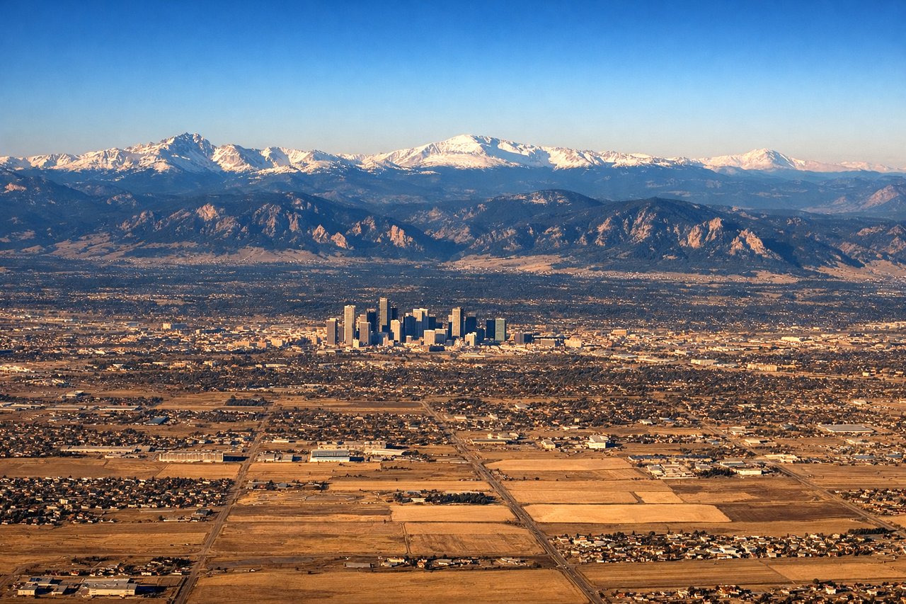
LEFTOn descent into Denver, the left side offers a sweeping view of the Front Range, including the Rocky Mountain National Park foothills and peaks like Longs Peak, with the Denver skyline visible against the mountain backdrop. The right side over the eastern plains is comparatively flat and featureless.
Will your flight be in sunlight?
Pick a date and time in the Sun Map to watch the sun move across your whole flight.
About This Route
Which side of the plane should I sit on flying from Fresno Yosemite International (FAT) to Denver International (DEN)?
Sit on the Left side of the plane for the best views on flights from Fresno to Denver. The left side wins on both ends of the flight: dramatic Sierra Nevada and Yosemite views during departure, and a striking Front Range and Denver skyline view during arrival, while the right side offers mostly flat valley and plains scenery throughout.
What can I see during takeoff from Fresno Yosemite International in Fresno?
During takeoff from Fresno Yosemite International (FAT), sit on the Left side for the best views. Climbing out of Fresno, the left side faces north toward the Sierra Nevada foothills and the high peaks of Yosemite, a dramatic contrast to the flat farmland below. The right side only shows the featureless southern San Joaquin Valley. Notable sights include: Sierra Nevada foothills, Yosemite high country (Half Dome area in the distance), San Joaquin Valley farmland patchwork.
What can I see when landing at Denver International in Denver?
When landing at Denver International (DEN), sit on the Left side for the best views. On descent into Denver, the left side offers a sweeping view of the Front Range, including the Rocky Mountain National Park foothills and peaks like Longs Peak, with the Denver skyline visible against the mountain backdrop. The right side over the eastern plains is comparatively flat and featureless. Notable sights include: Front Range of the Rockies, Longs Peak, Denver skyline, South Platte River valley.
How long is the flight from Fresno to Denver?
The flight from Fresno Yosemite International (FAT) to Denver International (DEN) takes about 2 hours 10 minutes. The shortest flight path between them is 842 miles (1,355 km); winds and air traffic control usually add a few percent.
What does the Fresno to Denver flight path pass over?
The route's midpoint crosses central Utah's canyon country near the San Rafael Swell and the Wasatch Plateau, a rugged landscape of red-rock mesas and dry washes on the Colorado Plateau before the terrain rises into the Rocky Mountains approaching Colorado.