The left side dominates because it captures the flight's most dramatic terrain: the Sierra Nevada during climb-out and, further along the route, the northern edge of the Colorado Plateau and Grand Canyon region, which sits just north of the great-circle path across Nevada and Arizona. The right side offers only the Coast Ranges early on and flat desert basins later, with the Dallas skyline on landing not enough to close the gap.
Flown FAT to DFW? Did we get it right?
Flight Path
Fresno to Dallas-Fort Worth is 1,311 miles (2,109 km), a flight of about 3 hours 5 minutes.
Nevada's Basin and Range desert ridges, the southern edge of the Colorado Plateau near the Grand Canyon and Lake Mead, and the high desert mesas of northern Arizona and New Mexico before the terrain flattens into the Texas Panhandle.
Great circle distance and headings ›


Phase by phase
Takeoff from FAT
LEFTDeparting FAT, the northwesterly-favored runway means a climbing right turn back toward the east, putting the Sierra Nevada crest and the high peaks around Yosemite and Kings Canyon on the left side as the plane straightens out over the San Joaquin Valley. The right side mostly shows the lower, hazier Coast Ranges receding behind.
Landing at DFW
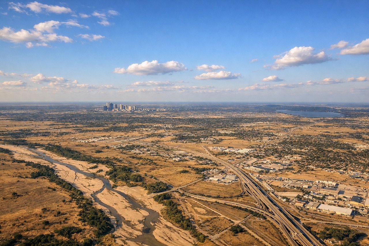
RIGHTOn the descent into DFW, arrival paths from the west commonly pass south of downtown before turning onto final, giving right-side passengers a view of the Dallas skyline and the Trinity River corridor in the distance. The left side mostly faces flat, undistinguished suburban terrain toward Fort Worth.
Will your flight be in sunlight?
Pick a date and time in the Sun Map to watch the sun move across your whole flight.
About This Route
Which side of the plane should I sit on flying from Fresno Yosemite International (FAT) to Dallas Fort Worth International (DFW)?
Sit on the Left side of the plane for the best views on flights from Fresno to Dallas-Fort Worth. The left side dominates because it captures the flight's most dramatic terrain: the Sierra Nevada during climb-out and, further along the route, the northern edge of the Colorado Plateau and Grand Canyon region, which sits just north of the great-circle path across Nevada and Arizona. The right side offers only the Coast Ranges early on and flat desert basins later, with the Dallas skyline on landing not enough to close the gap.
What can I see during takeoff from Fresno Yosemite International in Fresno?
During takeoff from Fresno Yosemite International (FAT), sit on the Left side for the best views. Departing FAT, the northwesterly-favored runway means a climbing right turn back toward the east, putting the Sierra Nevada crest and the high peaks around Yosemite and Kings Canyon on the left side as the plane straightens out over the San Joaquin Valley. The right side mostly shows the lower, hazier Coast Ranges receding behind. Notable sights include: Sierra Nevada crest, Yosemite high country, Kings Canyon peaks, San Joaquin Valley farmland patchwork.
What can I see when landing at Dallas Fort Worth International in Dallas-Fort Worth?
When landing at Dallas Fort Worth International (DFW), sit on the Right side for the best views. On the descent into DFW, arrival paths from the west commonly pass south of downtown before turning onto final, giving right-side passengers a view of the Dallas skyline and the Trinity River corridor in the distance. The left side mostly faces flat, undistinguished suburban terrain toward Fort Worth. Notable sights include: Downtown Dallas skyline, Trinity River, Lake Grapevine, Arlington's AT&T Stadium.
How long is the flight from Fresno to Dallas-Fort Worth?
The flight from Fresno Yosemite International (FAT) to Dallas Fort Worth International (DFW) takes about 3 hours 5 minutes. The shortest flight path between them is 1,311 miles (2,109 km); winds and air traffic control usually add a few percent.
What does the Fresno to Dallas-Fort Worth flight path pass over?
Nevada's Basin and Range desert ridges, the southern edge of the Colorado Plateau near the Grand Canyon and Lake Mead, and the high desert mesas of northern Arizona and New Mexico before the terrain flattens into the Texas Panhandle.