While the takeoff offers excellent Sierra Nevada views on the left, the landing approach provides more dramatic and concentrated scenery with the White River, downtown skyline, and urban geography all visible together on the right side. The landing experience is more visually rewarding for most passengers.
Flown FAT to IND? Did we get it right?
Flight Path
Fresno to Indianapolis is 1,814 miles (2,920 km), a flight of about 4 hours 15 minutes.
The flight path crosses the Sierra Nevada passes (around 2 hours out), then traverses the Great Basin and Rocky Mountain region. Notable features include the Wasatch Range near Salt Lake City area, the Colorado Plateau, and eventually the transition into the flatter Midwest terrain. The flight typically passes over or near the Great Salt Lake region, then continues eastward over Utah, Wyoming, and Colorado before descending into the Great Plains and approaching Indiana from the northwest.
Great circle distance and headings ›


Phase by phase
Takeoff from FAT
LEFTLeft-side seats offer the best views during the initial climb-out from Fresno. You'll see the Sierra Nevada mountain range rising dramatically to the east, with the San Joaquin Valley floor stretching westward. The left wing position gives you a direct view of these mountains as you gain altitude.
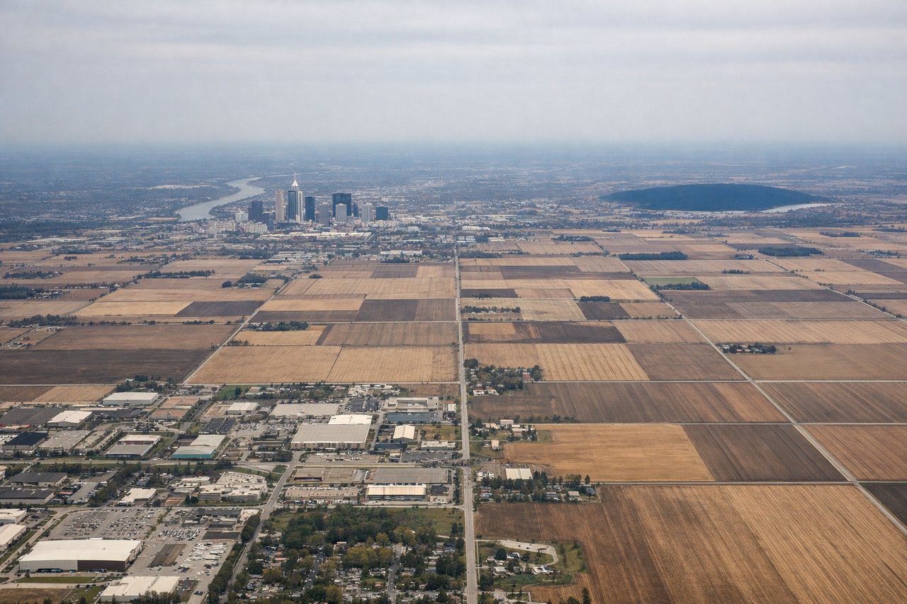
Landing at IND
RIGHTRight-side seats provide superior views on approach to Indianapolis. As you descend from the northeast, the right wing gives you a clear view of the White River and downtown Indianapolis's skyline. You'll also see the urban sprawl and surrounding terrain that defines the approach corridor.
Will your flight be in sunlight?
Pick a date and time in the Sun Map to watch the sun move across your whole flight.
About This Route
Which side of the plane should I sit on flying from Fresno Yosemite International (FAT) to Indianapolis International (IND)?
Sit on the Right side of the plane for the best views on flights from Fresno to Indianapolis. While the takeoff offers excellent Sierra Nevada views on the left, the landing approach provides more dramatic and concentrated scenery with the White River, downtown skyline, and urban geography all visible together on the right side. The landing experience is more visually rewarding for most passengers.
What can I see during takeoff from Fresno Yosemite International in Fresno?
During takeoff from Fresno Yosemite International (FAT), sit on the Left side for the best views. Left-side seats offer the best views during the initial climb-out from Fresno. You'll see the Sierra Nevada mountain range rising dramatically to the east, with the San Joaquin Valley floor stretching westward. The left wing position gives you a direct view of these mountains as you gain altitude. Notable sights include: Sierra Nevada range (eastern horizon), San Joaquin Valley agricultural plains, Fresno city grid (directly below during initial climb), Kings River drainage patterns visible in the valley floor.
What can I see when landing at Indianapolis International in Indianapolis?
When landing at Indianapolis International (IND), sit on the Right side for the best views. Right-side seats provide superior views on approach to Indianapolis. As you descend from the northeast, the right wing gives you a clear view of the White River and downtown Indianapolis's skyline. You'll also see the urban sprawl and surrounding terrain that defines the approach corridor. Notable sights include: White River (winding through downtown Indianapolis), Indianapolis downtown skyline and Monument Circle, Interstate 465 ring highway, suburban development patterns radiating from the city center.
How long is the flight from Fresno to Indianapolis?
The flight from Fresno Yosemite International (FAT) to Indianapolis International (IND) takes about 4 hours 15 minutes. The shortest flight path between them is 1,814 miles (2,920 km); winds and air traffic control usually add a few percent.
What does the Fresno to Indianapolis flight path pass over?
The flight path crosses the Sierra Nevada passes (around 2 hours out), then traverses the Great Basin and Rocky Mountain region. Notable features include the Wasatch Range near Salt Lake City area, the Colorado Plateau, and eventually the transition into the flatter Midwest terrain. The flight typically passes over or near the Great Salt Lake region, then continues eastward over Utah, Wyoming, and Colorado before descending into the Great Plains and approaching Indiana from the northwest.