Rome to Cedar City is 5,955 miles (9,584 km), a flight of about 11 hours 30 minutes.
Right side wins both segments. Departure offers the Tiber and Alban Hills drama, while arrival captures the Markagunt Plateau and Cedar Breaks formations. The right side provides more visually distinctive terrain throughout this transatlantic-to-regional routing.
Flight Path
The flight path crosses the North Atlantic, typically passing south of Iceland and Greenland. Over the Atlantic, no landmarks are visible except occasional icebergs or sea ice near Greenland (if flying far north). Upon reaching North America, the flight crosses eastern Canada, then the Great Lakes region or northern US plains. The Appalachian Mountains may be visible if the routing passes over the eastern US. As the flight approaches the western US, the Rocky Mountains become visible, with the Colorado Plateau and Great Basin terrain becoming increasingly prominent. The final approach into Cedar City crosses the high desert of southwestern Utah with its distinctive red rock formations.
Great circle distance and headings ›
_-_24_(50543603956).jpg?width=600)


_Panoramica_del_centro_della_citt%C3%A0_dal_lago.jpg?width=600)
.jpg?width=600)
.jpg?width=600)
Phase by phase
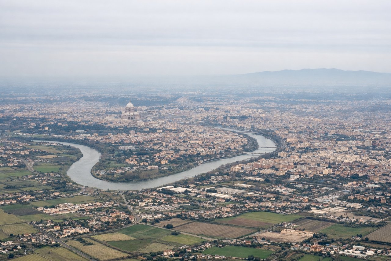
Takeoff from FCO
RIGHTRight side seats offer views of the Tiber River winding through Rome's urban sprawl immediately after departure, plus the Alban Hills rising to the southeast. Left side faces the Tyrrhenian Sea but offers less dramatic terrain variation during the critical climb-out phase.
Landing at CDC
RIGHTRight side provides the best views during approach to Cedar City Regional. The airport sits in a high desert basin surrounded by the Markagunt Plateau to the north and east. Right-side seats capture the distinctive red rock formations and the plateau's escarpment as you descend into the valley.
Landmarks on this routeAll landmarks →
Will your flight be in sunlight?
Pick a date and time in the Sun Map to watch the sun move across your whole flight.
About This Route
Which side of the plane should I sit on flying from Fiumicino (FCO) to Cedar City Rgnl (CDC)?
Sit on the Right side of the plane for the best views on flights from Rome to Cedar City. Right side wins both segments. Departure offers the Tiber and Alban Hills drama, while arrival captures the Markagunt Plateau and Cedar Breaks formations. The right side provides more visually distinctive terrain throughout this transatlantic-to-regional routing.
What can I see during takeoff from Fiumicino in Rome?
During takeoff from Fiumicino (FCO), sit on the Right side for the best views. Right side seats offer views of the Tiber River winding through Rome's urban sprawl immediately after departure, plus the Alban Hills rising to the southeast. Left side faces the Tyrrhenian Sea but offers less dramatic terrain variation during the critical climb-out phase. Notable sights include: Tiber River (visible as a silvery thread through central Rome), Alban Hills (volcanic ridge southeast of the airport), Rome's urban grid (distinctive street patterns), Castel Gandolfo (papal residence visible on hilltop to southeast).
What can I see when landing at Cedar City Rgnl in Cedar City?
When landing at Cedar City Rgnl (CDC), sit on the Right side for the best views. Right side provides the best views during approach to Cedar City Regional. The airport sits in a high desert basin surrounded by the Markagunt Plateau to the north and east. Right-side seats capture the distinctive red rock formations and the plateau's escarpment as you descend into the valley. Notable sights include: Markagunt Plateau (elevated terrain to north and east), Cedar Breaks National Monument area (distinctive eroded formations visible to northeast), Hurricane Valley (the basin containing Cedar City), Iron County red rock formations (visible as rust-colored terrain).
How long is the flight from Rome to Cedar City?
The flight from Fiumicino (FCO) to Cedar City Rgnl (CDC) takes about 11 hours 30 minutes. The shortest flight path between them is 5,955 miles (9,584 km); winds and air traffic control usually add a few percent.
What does the Rome to Cedar City flight path pass over?
The flight path crosses the North Atlantic, typically passing south of Iceland and Greenland. Over the Atlantic, no landmarks are visible except occasional icebergs or sea ice near Greenland (if flying far north). Upon reaching North America, the flight crosses eastern Canada, then the Great Lakes region or northern US plains. The Appalachian Mountains may be visible if the routing passes over the eastern US. As the flight approaches the western US, the Rocky Mountains become visible, with the Colorado Plateau and Great Basin terrain becoming increasingly prominent. The final approach into Cedar City crosses the high desert of southwestern Utah with its distinctive red rock formations.