Guadalajara to Salt Lake City is 1,490 miles (2,398 km), a flight of about 3 hours 15 minutes.
Left side scores higher due to the Wasatch Range's dramatic presence during landing approach and the visual interest of Guadalajara's highland departure. The right side offers only flat desert and urban sprawl on both ends. The Wasatch Mountains provide the kind of terrain drama and landmark density that elevates this route above typical cross-country flights, while the right side remains visually monotonous throughout.
Flight Path
The flight path crosses northern Mexico through Durango and Chihuahua states, passing over the Sierra Madre Occidental mountain range (visible as a series of north-south trending ridges and canyons in the mid-flight portion). The terrain transitions from volcanic highlands near Guadalajara to the higher, more rugged Sierra Madre peaks around the Durango-Chihuahua border, then descends into the high desert plateau of northern Mexico and southern New Mexico. The Rio Grande becomes visible in the final approach to the US border. The flight then crosses into New Mexico's high desert terrain before climbing toward the Wasatch Range in Utah.
Great circle distance and headings ›.jpg?width=600)

.jpg?width=600)

Phase by phase
Takeoff from GDL
LEFTLeft side captures Guadalajara's urban sprawl and the surrounding Jalisco highlands during departure. The terrain immediately west and northwest of GDL rises into volcanic plateaus with visible elevation changes, providing immediate visual interest absent on the right side's flat approach corridor.
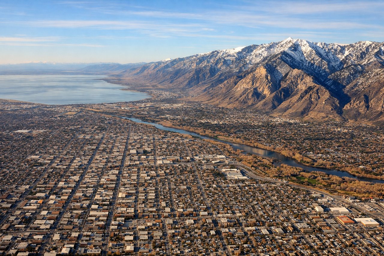
Landing at SLC
LEFTLeft side provides the dramatic approach to Salt Lake City with the Wasatch Range dominating the descent. The mountains create a striking visual corridor, and the Great Salt Lake becomes visible in the final approach, offering far more scenic variety than the right side's desert and urban sprawl.
Landmarks on this routeAll landmarks →
Will your flight be in sunlight?
Pick a date and time in the Sun Map to watch the sun move across your whole flight.
About This Route
Which side of the plane should I sit on flying from Don Miguel Y Hidalgo International (GDL) to Salt Lake City International (SLC)?
Sit on the Left side of the plane for the best views on flights from Guadalajara to Salt Lake City. Left side scores higher due to the Wasatch Range's dramatic presence during landing approach and the visual interest of Guadalajara's highland departure. The right side offers only flat desert and urban sprawl on both ends. The Wasatch Mountains provide the kind of terrain drama and landmark density that elevates this route above typical cross-country flights, while the right side remains visually monotonous throughout.
What can I see during takeoff from Don Miguel Y Hidalgo International in Guadalajara?
During takeoff from Don Miguel Y Hidalgo International (GDL), sit on the Left side for the best views. Left side captures Guadalajara's urban sprawl and the surrounding Jalisco highlands during departure. The terrain immediately west and northwest of GDL rises into volcanic plateaus with visible elevation changes, providing immediate visual interest absent on the right side's flat approach corridor. Notable sights include: Guadalajara city grid and urban development, Jalisco volcanic highlands to the northwest, Lake Chapala (Mexico's largest freshwater lake) visible 40 miles northeast if climbing northbound.
What can I see when landing at Salt Lake City International in Salt Lake City?
When landing at Salt Lake City International (SLC), sit on the Left side for the best views. Left side provides the dramatic approach to Salt Lake City with the Wasatch Range dominating the descent. The mountains create a striking visual corridor, and the Great Salt Lake becomes visible in the final approach, offering far more scenic variety than the right side's desert and urban sprawl. Notable sights include: Wasatch Range peaks (including Mount Olympus and the central ridge), Great Salt Lake with its distinctive irregular shoreline, Salt Lake City's downtown grid nestled against the mountains.
How long is the flight from Guadalajara to Salt Lake City?
The flight from Don Miguel Y Hidalgo International (GDL) to Salt Lake City International (SLC) takes about 3 hours 15 minutes. The shortest flight path between them is 1,490 miles (2,398 km); winds and air traffic control usually add a few percent.
What does the Guadalajara to Salt Lake City flight path pass over?
The flight path crosses northern Mexico through Durango and Chihuahua states, passing over the Sierra Madre Occidental mountain range (visible as a series of north-south trending ridges and canyons in the mid-flight portion). The terrain transitions from volcanic highlands near Guadalajara to the higher, more rugged Sierra Madre peaks around the Durango-Chihuahua border, then descends into the high desert plateau of northern Mexico and southern New Mexico. The Rio Grande becomes visible in the final approach to the US border. The flight then crosses into New Mexico's high desert terrain before climbing toward the Wasatch Range in Utah.