Salt Lake City to Guadalajara is 1,490 miles (2,398 km), a flight of about 2 hours 45 minutes.
Left side scores higher due to the dramatic Wasatch Range departure from Salt Lake City, which provides immediate, striking mountain scenery. While the landing into Guadalajara offers decent urban and foothill views on the right, the takeoff experience and the sustained visibility of the Wasatch peaks during initial climb-out give the left side a scenic advantage. The flight path itself crosses relatively flat terrain over Nevada and Arizona, so the most memorable views concentrate at the endpoints, where left wins decisively.
Flight Path
The flight path crosses the Great Basin and Mojave Desert regions, with views of the Virgin River drainage, Lake Mead area (if routed northeast), and the Colorado Plateau. Southern Nevada and northern Arizona present open desert with sparse vegetation and occasional mesas. As the aircraft approaches Mexican airspace, the Sierra Madre Occidental becomes visible on the horizon, marking the transition to more dramatic topography before descent into Guadalajara.
Great circle distance and headings ›
.jpg?width=600)

.jpg?width=600)
Phase by phase
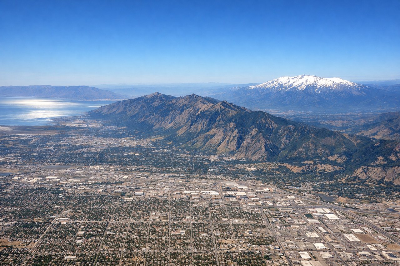
Takeoff from SLC
LEFTLeft side captures the Wasatch Range immediately after departure, with dramatic peaks rising directly west of Salt Lake City. The urban grid of Salt Lake City itself is visible during initial climb, providing excellent context before transitioning to mountain terrain.
Landing at GDL
RIGHTRight side offers the approach into Guadalajara with views of the Sierra Madre Occidental foothills and the city's urban sprawl. The descent provides clear sightlines to the surrounding volcanic plateau terrain and the city's distinctive layout in the Atemajac Valley.
Landmarks on this routeAll landmarks →
Will your flight be in sunlight?
Pick a date and time in the Sun Map to watch the sun move across your whole flight.
About This Route
Which side of the plane should I sit on flying from Salt Lake City International (SLC) to Don Miguel Y Hidalgo International (GDL)?
Sit on the Left side of the plane for the best views on flights from Salt Lake City to Guadalajara. Left side scores higher due to the dramatic Wasatch Range departure from Salt Lake City, which provides immediate, striking mountain scenery. While the landing into Guadalajara offers decent urban and foothill views on the right, the takeoff experience and the sustained visibility of the Wasatch peaks during initial climb-out give the left side a scenic advantage. The flight path itself crosses relatively flat terrain over Nevada and Arizona, so the most memorable views concentrate at the endpoints, where left wins decisively.
What can I see during takeoff from Salt Lake City International in Salt Lake City?
During takeoff from Salt Lake City International (SLC), sit on the Left side for the best views. Left side captures the Wasatch Range immediately after departure, with dramatic peaks rising directly west of Salt Lake City. The urban grid of Salt Lake City itself is visible during initial climb, providing excellent context before transitioning to mountain terrain. Notable sights include: Wasatch Range peaks (including Mount Olympus and Lone Peak), Great Salt Lake shoreline to the northwest, Salt Lake City urban grid and downtown skyline.
What can I see when landing at Don Miguel Y Hidalgo International in Guadalajara?
When landing at Don Miguel Y Hidalgo International (GDL), sit on the Right side for the best views. Right side offers the approach into Guadalajara with views of the Sierra Madre Occidental foothills and the city's urban sprawl. The descent provides clear sightlines to the surrounding volcanic plateau terrain and the city's distinctive layout in the Atemajac Valley. Notable sights include: Sierra Madre Occidental foothills, Guadalajara city sprawl and urban grid, volcanic plateau terrain of Jalisco state.
How long is the flight from Salt Lake City to Guadalajara?
The flight from Salt Lake City International (SLC) to Don Miguel Y Hidalgo International (GDL) takes about 2 hours 45 minutes. The shortest flight path between them is 1,490 miles (2,398 km); winds and air traffic control usually add a few percent.
What does the Salt Lake City to Guadalajara flight path pass over?
The flight path crosses the Great Basin and Mojave Desert regions, with views of the Virgin River drainage, Lake Mead area (if routed northeast), and the Colorado Plateau. Southern Nevada and northern Arizona present open desert with sparse vegetation and occasional mesas. As the aircraft approaches Mexican airspace, the Sierra Madre Occidental becomes visible on the horizon, marking the transition to more dramatic topography before descent into Guadalajara.