While takeoff offers coastal and lowland views on the right, the landing approach on the left provides the most dramatic and geographically significant scenery—the Andes cordillera and Pichincha volcano are far more visually distinctive than the coastal plains. Left seats capture the flight's transition from sea-level tropics to high-altitude mountain basin.
Flown GYE to UIO? Did we get it right?
Flight Path
Guayaquil to Quito is 176 miles (283 km), a flight of about 35 minutes.
During climb and cruise, the flight crosses the western Cordillera foothills and enters the inter-Andean valley. The landscape transitions from coastal lowlands (mangrove, agricultural plains) through pre-Andean foothills (forested, increasingly steep) to high-altitude cloud forest and páramo grasslands above 9,000 feet. Pichincha volcano becomes the dominant landmark during the final 15 minutes of approach. The Chocó cloud forest region west of the Andes is often obscured by persistent cloud cover.
Great circle distance and headings ›

Phase by phase
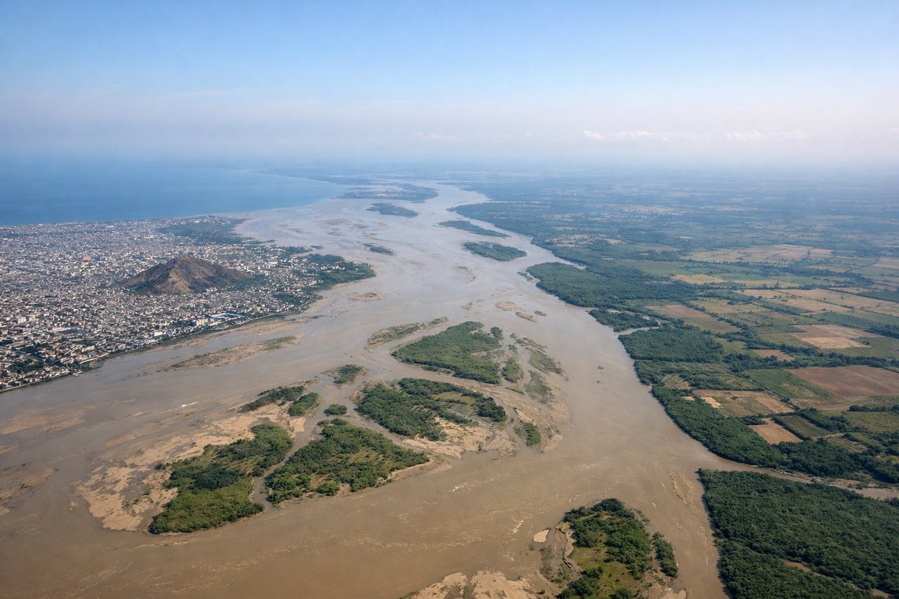
Takeoff from GYE
RIGHTGYE typically departs runway 09 (westbound) or 27 (eastbound). Right-side seats offer views of the Guayas River estuary and mangrove wetlands immediately west of the airport. If departing 27 eastbound, right seats still capture the broader coastal plain and agricultural zones extending toward the Andes.
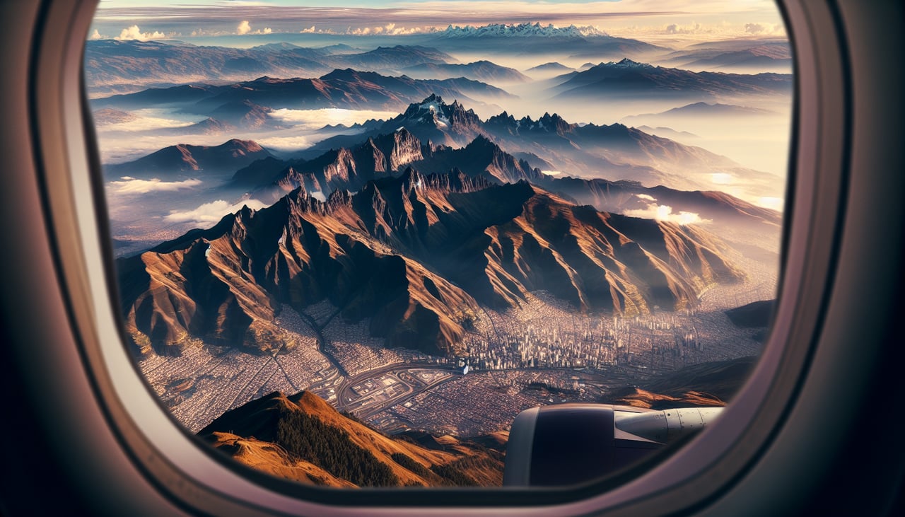
Landing at UIO
LEFTUIO typically lands runway 28 (westbound approach) or 10 (eastbound). Left-side seats on approach capture the dramatic eastern Cordillera of the Andes, including Pichincha volcano and the high-altitude basin containing Quito. The city itself becomes visible nestled in the inter-Andean valley during final descent.
Will your flight be in sunlight?
Pick a date and time in the Sun Map to watch the sun move across your whole flight.
About This Route
Which side of the plane should I sit on flying from Simon Bolivar International (GYE) to Mariscal Sucre International Airport (UIO)?
Sit on the Left side of the plane for the best views on flights from Guayaquil to Quito. While takeoff offers coastal and lowland views on the right, the landing approach on the left provides the most dramatic and geographically significant scenery—the Andes cordillera and Pichincha volcano are far more visually distinctive than the coastal plains. Left seats capture the flight's transition from sea-level tropics to high-altitude mountain basin.
What can I see during takeoff from Simon Bolivar International in Guayaquil?
During takeoff from Simon Bolivar International (GYE), sit on the Right side for the best views. GYE typically departs runway 09 (westbound) or 27 (eastbound). Right-side seats offer views of the Guayas River estuary and mangrove wetlands immediately west of the airport. If departing 27 eastbound, right seats still capture the broader coastal plain and agricultural zones extending toward the Andes. Notable sights include: Guayas River estuary and mangrove systems, Coastal plain agricultural grid, Pacific Ocean (distant western horizon), Pre-Andean foothills (eastern horizon during climb).
What can I see when landing at Mariscal Sucre International Airport in Quito?
When landing at Mariscal Sucre International Airport (UIO), sit on the Left side for the best views. UIO typically lands runway 28 (westbound approach) or 10 (eastbound). Left-side seats on approach capture the dramatic eastern Cordillera of the Andes, including Pichincha volcano and the high-altitude basin containing Quito. The city itself becomes visible nestled in the inter-Andean valley during final descent. Notable sights include: Pichincha volcano (dormant, 15,696 ft), Eastern Cordillera ridge line, Inter-Andean valley basin, Quito city sprawl in the valley floor.
How long is the flight from Guayaquil to Quito?
The flight from Simon Bolivar International (GYE) to Mariscal Sucre International Airport (UIO) takes about 35 minutes. The shortest flight path between them is 176 miles (283 km); winds and air traffic control usually add a few percent.
What does the Guayaquil to Quito flight path pass over?
During climb and cruise, the flight crosses the western Cordillera foothills and enters the inter-Andean valley. The landscape transitions from coastal lowlands (mangrove, agricultural plains) through pre-Andean foothills (forested, increasingly steep) to high-altitude cloud forest and páramo grasslands above 9,000 feet. Pichincha volcano becomes the dominant landmark during the final 15 minutes of approach. The Chocó cloud forest region west of the Andes is often obscured by persistent cloud cover.