While the right side wins at takeoff for Tokyo Bay views, the left side delivers the more sustained and dramatic scenery: as the flight tracks northeast over Honshu and into Hokkaido, the left side picks up views of the Ou Mountains, the Tsugaru Strait crossing, and then the spectacular Daisetsuzan range on approach. The Daisetsuzan view alone on landing makes left the overall winner.
Flown HND to AKJ? Did we get it right?
Flight Path
Tokyo to Asahikawa is 579 miles (931 km), a flight of about 1 hour 20 minutes.
The flight tracks northeast over the Kanto Plain, crosses the Tohoku region with the Ou Mountain Range visible to the west, crosses the Tsugaru Strait between Honshu and Hokkaido, then traverses southern Hokkaido's forested interior over the Hidaka and Yubari mountain ranges before descending into the Ishikari Plain toward Asahikawa. On clear days the Tsugaru Strait crossing is a notable visual landmark with both coastlines visible simultaneously.
Great circle distance and headings ›Phase by phase
Takeoff from HND
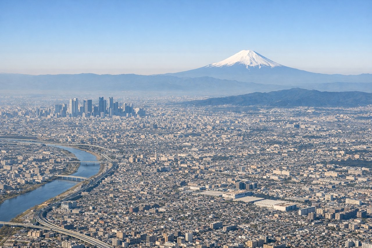
RIGHTHND typically departs northbound on Runway 34L/34R, so the right side faces east toward Tokyo Bay and the urban sprawl of central Tokyo. You get a clear view of the bay's geometry and the dense city grid as you climb out over the water.
Landing at AKJ
LEFTAsahikawa Airport (AKJ) typically lands from the south on Runway 34, meaning the approach comes from the south-southwest. The left side faces west toward the Taisetsuzan (Daisetsuzan) volcanic mountain range, which dominates the skyline with peaks including Asahidake. This is the most dramatic scenery on the entire flight.
Will your flight be in sunlight?
Pick a date and time in the Sun Map to watch the sun move across your whole flight.
About This Route
Which side of the plane should I sit on flying from Tokyo International (HND) to Asahikawa (AKJ)?
Sit on the Left side of the plane for the best views on flights from Tokyo to Asahikawa. While the right side wins at takeoff for Tokyo Bay views, the left side delivers the more sustained and dramatic scenery: as the flight tracks northeast over Honshu and into Hokkaido, the left side picks up views of the Ou Mountains, the Tsugaru Strait crossing, and then the spectacular Daisetsuzan range on approach. The Daisetsuzan view alone on landing makes left the overall winner.
What can I see during takeoff from Tokyo International in Tokyo?
During takeoff from Tokyo International (HND), sit on the Right side for the best views. HND typically departs northbound on Runway 34L/34R, so the right side faces east toward Tokyo Bay and the urban sprawl of central Tokyo. You get a clear view of the bay's geometry and the dense city grid as you climb out over the water. Notable sights include: Tokyo Bay, Yokohama port and waterfront, Kawasaki industrial zone along the bay shore, Tokyo city grid to the northeast.
What can I see when landing at Asahikawa in Asahikawa?
When landing at Asahikawa (AKJ), sit on the Left side for the best views. Asahikawa Airport (AKJ) typically lands from the south on Runway 34, meaning the approach comes from the south-southwest. The left side faces west toward the Taisetsuzan (Daisetsuzan) volcanic mountain range, which dominates the skyline with peaks including Asahidake. This is the most dramatic scenery on the entire flight. Notable sights include: Daisetsuzan (Taisetsuzan) volcanic range including Asahidake, Ishikari Plain agricultural patchwork, Asahikawa city grid in the river valley, Biei rolling hills to the south.
How long is the flight from Tokyo to Asahikawa?
The flight from Tokyo International (HND) to Asahikawa (AKJ) takes about 1 hour 20 minutes. The shortest flight path between them is 579 miles (931 km); winds and air traffic control usually add a few percent.
What does the Tokyo to Asahikawa flight path pass over?
The flight tracks northeast over the Kanto Plain, crosses the Tohoku region with the Ou Mountain Range visible to the west, crosses the Tsugaru Strait between Honshu and Hokkaido, then traverses southern Hokkaido's forested interior over the Hidaka and Yubari mountain ranges before descending into the Ishikari Plain toward Asahikawa. On clear days the Tsugaru Strait crossing is a notable visual landmark with both coastlines visible simultaneously.