The takeoff sequence from Tokyo offers more dramatic and iconic scenery (Mount Fuji, Tokyo Bay) than the landing approach. While Zion is visually striking, the extended departure views over Japan's most recognizable geography provide superior overall window-seat value.
Flown HND to CDC? Did we get it right?
Flight Path
Tokyo to Cedar City is 5,558 miles (8,944 km), a flight of about 11 hours 15 minutes.
The flight crosses the North Pacific at high altitude with limited visible landmarks; the Aleutian Islands may be visible on clear days during the northern Pacific crossing. Upon approaching North America, the Rocky Mountains become visible, including peaks in Montana and Idaho. The Great Basin's high desert terrain becomes increasingly prominent as the aircraft descends toward Utah.
Great circle distance and headings ›


Phase by phase
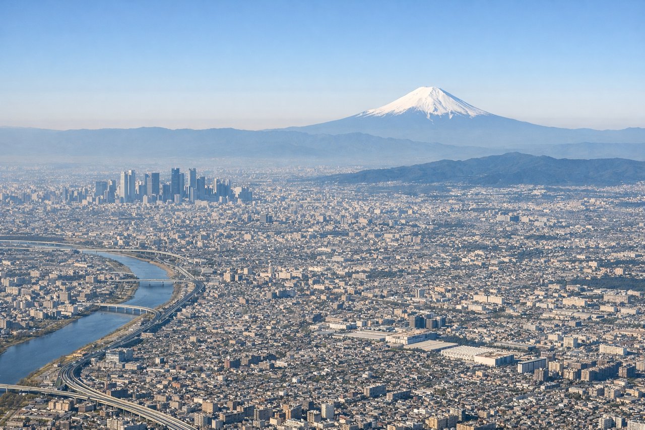
Takeoff from HND
RIGHTRight-side seats offer views of Tokyo Bay, the Kanto Plain, and Mount Fuji during the initial climb-out. The aircraft departs eastward over water before turning northwest, so right-facing windows capture the bay's distinctive shape and Japan's most iconic peak.
Landing at CDC
LEFTLeft-side seats provide views of the Colorado Plateau's dramatic red rock formations, including Zion National Park and the Virgin River canyon system during descent into Cedar City. The approach from the west crosses some of the most visually striking geology in the region.
Will your flight be in sunlight?
Pick a date and time in the Sun Map to watch the sun move across your whole flight.
About This Route
Which side of the plane should I sit on flying from Tokyo International (HND) to Cedar City Rgnl (CDC)?
Sit on the Right side of the plane for the best views on flights from Tokyo to Cedar City. The takeoff sequence from Tokyo offers more dramatic and iconic scenery (Mount Fuji, Tokyo Bay) than the landing approach. While Zion is visually striking, the extended departure views over Japan's most recognizable geography provide superior overall window-seat value.
What can I see during takeoff from Tokyo International in Tokyo?
During takeoff from Tokyo International (HND), sit on the Right side for the best views. Right-side seats offer views of Tokyo Bay, the Kanto Plain, and Mount Fuji during the initial climb-out. The aircraft departs eastward over water before turning northwest, so right-facing windows capture the bay's distinctive shape and Japan's most iconic peak. Notable sights include: Tokyo Bay, Mount Fuji (Fuji-san), Kanto Plain urban sprawl, Izu Peninsula.
What can I see when landing at Cedar City Rgnl in Cedar City?
When landing at Cedar City Rgnl (CDC), sit on the Left side for the best views. Left-side seats provide views of the Colorado Plateau's dramatic red rock formations, including Zion National Park and the Virgin River canyon system during descent into Cedar City. The approach from the west crosses some of the most visually striking geology in the region. Notable sights include: Zion National Park (Navajo Sandstone cliffs), Virgin River canyon, Hurricane Cliffs, Cedar Breaks National Monument.
How long is the flight from Tokyo to Cedar City?
The flight from Tokyo International (HND) to Cedar City Rgnl (CDC) takes about 11 hours 15 minutes. The shortest flight path between them is 5,558 miles (8,944 km); winds and air traffic control usually add a few percent.
What does the Tokyo to Cedar City flight path pass over?
The flight crosses the North Pacific at high altitude with limited visible landmarks; the Aleutian Islands may be visible on clear days during the northern Pacific crossing. Upon approaching North America, the Rocky Mountains become visible, including peaks in Montana and Idaho. The Great Basin's high desert terrain becomes increasingly prominent as the aircraft descends toward Utah.