This route's long cruise phase follows a great-circle arc north over Japan's coast, the volcanic Kamchatka Peninsula, the Bering Sea, Alaska's mountains near Denali, and the Canadian Arctic before descending toward Hudson Bay and the Great Lakes region. Because the route bulges northward, the left side faces this dramatic, ever-changing Arctic and mountain terrain for most of the flight, far outweighing the modest advantages the right side has during takeoff and landing.
Flight Path
The flight's midpoint falls roughly over the Bering Sea and southern Alaska, near the Alaska Range and Denali, with the great-circle path continuing over the Yukon, Northwest Territories, and toward Hudson Bay before angling south over Ontario and the Great Lakes.
Great circle distance and headings ›


.jpeg?width=600)
Phase by phase
Takeoff from HND
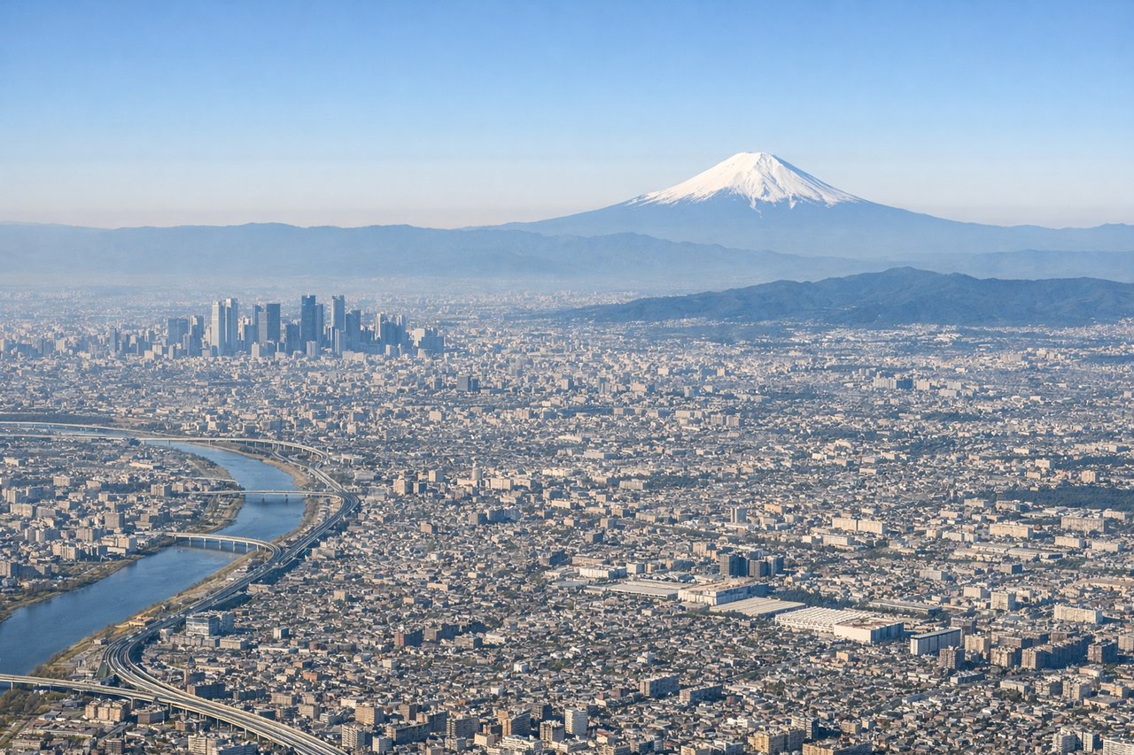
RIGHTHaneda's typical south-wind departure sends aircraft out over Tokyo Bay before turning east toward the Pacific. Passengers on the right side get a receding view of the Tokyo skyline and, on clear days, the iconic cone of Mount Fuji on the southwestern horizon, while the left side mostly faces the flatter Chiba shoreline.
Landing at IAD
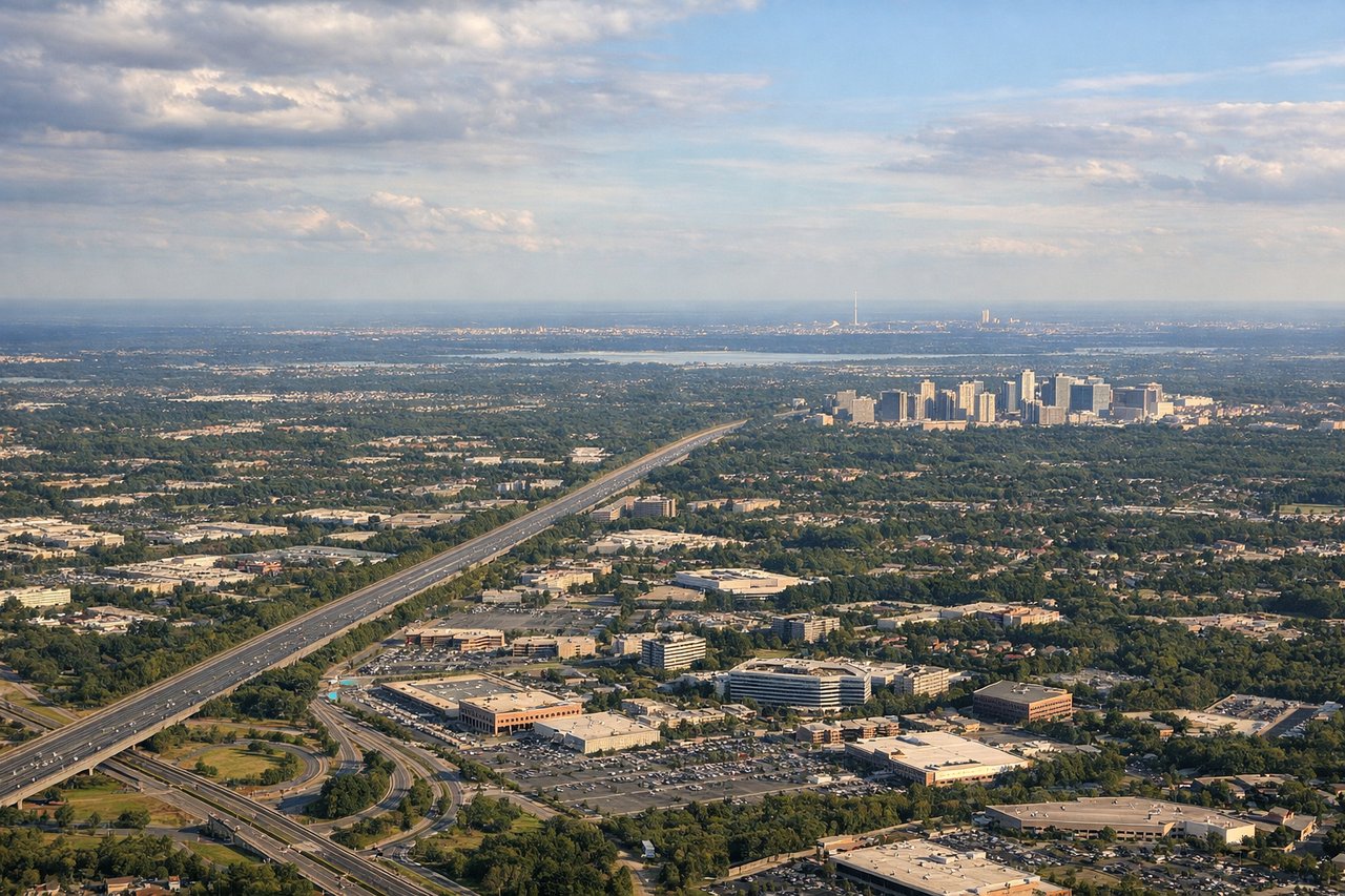
RIGHTOn the descent into Dulles from the north, the approach path typically keeps the Blue Ridge and Catoctin ridgelines visible on the right side of the aircraft along with the Potomac River valley. The left side mostly shows flatter, less distinctive Maryland farmland.
Landmarks on this routeAll landmarks →
Will your flight be in sunlight?
See exactly which side of the plane gets sun and shade at your departure time.
About This Route
Which side of the plane should I sit on flying from Tokyo International (HND) to Washington Dulles International (IAD)?
Sit on the Left side of the plane for the best views on flights from Tokyo to Washington. This route's long cruise phase follows a great-circle arc north over Japan's coast, the volcanic Kamchatka Peninsula, the Bering Sea, Alaska's mountains near Denali, and the Canadian Arctic before descending toward Hudson Bay and the Great Lakes region. Because the route bulges northward, the left side faces this dramatic, ever-changing Arctic and mountain terrain for most of the flight, far outweighing the modest advantages the right side has during takeoff and landing.
What can I see during takeoff from Tokyo International in Tokyo?
During takeoff from Tokyo International (HND), sit on the Right side for the best views. Haneda's typical south-wind departure sends aircraft out over Tokyo Bay before turning east toward the Pacific. Passengers on the right side get a receding view of the Tokyo skyline and, on clear days, the iconic cone of Mount Fuji on the southwestern horizon, while the left side mostly faces the flatter Chiba shoreline. Notable sights include: Tokyo Bay and the Rainbow Bridge, the Odaiba/Minato skyline, Mount Fuji on the horizon.
What can I see when landing at Washington Dulles International in Washington?
When landing at Washington Dulles International (IAD), sit on the Right side for the best views. On the descent into Dulles from the north, the approach path typically keeps the Blue Ridge and Catoctin ridgelines visible on the right side of the aircraft along with the Potomac River valley. The left side mostly shows flatter, less distinctive Maryland farmland. Notable sights include: Blue Ridge Mountains, Catoctin Ridge, the Potomac River, Piedmont farmland of northern Virginia.
How long is the flight from Tokyo to Washington?
The flight from Tokyo International (HND) to Washington Dulles International (IAD) takes 13h 05m.
What does the Tokyo to Washington flight path pass over?
The flight's midpoint falls roughly over the Bering Sea and southern Alaska, near the Alaska Range and Denali, with the great-circle path continuing over the Yukon, Northwest Territories, and toward Hudson Bay before angling south over Ontario and the Great Lakes.