Right side scores higher due to the dramatic volcanic island approach at landing (3.5 vs 2.5 for left). While takeoff favors right with Tokyo Bay and Mount Fuji views, the landing scenery—Miyako's turquoise reefs and island topography—provides more distinctive visual drama than the left side's open ocean. The route's most memorable moment occurs on descent to Miyako.
Flown HND to MMY? Did we get it right?
Flight Path
Tokyo to Miyako is 1,139 miles (1,833 km), a flight of about 2 hours 55 minutes.
Izu Islands chain (Izu Oshima, Miyakejima visible as small volcanic islands), transition from Kanto coastal waters to open Pacific, Okinawa Trough deepwater zone, approach to Ryukyu Island chain
Great circle distance and headings ›

Phase by phase
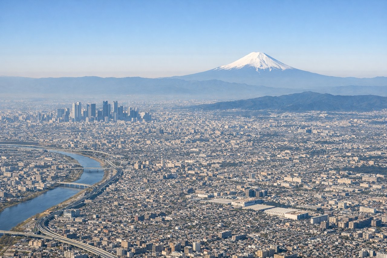
Takeoff from HND
RIGHTRight side captures Tokyo Bay, the Kanto Plain urban sprawl, and Mount Fuji during departure. Left side faces inland toward flat Kanto agricultural areas with minimal visual interest during climb-out.
Landing at MMY
RIGHTRight side offers the dramatic approach to Miyako Island itself—coral reefs, turquoise lagoons, and the island's volcanic topography become visible during descent. Left side shows only open Pacific Ocean for the final 30 minutes with no distinctive features.
Will your flight be in sunlight?
Pick a date and time in the Sun Map to watch the sun move across your whole flight.
About This Route
Which side of the plane should I sit on flying from Tokyo International (HND) to Miyako (MMY)?
Sit on the Right side of the plane for the best views on flights from Tokyo to Miyako. Right side scores higher due to the dramatic volcanic island approach at landing (3.5 vs 2.5 for left). While takeoff favors right with Tokyo Bay and Mount Fuji views, the landing scenery—Miyako's turquoise reefs and island topography—provides more distinctive visual drama than the left side's open ocean. The route's most memorable moment occurs on descent to Miyako.
What can I see during takeoff from Tokyo International in Tokyo?
During takeoff from Tokyo International (HND), sit on the Right side for the best views. Right side captures Tokyo Bay, the Kanto Plain urban sprawl, and Mount Fuji during departure. Left side faces inland toward flat Kanto agricultural areas with minimal visual interest during climb-out. Notable sights include: Tokyo Bay with harbor infrastructure, Mount Fuji (visible on clear days to the southwest), Yokohama waterfront, Kanto Plain extending inland.
What can I see when landing at Miyako in Miyako?
When landing at Miyako (MMY), sit on the Right side for the best views. Right side offers the dramatic approach to Miyako Island itself—coral reefs, turquoise lagoons, and the island's volcanic topography become visible during descent. Left side shows only open Pacific Ocean for the final 30 minutes with no distinctive features. Notable sights include: Miyako Island's distinctive shape and volcanic terrain, turquoise coral reef waters surrounding the island, Hirara city waterfront, smaller surrounding islands (Ikema, Ogami).
How long is the flight from Tokyo to Miyako?
The flight from Tokyo International (HND) to Miyako (MMY) takes about 2 hours 55 minutes. The shortest flight path between them is 1,139 miles (1,833 km); winds and air traffic control usually add a few percent.
What does the Tokyo to Miyako flight path pass over?
Izu Islands chain (Izu Oshima, Miyakejima visible as small volcanic islands), transition from Kanto coastal waters to open Pacific, Okinawa Trough deepwater zone, approach to Ryukyu Island chain