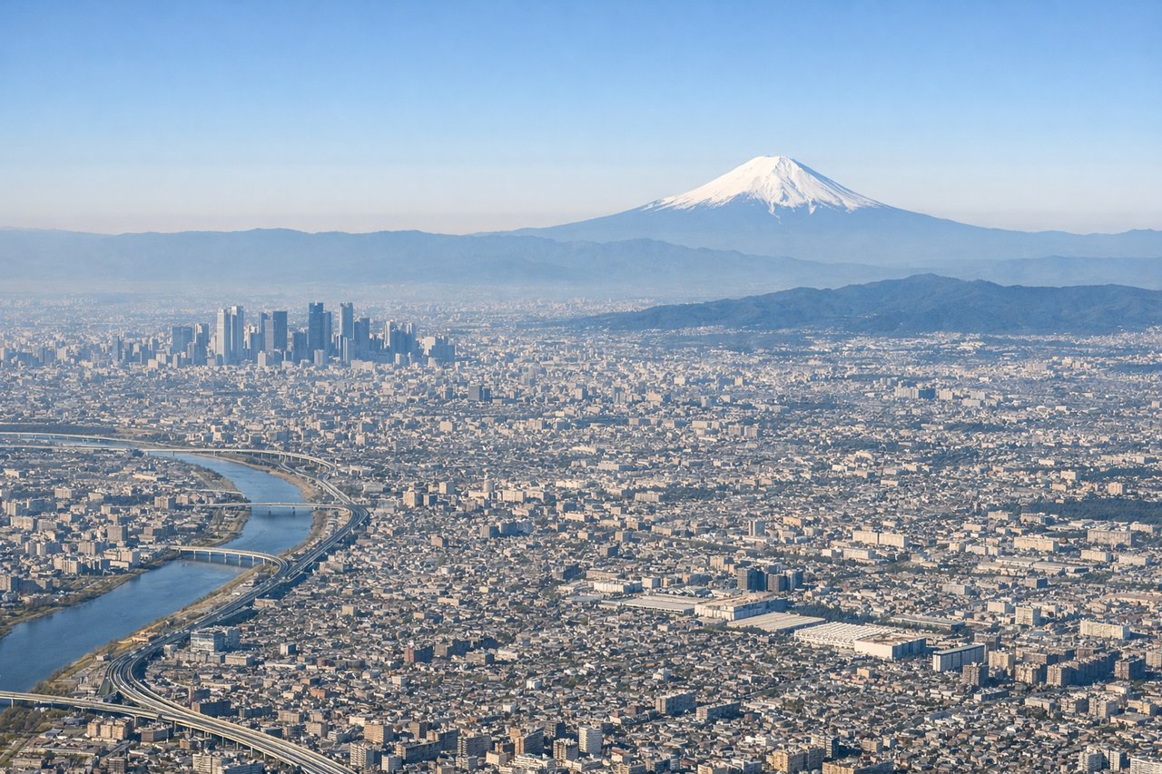
The right side offers the flight's standout feature — a view of Mount Fuji during the Tokyo departure sequence — plus glimpses of Yokohama and Nagoya's urban areas, while the left side is dominated by relatively featureless coastal and open-water views.
Flight Path
Suruga Bay, Izu Peninsula coastline, distant Southern Japan Alps, Mount Fuji to the north of the flight path
Great circle distance and headings ›

Phase by phase
Takeoff from HND
RIGHTClimbing out of Haneda on the south-wind pattern, the right side faces west across Tokyo Bay toward Yokohama's harbor and skyline, with Mount Fuji's snow-capped cone often visible in the distance as the aircraft turns onto its westbound track. The left side mostly shows flatter Chiba coastline and open bay water.
Landing at NGO
RIGHTOn approach into Centrair, the runway 18 arrival crosses Ise Bay with the Chita Peninsula and Nagoya's skyline visible off to the north (right side), giving a last good look at the city before touchdown. The left side shows mostly open bay water toward the Pacific with fewer landmarks.
Landmarks on this routeAll landmarks →
Will your flight be in sunlight?
See exactly which side of the plane gets sun and shade at your departure time.
About This Route
Which side of the plane should I sit on flying from Tokyo International (HND) to Chubu Centrair International Airport (NGO)?
Sit on the Right side of the plane for the best views on flights from Tokyo to Nagoya. The right side offers the flight's standout feature — a view of Mount Fuji during the Tokyo departure sequence — plus glimpses of Yokohama and Nagoya's urban areas, while the left side is dominated by relatively featureless coastal and open-water views.
What can I see during takeoff from Tokyo International in Tokyo?
During takeoff from Tokyo International (HND), sit on the Right side for the best views. Climbing out of Haneda on the south-wind pattern, the right side faces west across Tokyo Bay toward Yokohama's harbor and skyline, with Mount Fuji's snow-capped cone often visible in the distance as the aircraft turns onto its westbound track. The left side mostly shows flatter Chiba coastline and open bay water. Notable sights include: Tokyo Bay, Yokohama skyline and port, distant Mount Fuji.
What can I see when landing at Chubu Centrair International Airport in Nagoya?
When landing at Chubu Centrair International Airport (NGO), sit on the Right side for the best views. On approach into Centrair, the runway 18 arrival crosses Ise Bay with the Chita Peninsula and Nagoya's skyline visible off to the north (right side), giving a last good look at the city before touchdown. The left side shows mostly open bay water toward the Pacific with fewer landmarks. Notable sights include: Chita Peninsula, Nagoya skyline in the distance, Ise Bay shoreline.
How long is the flight from Tokyo to Nagoya?
The flight from Tokyo International (HND) to Chubu Centrair International Airport (NGO) takes 0h 55m.
What does the Tokyo to Nagoya flight path pass over?
Suruga Bay, Izu Peninsula coastline, distant Southern Japan Alps, Mount Fuji to the north of the flight path