While takeoff offers interesting Tokyo Bay views on the right, the landing approach into Porto on the left provides more dramatic and varied scenery—the Douro estuary, coastal cliffs, and the distinctive hillside city itself make for a more memorable window experience overall.
Flown HND to OPO? Did we get it right?
Flight Path
Tokyo to Porto is 6,767 miles (10,890 km), a flight of about 13 hours.
This route typically crosses the Eurasian continent via the Middle East. Notable features along the path include: the Caucasus Mountains (if routing through southern Russia), the Caspian Sea region, the Iranian plateau, the Persian Gulf, the Arabian Peninsula, the Red Sea, and the Mediterranean Sea. The flight then crosses southern Europe over the Iberian Peninsula before descending into Porto. Actual routing varies by weather and air traffic control, but westbound flights generally follow corridors over Turkey, Iraq/Syria, or the Arabian Peninsula.
Great circle distance and headings ›


Phase by phase
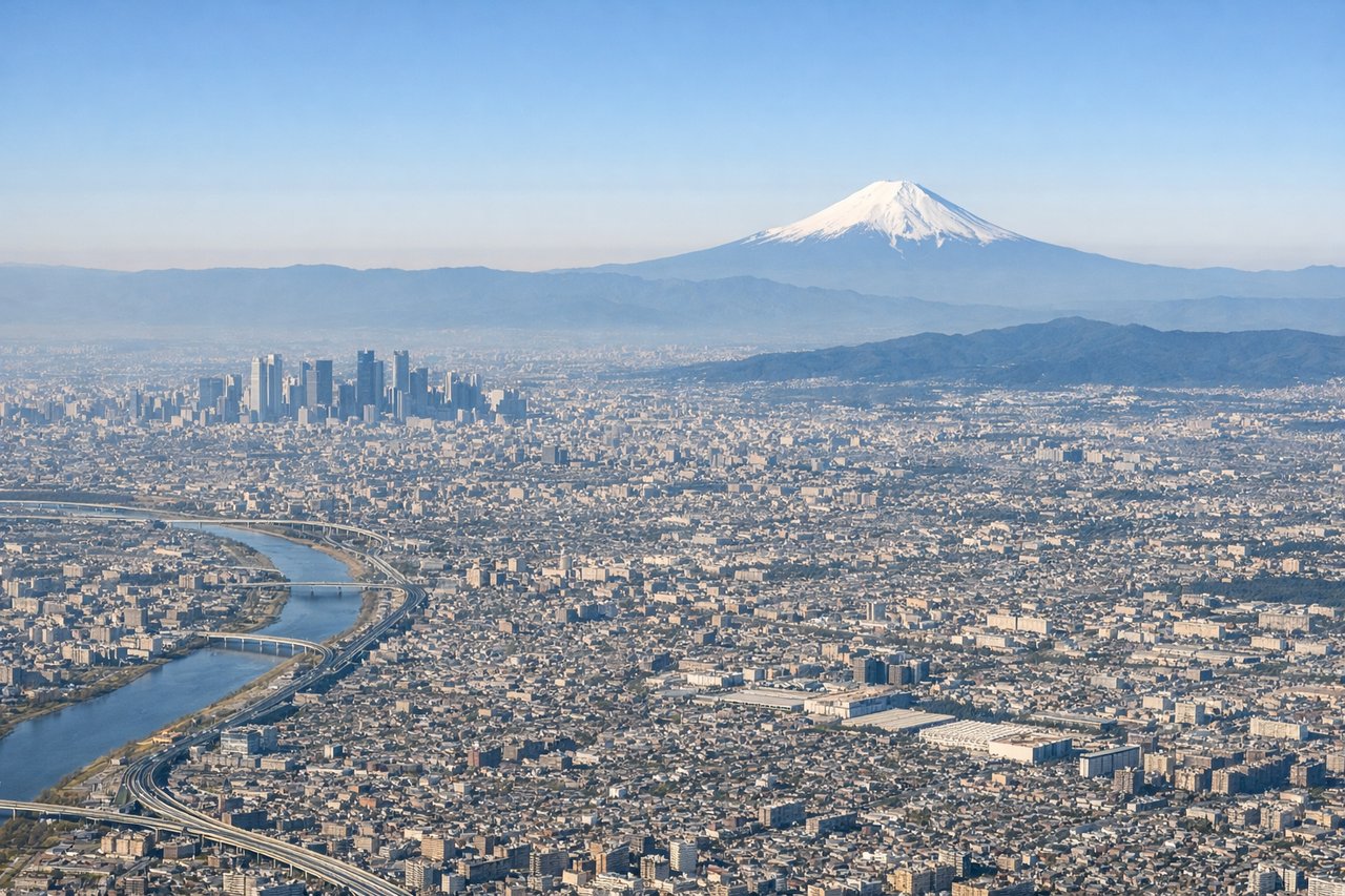
Takeoff from HND
RIGHTRight-side seats offer views of Tokyo Bay and the Kanto Plain as the aircraft climbs northwestward. You'll see the urban sprawl of greater Tokyo, including the distinctive geometry of Tokyo's port facilities and the Boso Peninsula across the bay.
Landing at OPO
LEFTLeft-side seats provide excellent views during the descent into Porto. You'll see the Douro River valley as it approaches the Atlantic coast, the distinctive terraced vineyards of the Douro region, and the coastal cliffs and beaches near Porto itself.
Will your flight be in sunlight?
Pick a date and time in the Sun Map to watch the sun move across your whole flight.
About This Route
Which side of the plane should I sit on flying from Tokyo International (HND) to Porto (OPO)?
Sit on the Left side of the plane for the best views on flights from Tokyo to Porto. While takeoff offers interesting Tokyo Bay views on the right, the landing approach into Porto on the left provides more dramatic and varied scenery—the Douro estuary, coastal cliffs, and the distinctive hillside city itself make for a more memorable window experience overall.
What can I see during takeoff from Tokyo International in Tokyo?
During takeoff from Tokyo International (HND), sit on the Right side for the best views. Right-side seats offer views of Tokyo Bay and the Kanto Plain as the aircraft climbs northwestward. You'll see the urban sprawl of greater Tokyo, including the distinctive geometry of Tokyo's port facilities and the Boso Peninsula across the bay. Notable sights include: Tokyo Bay, Boso Peninsula, Mount Fuji (visible on clear days to the southwest at distance), Kanto Plain urban grid.
What can I see when landing at Porto in Porto?
When landing at Porto (OPO), sit on the Left side for the best views. Left-side seats provide excellent views during the descent into Porto. You'll see the Douro River valley as it approaches the Atlantic coast, the distinctive terraced vineyards of the Douro region, and the coastal cliffs and beaches near Porto itself. Notable sights include: Douro River estuary, Atlantic coastline with cliffs, Porto city waterfront, terraced vineyard slopes in the Douro valley.
How long is the flight from Tokyo to Porto?
The flight from Tokyo International (HND) to Porto (OPO) takes about 13 hours. The shortest flight path between them is 6,767 miles (10,890 km); winds and air traffic control usually add a few percent.
What does the Tokyo to Porto flight path pass over?
This route typically crosses the Eurasian continent via the Middle East. Notable features along the path include: the Caucasus Mountains (if routing through southern Russia), the Caspian Sea region, the Iranian plateau, the Persian Gulf, the Arabian Peninsula, the Red Sea, and the Mediterranean Sea. The flight then crosses southern Europe over the Iberian Peninsula before descending into Porto. Actual routing varies by weather and air traffic control, but westbound flights generally follow corridors over Turkey, Iraq/Syria, or the Arabian Peninsula.