Tokyo to Copenhagen is 5,426 miles (8,733 km), a flight of about 12 hours.
Right side offers superior scenery for the majority of the flight. Takeoff provides Mount Fuji and Tokyo Bay views, and throughout the trans-continental journey, the right side faces north across Russia, offering glimpses of the Ural Mountains, Lake Baikal region, and the Scandinavian Peninsula's terrain during descent.
Flight Path
The flight path crosses central Russia at high altitude. Notable features include the Ural Mountains (visible as a distant ridge roughly 6-7 hours into flight), the vast Siberian taiga forests, and Lake Baikal (one of the world's largest freshwater lakes, visible as a distinctive elongated blue shape if conditions permit). As the aircraft approaches European airspace, the Scandinavian Peninsula becomes visible, with Norway's fjord-carved coastline and Sweden's forested terrain appearing on the left side during the final 2-3 hours. The flight typically follows a great-circle route across the Arctic regions, so polar geography dominates the mid-flight experience rather than equatorial landmarks.
Great circle distance and headings ›


Phase by phase
Takeoff from HND
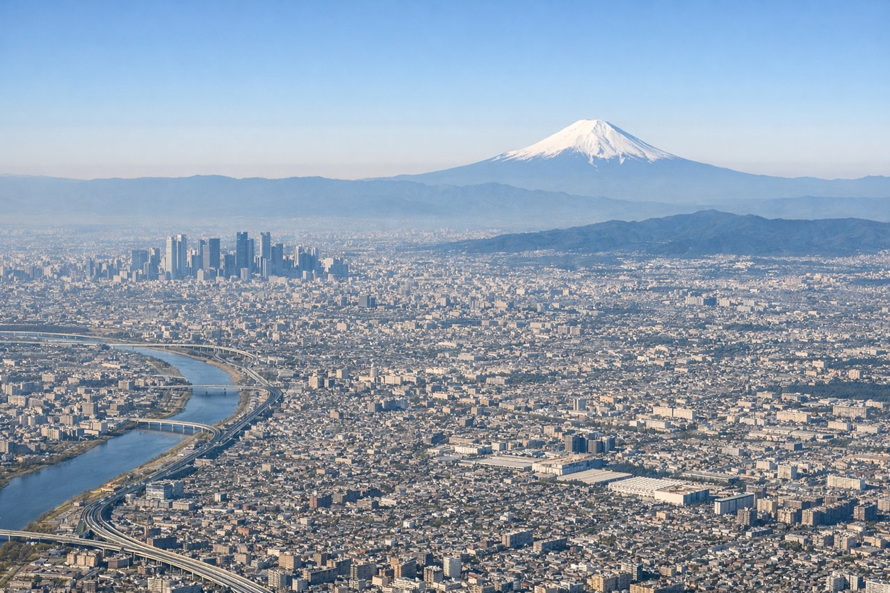
RIGHTRight side captures the initial climb-out over Tokyo Bay and the Kanto Plain. You'll see the urban sprawl of greater Tokyo, the bay's distinctive shape, and on clear days, the silhouette of Mount Fuji to the west.
Landing at RKE
LEFTLeft side provides the best approach views into Copenhagen. You'll see the Danish coastline, the Øresund Strait separating Denmark from Sweden, and the distinctive geography of Zealand island as you descend toward Roskilde.
Landmarks on this routeAll landmarks →
Will your flight be in sunlight?
Pick a date and time in the Sun Map to watch the sun move across your whole flight.
About This Route
Which side of the plane should I sit on flying from Tokyo International (HND) to Roskilde (RKE)?
Sit on the Right side of the plane for the best views on flights from Tokyo to Copenhagen. Right side offers superior scenery for the majority of the flight. Takeoff provides Mount Fuji and Tokyo Bay views, and throughout the trans-continental journey, the right side faces north across Russia, offering glimpses of the Ural Mountains, Lake Baikal region, and the Scandinavian Peninsula's terrain during descent.
What can I see during takeoff from Tokyo International in Tokyo?
During takeoff from Tokyo International (HND), sit on the Right side for the best views. Right side captures the initial climb-out over Tokyo Bay and the Kanto Plain. You'll see the urban sprawl of greater Tokyo, the bay's distinctive shape, and on clear days, the silhouette of Mount Fuji to the west. Notable sights include: Tokyo Bay, Kanto Plain urban grid, Mount Fuji (western horizon), Boso Peninsula.
What can I see when landing at Roskilde in Copenhagen?
When landing at Roskilde (RKE), sit on the Left side for the best views. Left side provides the best approach views into Copenhagen. You'll see the Danish coastline, the Øresund Strait separating Denmark from Sweden, and the distinctive geography of Zealand island as you descend toward Roskilde. Notable sights include: Øresund Strait, Swedish coast (Scania), Roskilde Fjord, Zealand's rolling terrain.
How long is the flight from Tokyo to Copenhagen?
The flight from Tokyo International (HND) to Roskilde (RKE) takes about 12 hours. The shortest flight path between them is 5,426 miles (8,733 km); winds and air traffic control usually add a few percent.
What does the Tokyo to Copenhagen flight path pass over?
The flight path crosses central Russia at high altitude. Notable features include the Ural Mountains (visible as a distant ridge roughly 6-7 hours into flight), the vast Siberian taiga forests, and Lake Baikal (one of the world's largest freshwater lakes, visible as a distinctive elongated blue shape if conditions permit). As the aircraft approaches European airspace, the Scandinavian Peninsula becomes visible, with Norway's fjord-carved coastline and Sweden's forested terrain appearing on the left side during the final 2-3 hours. The flight typically follows a great-circle route across the Arctic regions, so polar geography dominates the mid-flight experience rather than equatorial landmarks.