Right-side seats capture the dramatic departure from Oahu's volcanic landscape and maintain better views during the long Pacific crossing. While left seats have the advantage on landing approach to Guam, the takeoff experience from Honolulu is more visually rewarding and memorable.
Flight Path
The flight path crosses the central Pacific with no significant landmass between Hawaii and Guam. You'll pass north of the Marshall Islands (not visible at cruise altitude). The ocean remains consistently deep blue throughout the crossing. Occasional tropical cumulus cloud formations develop over the warm Pacific waters. As you approach Guam from the east, the Mariana Trench lies directly beneath the aircraft (deepest point on Earth at 36,000 feet, but invisible from altitude). The island of Guam rises abruptly from the ocean floor with no visible surrounding islands until final approach.
Great circle distance and headings ›Phase by phase
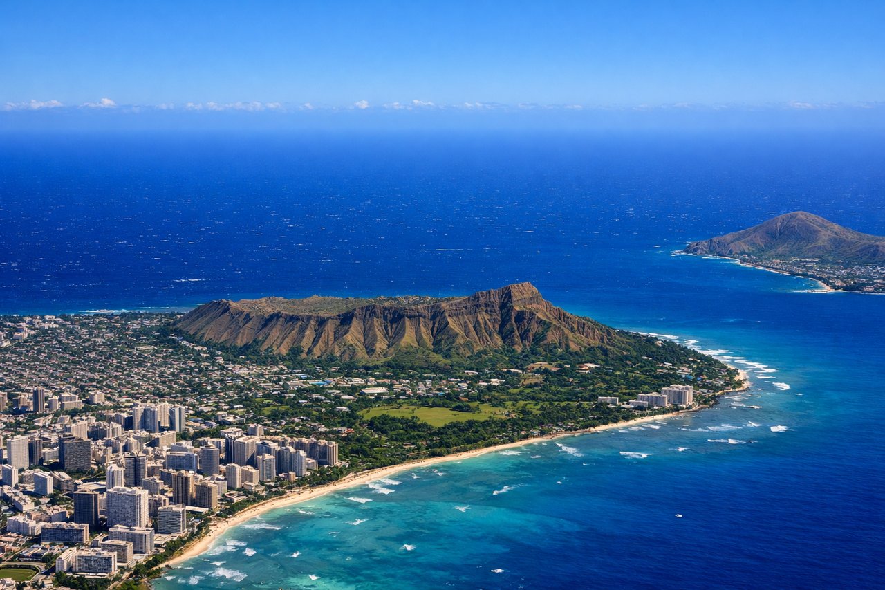
Takeoff from HNL
RIGHTHNL typically departs runway 08L or 08R (eastbound). Right-side seats face north toward the Waianae Range and the windward coast of Oahu, offering dramatic volcanic ridgelines and the island's northern shoreline. Left seats look south over the ocean with minimal landmass.
Landing at GUM
LEFTGuam typically lands runway 06L or 06R (northbound approach). Left-side seats face west toward the Philippine Sea and approach the island from the west. This provides views of Guam's western coastline, Apra Harbor, and the island's volcanic topography as you descend. Right seats face the open ocean with minimal island features until very late approach.
Landmarks on this routeAll landmarks →
Will your flight be in sunlight?
See exactly which side of the plane gets sun and shade at your departure time.
About This Route
Which side of the plane should I sit on flying from Honolulu International (HNL) to Guam International (GUM)?
Sit on the Right side of the plane for the best views on flights from Honolulu to Agana. Right-side seats capture the dramatic departure from Oahu's volcanic landscape and maintain better views during the long Pacific crossing. While left seats have the advantage on landing approach to Guam, the takeoff experience from Honolulu is more visually rewarding and memorable.
What can I see during takeoff from Honolulu International in Honolulu?
During takeoff from Honolulu International (HNL), sit on the Right side for the best views. HNL typically departs runway 08L or 08R (eastbound). Right-side seats face north toward the Waianae Range and the windward coast of Oahu, offering dramatic volcanic ridgelines and the island's northern shoreline. Left seats look south over the ocean with minimal landmass. Notable sights include: Waianae Range (western volcanic ridge), Kailua Bay and windward Oahu coastline, Pearl Harbor inlet (visible below during initial climb), Koko Head crater (southeastern Oahu, visible as you climb eastbound).
What can I see when landing at Guam International in Agana?
When landing at Guam International (GUM), sit on the Left side for the best views. Guam typically lands runway 06L or 06R (northbound approach). Left-side seats face west toward the Philippine Sea and approach the island from the west. This provides views of Guam's western coastline, Apra Harbor, and the island's volcanic topography as you descend. Right seats face the open ocean with minimal island features until very late approach. Notable sights include: Apra Harbor (large natural harbor on western coast), Two Lovers Point (northern peninsula), Mount Lam Lam (highest point, 1,296 feet, visible as central ridge), Cocos Island (small island south of Apra Harbor).
How long is the flight from Honolulu to Agana?
The flight from Honolulu International (HNL) to Guam International (GUM) takes Approximately 7.5 to 8 hours.
What does the Honolulu to Agana flight path pass over?
The flight path crosses the central Pacific with no significant landmass between Hawaii and Guam. You'll pass north of the Marshall Islands (not visible at cruise altitude). The ocean remains consistently deep blue throughout the crossing. Occasional tropical cumulus cloud formations develop over the warm Pacific waters. As you approach Guam from the east, the Mariana Trench lies directly beneath the aircraft (deepest point on Earth at 36,000 feet, but invisible from altitude). The island of Guam rises abruptly from the ocean floor with no visible surrounding islands until final approach.