Honolulu to Oakland is 2,407 miles (3,873 km), a flight of about 4 hours 50 minutes.
The right side captures both scenic bookends of the flight — Diamond Head and Waikiki at takeoff, and the San Francisco Bay skyline at landing — while the left side sees mostly open ocean and less distinctive terrain during both phases.
Flight Path
The cruise phase is almost entirely over open Pacific Ocean with no landmarks visible until the California coastline and Central Valley appear on descent.
Great circle distance and headings ›

Phase by phase
Takeoff from HNL
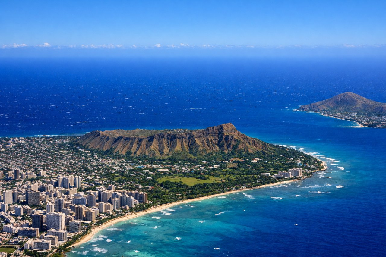
RIGHTDeparting on HNL's Reef Runway heading east, the initial climb puts Diamond Head crater and the Waikiki coastline on the right side of the aircraft before the turn north toward the mainland. The left side mostly shows open ocean and the industrial harbor area.
Landing at OAK
RIGHTArriving at OAK from the east on the 28 runways, the aircraft descends westward with the San Francisco Bay opening up ahead; the San Francisco skyline, Bay Bridge, and Golden Gate are visible on the right side of the cabin looking north across the water. The left side shows the flatter East Bay hills and suburbs.
Landmarks on this routeAll landmarks →
Will your flight be in sunlight?
Pick a date and time in the Sun Map to watch the sun move across your whole flight.
About This Route
Which side of the plane should I sit on flying from Honolulu International (HNL) to Metropolitan Oakland International (OAK)?
Sit on the Right side of the plane for the best views on flights from Honolulu to Oakland. The right side captures both scenic bookends of the flight — Diamond Head and Waikiki at takeoff, and the San Francisco Bay skyline at landing — while the left side sees mostly open ocean and less distinctive terrain during both phases.
What can I see during takeoff from Honolulu International in Honolulu?
During takeoff from Honolulu International (HNL), sit on the Right side for the best views. Departing on HNL's Reef Runway heading east, the initial climb puts Diamond Head crater and the Waikiki coastline on the right side of the aircraft before the turn north toward the mainland. The left side mostly shows open ocean and the industrial harbor area. Notable sights include: Diamond Head crater, Waikiki Beach and hotel skyline, Koko Head, the reef-lined south shore of Oahu.
What can I see when landing at Metropolitan Oakland International in Oakland?
When landing at Metropolitan Oakland International (OAK), sit on the Right side for the best views. Arriving at OAK from the east on the 28 runways, the aircraft descends westward with the San Francisco Bay opening up ahead; the San Francisco skyline, Bay Bridge, and Golden Gate are visible on the right side of the cabin looking north across the water. The left side shows the flatter East Bay hills and suburbs. Notable sights include: San Francisco skyline and Financial District towers, San Francisco Bay, Bay Bridge, Golden Gate Bridge in the distance.
How long is the flight from Honolulu to Oakland?
The flight from Honolulu International (HNL) to Metropolitan Oakland International (OAK) takes about 4 hours 50 minutes. The shortest flight path between them is 2,407 miles (3,873 km); winds and air traffic control usually add a few percent.
What does the Honolulu to Oakland flight path pass over?
The cruise phase is almost entirely over open Pacific Ocean with no landmarks visible until the California coastline and Central Valley appear on descent.