Right-side seats provide superior scenery for the majority of this transcontinental flight. The takeoff views of Honolulu's mountain ranges are exceptional, and the right side maintains better sightlines across the Pacific and into the continental interior as the flight progresses eastward.
Flown HNL to PWM? Did we get it right?
Flight Path
Honolulu to Portland is 5,099 miles (8,206 km), a flight of about 10 hours 15 minutes.
The flight path crosses the central Pacific Ocean for roughly 5 hours with no significant landmarks visible—primarily open water. As the aircraft approaches the North American continent, the Sierra Nevada and Rocky Mountain ranges become visible on the right side during the descent phase. The Great Basin and high desert regions of Nevada and Utah appear as arid, tan-colored terrain with sparse vegetation. The Columbia River Gorge becomes visible in the final approach phase, marking the transition into the Pacific Northwest.
Great circle distance and headings ›


Phase by phase
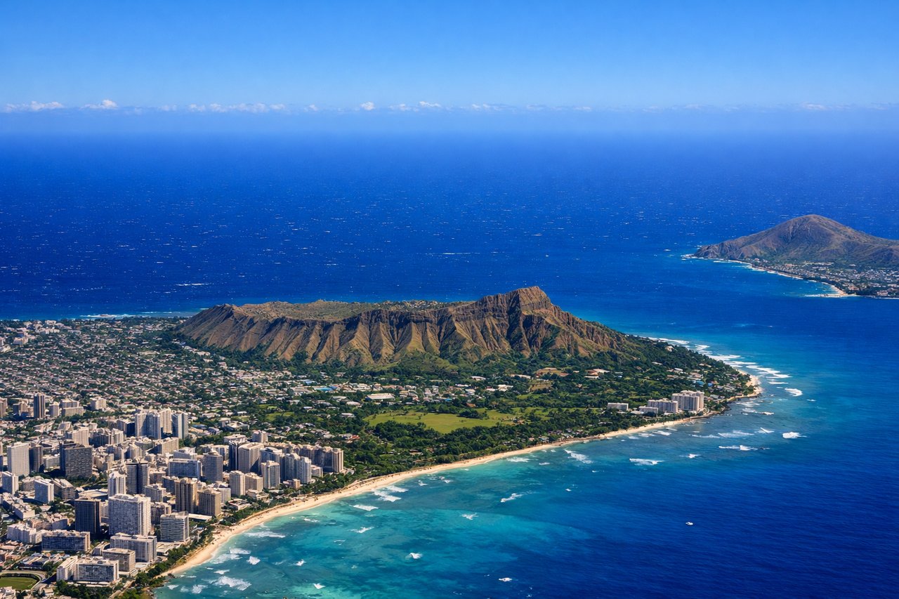
Takeoff from HNL
RIGHTRight-side seats capture the dramatic Ko'olau and Waianae mountain ranges that frame Honolulu's windward and leeward sides. You'll also see the transition from the urban airport area into the Pacific Ocean, with excellent views of the island's topography during the initial climb.
Landing at PWM
LEFTLeft-side seats offer the best views during the approach into Portland. You'll see the Cascade Range to the east, the Willamette River valley, and the transition from rural Oregon farmland into the Portland metropolitan area. The descent path typically brings these features into clear view on the left side.
Will your flight be in sunlight?
Pick a date and time in the Sun Map to watch the sun move across your whole flight.
About This Route
Which side of the plane should I sit on flying from Honolulu International (HNL) to Portland International Jetport (PWM)?
Sit on the Right side of the plane for the best views on flights from Honolulu to Portland. Right-side seats provide superior scenery for the majority of this transcontinental flight. The takeoff views of Honolulu's mountain ranges are exceptional, and the right side maintains better sightlines across the Pacific and into the continental interior as the flight progresses eastward.
What can I see during takeoff from Honolulu International in Honolulu?
During takeoff from Honolulu International (HNL), sit on the Right side for the best views. Right-side seats capture the dramatic Ko'olau and Waianae mountain ranges that frame Honolulu's windward and leeward sides. You'll also see the transition from the urban airport area into the Pacific Ocean, with excellent views of the island's topography during the initial climb. Notable sights include: Ko'olau Range (northeast), Waianae Range (west), Pearl Harbor inlet (visible to the south), Pacific Ocean extending northward.
What can I see when landing at Portland International Jetport in Portland?
When landing at Portland International Jetport (PWM), sit on the Left side for the best views. Left-side seats offer the best views during the approach into Portland. You'll see the Cascade Range to the east, the Willamette River valley, and the transition from rural Oregon farmland into the Portland metropolitan area. The descent path typically brings these features into clear view on the left side. Notable sights include: Cascade Range (distant eastern horizon), Willamette River (visible as a meandering waterway through the valley), Portland city grid and downtown skyline, Mount Hood (visible on clear days to the southeast).
How long is the flight from Honolulu to Portland?
The flight from Honolulu International (HNL) to Portland International Jetport (PWM) takes about 10 hours 15 minutes. The shortest flight path between them is 5,099 miles (8,206 km); winds and air traffic control usually add a few percent.
What does the Honolulu to Portland flight path pass over?
The flight path crosses the central Pacific Ocean for roughly 5 hours with no significant landmarks visible—primarily open water. As the aircraft approaches the North American continent, the Sierra Nevada and Rocky Mountain ranges become visible on the right side during the descent phase. The Great Basin and high desert regions of Nevada and Utah appear as arid, tan-colored terrain with sparse vegetation. The Columbia River Gorge becomes visible in the final approach phase, marking the transition into the Pacific Northwest.