While takeoff offers good mountain views on the right, the landing approach on the left provides more dramatic and sustained scenery—the North Shore Mountains are significantly more impressive than Honolulu's ranges, and the Strait of Georgia crossing offers extended water and island views.
Flown HNL to YVR? Did we get it right?
Flight Path
Honolulu to Vancouver is 2,705 miles (4,354 km), a flight of about 5 hours 15 minutes.
The flight path crosses the open North Pacific Ocean for roughly 2,000 miles with no significant landmarks visible—mostly water and sky. As you approach the British Columbia coast (around 1.5 hours before landing), the continental shelf and occasional cloud formations over the ocean become visible, but the most dramatic scenery occurs in the final descent phase when the North Cascades and coastal geography emerge.
Great circle distance and headings ›

Phase by phase
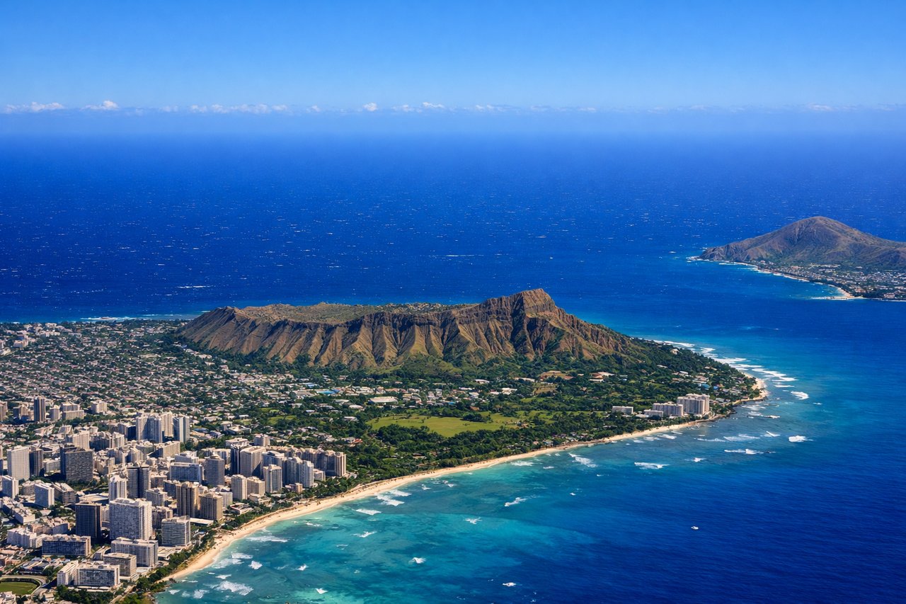
Takeoff from HNL
RIGHTRight-side seats capture the Ko'olau and Waianae mountain ranges that frame Honolulu's windward and leeward sides as you climb northwestward. You'll also see Pearl Harbor and the urban sprawl of Honolulu receding beneath you.
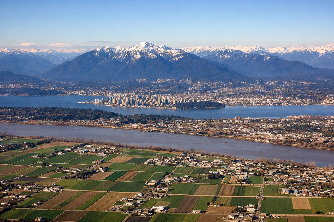
Landing at YVR
LEFTLeft-side seats offer the best views during approach to YVR. You'll see the North Shore mountains of British Columbia, the Strait of Georgia, and Vancouver's urban landscape as you descend toward the airport on the south side of the city.
Will your flight be in sunlight?
Pick a date and time in the Sun Map to watch the sun move across your whole flight.
About This Route
Which side of the plane should I sit on flying from Honolulu International (HNL) to Vancouver International (YVR)?
Sit on the Left side of the plane for the best views on flights from Honolulu to Vancouver. While takeoff offers good mountain views on the right, the landing approach on the left provides more dramatic and sustained scenery—the North Shore Mountains are significantly more impressive than Honolulu's ranges, and the Strait of Georgia crossing offers extended water and island views.
What can I see during takeoff from Honolulu International in Honolulu?
During takeoff from Honolulu International (HNL), sit on the Right side for the best views. Right-side seats capture the Ko'olau and Waianae mountain ranges that frame Honolulu's windward and leeward sides as you climb northwestward. You'll also see Pearl Harbor and the urban sprawl of Honolulu receding beneath you. Notable sights include: Ko'olau Range (northeast), Waianae Range (west), Pearl Harbor (central), Honolulu urban area.
What can I see when landing at Vancouver International in Vancouver?
When landing at Vancouver International (YVR), sit on the Left side for the best views. Left-side seats offer the best views during approach to YVR. You'll see the North Shore mountains of British Columbia, the Strait of Georgia, and Vancouver's urban landscape as you descend toward the airport on the south side of the city. Notable sights include: North Shore Mountains (Cascade Range foothills), Strait of Georgia, Vancouver city center and harbor, Vancouver Island (distant).
How long is the flight from Honolulu to Vancouver?
The flight from Honolulu International (HNL) to Vancouver International (YVR) takes about 5 hours 15 minutes. The shortest flight path between them is 2,705 miles (4,354 km); winds and air traffic control usually add a few percent.
What does the Honolulu to Vancouver flight path pass over?
The flight path crosses the open North Pacific Ocean for roughly 2,000 miles with no significant landmarks visible—mostly water and sky. As you approach the British Columbia coast (around 1.5 hours before landing), the continental shelf and occasional cloud formations over the ocean become visible, but the most dramatic scenery occurs in the final descent phase when the North Cascades and coastal geography emerge.