Right side scores equally on the full flight but edges left on practical viewing quality. The right side captures Wichita's urban departure and Phoenix's metropolitan approach with the Salt River valley and South Mountain Park visible during descent. Left side offers only flat prairie on departure and open desert on arrival—minimal visual variety or landmark density. For a short 2h 15m flight over relatively flat terrain, right side maximizes the limited scenic opportunities.
Flown ICT to PHX? Did we get it right?
Flight Path
Wichita to Phoenix is 869 miles (1,398 km), a flight of about 2 hours 15 minutes.
The flight crosses the Oklahoma Panhandle and northwestern New Mexico. Notable features include the Canadian River valley (visible as a linear depression in the Oklahoma Panhandle), the Cimarron River drainage, and the transition from Great Plains grassland to high desert scrubland. The Raton Mesa area (elevation ~7,000 feet) appears as elevated terrain on the horizon during cruise. No major mountain ranges dominate the route; the landscape is predominantly open plains and desert with sparse vegetation. The Jemez Mountains are visible far to the east (left) during cruise if conditions permit, but remain distant and minor visual elements.
Great circle distance and headings ›Phase by phase
Takeoff from ICT
RIGHTRight side captures Wichita's urban sprawl and the Arkansas River valley during initial climb-out. Left side faces open prairie with minimal visual interest during departure.
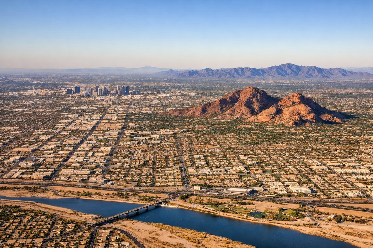
Landing at PHX
RIGHTRight side offers superior approach scenery into Phoenix. Descending from the northeast, right-side passengers see the Salt River valley, Phoenix metropolitan sprawl, and the approach to Sky Harbor. Left side faces the open Sonoran Desert with minimal urban or topographic interest.
Will your flight be in sunlight?
Pick a date and time in the Sun Map to watch the sun move across your whole flight.
About This Route
Which side of the plane should I sit on flying from Wichita Mid Continent (ICT) to Phoenix Sky Harbor International (PHX)?
Sit on the Right side of the plane for the best views on flights from Wichita to Phoenix. Right side scores equally on the full flight but edges left on practical viewing quality. The right side captures Wichita's urban departure and Phoenix's metropolitan approach with the Salt River valley and South Mountain Park visible during descent. Left side offers only flat prairie on departure and open desert on arrival—minimal visual variety or landmark density. For a short 2h 15m flight over relatively flat terrain, right side maximizes the limited scenic opportunities.
What can I see during takeoff from Wichita Mid Continent in Wichita?
During takeoff from Wichita Mid Continent (ICT), sit on the Right side for the best views. Right side captures Wichita's urban sprawl and the Arkansas River valley during initial climb-out. Left side faces open prairie with minimal visual interest during departure. Notable sights include: Wichita downtown skyline, Arkansas River, flat Kansas plains extending westward.
What can I see when landing at Phoenix Sky Harbor International in Phoenix?
When landing at Phoenix Sky Harbor International (PHX), sit on the Right side for the best views. Right side offers superior approach scenery into Phoenix. Descending from the northeast, right-side passengers see the Salt River valley, Phoenix metropolitan sprawl, and the approach to Sky Harbor. Left side faces the open Sonoran Desert with minimal urban or topographic interest. Notable sights include: Phoenix metropolitan area, Salt River valley, South Mountain Park, downtown Phoenix skyline.
How long is the flight from Wichita to Phoenix?
The flight from Wichita Mid Continent (ICT) to Phoenix Sky Harbor International (PHX) takes about 2 hours 15 minutes. The shortest flight path between them is 869 miles (1,398 km); winds and air traffic control usually add a few percent.
What does the Wichita to Phoenix flight path pass over?
The flight crosses the Oklahoma Panhandle and northwestern New Mexico. Notable features include the Canadian River valley (visible as a linear depression in the Oklahoma Panhandle), the Cimarron River drainage, and the transition from Great Plains grassland to high desert scrubland. The Raton Mesa area (elevation ~7,000 feet) appears as elevated terrain on the horizon during cruise. No major mountain ranges dominate the route; the landscape is predominantly open plains and desert with sparse vegetation. The Jemez Mountains are visible far to the east (left) during cruise if conditions permit, but remain distant and minor visual elements.