Left side scores higher due to the exceptional takeoff scenery from Iquitos—the Amazon River system with oxbow lakes and rainforest canopy provides dramatic visual variety and recognizable landmarks. While the landing approach favors the right side, the takeoff experience from the Amazon basin is more distinctive and memorable than a standard Andean approach. The full flight benefits from left-side positioning during the initial climb through the most visually interesting portion of the route.
Flight Path
Transition from Amazon rainforest basin to foothills of the eastern Andes; the Urubamba River valley becomes visible as the aircraft climbs toward the Cusco plateau; gradual elevation gain from 300 feet (Iquitos) to 11,000 feet (Cusco); cloud formations often obscure the mid-route terrain, particularly around the mountain transition zone
Great circle distance and headings ›
.jpg?width=600)

Phase by phase
Takeoff from IQT
LEFTLeft side captures the Amazon River basin and rainforest canopy during climb-out from Iquitos. The river's meandering channels and oxbow lakes are distinctive from altitude, with scattered settlements visible along the waterways. Right side shows only dense, uniform rainforest with minimal visual variation.
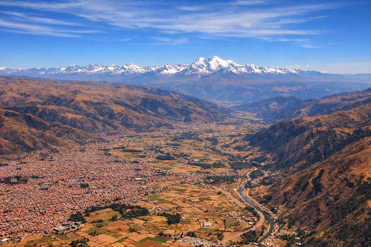
Landing at CUZ
RIGHTRight side offers superior approach scenery as the aircraft descends toward Cusco. The Andes Mountains become increasingly prominent, with the Sacred Valley visible and the high-altitude terrain around Cusco clearly defined. Left side shows only the eastern slopes and cloud-covered valleys with less dramatic relief.
Landmarks on this routeAll landmarks →
Will your flight be in sunlight?
See exactly which side of the plane gets sun and shade at your departure time.
About This Route
Which side of the plane should I sit on flying from Coronel Fap Francisco Secada Vignetta (IQT) to Velazco Astete (CUZ)?
Sit on the Left side of the plane for the best views on flights from Iquitos to Cuzco. Left side scores higher due to the exceptional takeoff scenery from Iquitos—the Amazon River system with oxbow lakes and rainforest canopy provides dramatic visual variety and recognizable landmarks. While the landing approach favors the right side, the takeoff experience from the Amazon basin is more distinctive and memorable than a standard Andean approach. The full flight benefits from left-side positioning during the initial climb through the most visually interesting portion of the route.
What can I see during takeoff from Coronel Fap Francisco Secada Vignetta in Iquitos?
During takeoff from Coronel Fap Francisco Secada Vignetta (IQT), sit on the Left side for the best views. Left side captures the Amazon River basin and rainforest canopy during climb-out from Iquitos. The river's meandering channels and oxbow lakes are distinctive from altitude, with scattered settlements visible along the waterways. Right side shows only dense, uniform rainforest with minimal visual variation. Notable sights include: Amazon River main channel and tributaries, oxbow lakes near Iquitos, rainforest canopy texture, scattered river settlements.
What can I see when landing at Velazco Astete in Cuzco?
When landing at Velazco Astete (CUZ), sit on the Right side for the best views. Right side offers superior approach scenery as the aircraft descends toward Cusco. The Andes Mountains become increasingly prominent, with the Sacred Valley visible and the high-altitude terrain around Cusco clearly defined. Left side shows only the eastern slopes and cloud-covered valleys with less dramatic relief. Notable sights include: Andes Mountains ridgelines, Sacred Valley agricultural terraces, Cusco basin at high altitude, surrounding peaks above 13,000 feet.
How long is the flight from Iquitos to Cuzco?
The flight from Coronel Fap Francisco Secada Vignetta (IQT) to Velazco Astete (CUZ) takes 1h 15m.
What does the Iquitos to Cuzco flight path pass over?
Transition from Amazon rainforest basin to foothills of the eastern Andes; the Urubamba River valley becomes visible as the aircraft climbs toward the Cusco plateau; gradual elevation gain from 300 feet (Iquitos) to 11,000 feet (Cusco); cloud formations often obscure the mid-route terrain, particularly around the mountain transition zone