Islamabad to Istanbul is 2,451 miles (3,944 km), a flight of about 4 hours 45 minutes.
While the right side offers a strong departure view of the Margalla Hills, the left side wins overall thanks to a dramatic final approach over the Sea of Marmara with the historic Istanbul skyline and Bosphorus coming into view, plus glimpses of Iran's Zagros/Alborz ranges and the Caspian basin during cruise.
Flight Path
Hindu Kush foothills over Afghanistan, the Alborz/Zagros mountain ranges of northern Iran, the southern Caspian Sea coastline, and the eastern Anatolian plateau near the Turkey-Iran border
Great circle distance and headings ›
_in_Istanbul.jpg?width=600)
Phase by phase
Takeoff from ISB
RIGHTDeparting ISB on a westerly heading, the Margalla Hills and the forested ridgelines north of Islamabad fall on the right side, along with a clear view of the twin cities of Islamabad and Rawalpindi spreading across the Potohar Plateau.
Landing at IST
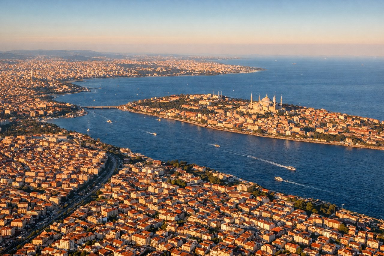
LEFTOn approach into IST from the southeast, the left side offers a sweeping view over the Sea of Marmara toward the historic Istanbul peninsula, with the Bosphorus strait, Topkapi Palace grounds, and the minarets of the old city visible just before touchdown.
Landmarks on this routeAll landmarks →
Will your flight be in sunlight?
Pick a date and time in the Sun Map to watch the sun move across your whole flight.
About This Route
Which side of the plane should I sit on flying from Islamabad International Airport (ISB) to İstanbul Airport (IST)?
Sit on the Left side of the plane for the best views on flights from Islamabad to Istanbul. While the right side offers a strong departure view of the Margalla Hills, the left side wins overall thanks to a dramatic final approach over the Sea of Marmara with the historic Istanbul skyline and Bosphorus coming into view, plus glimpses of Iran's Zagros/Alborz ranges and the Caspian basin during cruise.
What can I see during takeoff from Islamabad International Airport in Islamabad?
During takeoff from Islamabad International Airport (ISB), sit on the Right side for the best views. Departing ISB on a westerly heading, the Margalla Hills and the forested ridgelines north of Islamabad fall on the right side, along with a clear view of the twin cities of Islamabad and Rawalpindi spreading across the Potohar Plateau. Notable sights include: Margalla Hills, Islamabad's grid-planned government sector, Rawalpindi urban sprawl, Potohar Plateau.
What can I see when landing at İstanbul Airport in Istanbul?
When landing at İstanbul Airport (IST), sit on the Left side for the best views. On approach into IST from the southeast, the left side offers a sweeping view over the Sea of Marmara toward the historic Istanbul peninsula, with the Bosphorus strait, Topkapi Palace grounds, and the minarets of the old city visible just before touchdown. Notable sights include: Sea of Marmara, Bosphorus strait, Istanbul's historic peninsula, Princes' Islands.
How long is the flight from Islamabad to Istanbul?
The flight from Islamabad International Airport (ISB) to İstanbul Airport (IST) takes about 4 hours 45 minutes. The shortest flight path between them is 2,451 miles (3,944 km); winds and air traffic control usually add a few percent.
What does the Islamabad to Istanbul flight path pass over?
Hindu Kush foothills over Afghanistan, the Alborz/Zagros mountain ranges of northern Iran, the southern Caspian Sea coastline, and the eastern Anatolian plateau near the Turkey-Iran border